

Super Typhoon Champi churns across Pacific as another tropical threat begins to take shape
Computer forecast models indicate that Champi will continue to intensify and could peak as a violent super typhoon with sustained winds exceeding 160 mph, according to the FOX Forecast Center.
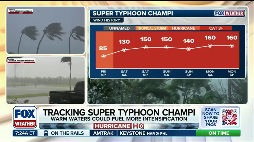
Super Typhoon Champi continues violent development in the Pacific
☔ 🌊 TRACKING CHAMPI: Super Typhoon Champi continues to churn in the Pacific basin and has reached strength equivalent to a Category 5 Atlantic Hurricane, with wind gusts expected to exceed 160 mph this week.
THE TAKEAWAY
- Champi is expected to peak as a violent super typhoon with winds exceeding 160 mph.
- Another tropical threat is beginning to take shape in the Pacific.
- The Pacific basin remains active amid a brewing Super El Niño.
The Pacific remains a hotbed of tropical activity this week as Super Typhoon Champi churns across the region, while the FOX Forecast Center keeps a close eye on another area for potential development.
The basin remains supercharged, fueling monster storms across the basin, including Champi, which has impacted Guam in recent days, with little sign of relief as Tropical Storm Trudy lingers near Mexico.
CALIFORNIA STORMS COULD BRING MUCH-NEEDED RAIN AND RELIEF TO WILDFIRE-WEARY AREAS
The FOX Forecast Center is also monitoring an additional storm that could develop in the near future.
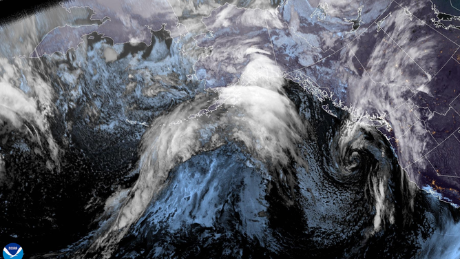
Satellite imagery showing the Northeast Pacific tropics.
(NOAA / FOX Weather)
Behind Tropical Storm Trudy, an area to watch with highly conductive environmental conditions is being observed south of Mexico, with a high probability of tropical development over the next seven days.
Forecast models show the storm having an impact on Mexico, but the timing of it is uncertain, the FOX Forecast Center said.
SUPER EL NIÑO FUELED WINTER COULD UNLEASH MORE STORMS, DRIVING MORE ACTIVE PATTERN INTO THE SOUTH
AI models are leaning towards the main impacts taking place on Baja California, while traditional models indicate a direct impact along the coasts of Colima, Jalisco and Nayarit earlier next week.
This storm system will likely be named Vance as the first V-named storm from the East Pacific since 2018, according to the FOX Forecast Center.
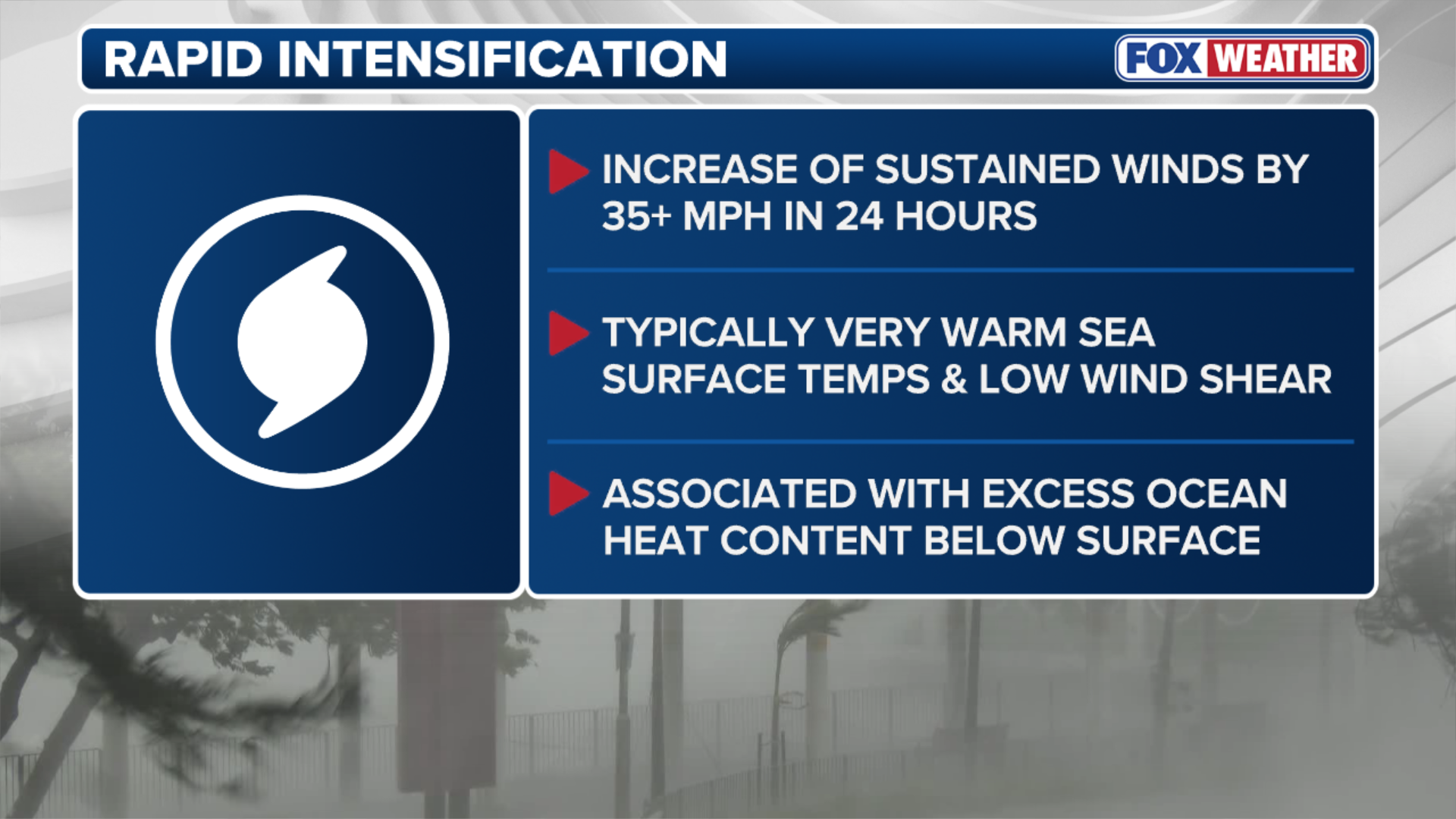
(FOX Weather)
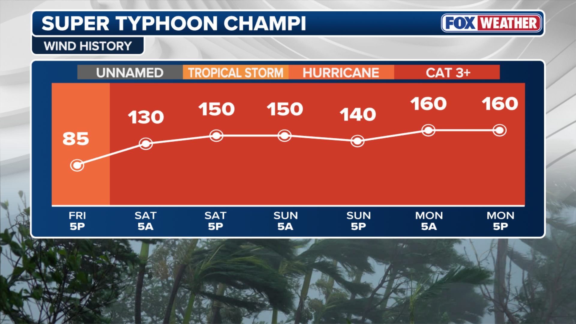
Typhoon Champi quickly swept through Guam over the weekend, with the equivalent of a Category 4 storm, packing wind gusts as strong as 150 mph.
The eye of the super typhoon passed just 10 miles off the southern tip of the island before moving west of the southern Mariana Islands.
WHAT IS AN 'EYEWALL REPLACEMENT CYCLE' INSIDE HURRICANES, TYPHOONS?
During this phase, the storm underwent an eyewall replacement cycle and slightly weakened on Sunday, but has since regained strength and increased into the equivalent of a Category 5 hurricane.

Footage recorded by X user David Hall shows palm trees swaying in strong wind and driving rain.
(David Hall via Storyful / FOX Weather)
The storm will continue to produce ferocious winds, intense rainfall and thunderstorms as it continues to develop.
SUPER EL NIÑO FUELED WINTER COULD UNLEASH MORE STORMS, DRIVING MORE ACTIVE PATTERN INTO THE SOUTH
(FOX Weather)
Computer forecast models indicate that Champi will continue to intensify and could peak as a violent super typhoon with sustained winds exceeding 160 mph, according to the FOX Forecast Center.
Champi’s forecast track is expected to curve northwest towards Eastern Asia, with other locations such as the Ryukyu Islands, Okinawa and northern Taiwan under threat later this week as the storm intensifies.