Quick-moving storm system to produce round of thunderstorms over Northeast on Sunday
The FOX Forecast Center expects some thunderstorms to develop during the late morning and afternoon as they work from west to east across the region.
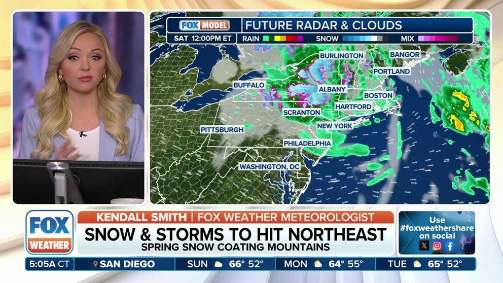
Snow, severe storms to hit Northeast this weekend
A large and powerful area of low-pressure system continues to move away from the U.S. While it's centered far north of the border, it's still bringing impacts to the Northeast.
NEW YORK — While Saturday felt wintry to some in the Northeast, a quick-moving storm system that will drop out of the Great Lakes has a chance of producing showers and thunderstorms on Sunday.
The FOX Forecast Center expects some thunderstorms to develop during the late morning and afternoon as they work from northwest to southeast across the region.
The Storm Prediction Center has highlighted communities from the eastern Ohio Valley through western Massachusetts for being at risk of strong to severe storms.
Communities such as State College and Scranton in Pennsylvania are included in NOAA's Level 3 out of 5 severe storm threat zone.
Damaging winds are expected to be the primary hazard, but a brief tornado and hail are also possible in the strongest of the storms.
OHIO RIVER EXPECTED TO FLOOD TOWNS AGAIN FOR SECOND TIME IN A WEEK

(FOX Weather)
Approximately 34 million are under the ‘possible’ threat zone on Sunday, with 2 million in the ‘very likely’ region.
Fortunately for the I-95 corridor, the threat for damaging thunderstorms is expected to greatly decrease after sunset, as storms run out of energy.
Cities such as Philadelphia, New York and Boston sit on the edge or just outside of the ‘possible’ threat zone for severe weather.
Depending on where the initial round of showers and thunderstorms develop, additional precipitation could fall over the eastern Ohio River Valley.
Although significant flash flooding is not expected, dozens of water gauges along the Ohio River and its tributaries are at flood stage and any additional rainfall will aggravate water levels.
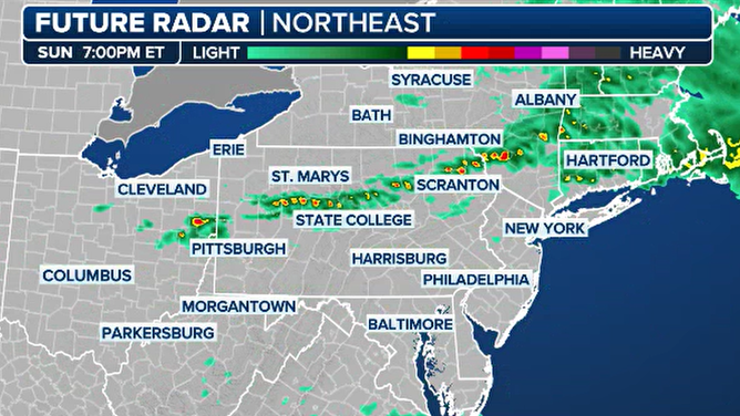
Northeast Futurecast for Sunday
(FOX Weather)