No signs of spring in Upper Midwest, Blizzard Warnings issued
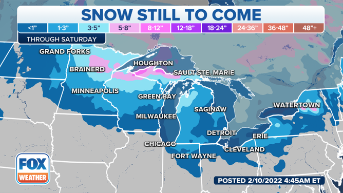
Periods of snow will blanket parts of northern Minnesota, northern Wisconsin and northern Michigan, with 3 to 6 inches expected in many areas
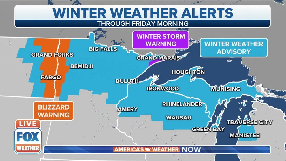
Blizzard warnings issued for the Northern Plains
Wind gusts anywhere from 30-40 miles per hour could make for ground blizzard conditions in the Northern Plains.
A stronger clipper system is pushing through the Upper Midwest and is expected to impact the Great Lakes on Friday with the potential of heavy snow and blizzard conditions.
Periods of snow will blanket parts of northern Minnesota, northern Wisconsin and northern Michigan, with 3 to 6 inches of accumulation expected. Localized amounts of a foot or more will be possible along the shore of Lake Superior.
(FOX Weather)
Strong winds behind the clipper are expected to create blowing snow in eastern North Dakota and western Minnesota.
The combination of snow and wind forced the National Weather Service to issue a Blizzard Warning for areas around Grand Forks and Fargo, North Dakota.
WHAT MAKES A BLIZZARD DIFFERENT FROM AN ORDINARY SNOWSTORM
Wind gusts could reach 50 mph on Friday with visibilities near zero in the warned region.
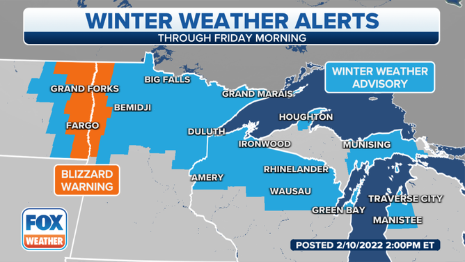
Blizzard warnings are in effect for parts of the Northern Plains.
(FOX Weather)
Colder air returns behind the system with highs dropping into the teens and lows below zero by Saturday.
Light to moderate lake-effect snow is expected across portions of Michigan and upstate New York in its wake.