

Hawaiian shores expected to see monstrous 20-foot waves as tropical system aims to form southeast of islands
The FOX Forecast Center notes that Hawaii is facing a legitimate tropical threat for the first time since Hurricane Hone in 2024, which brushed just south of the islands as a hurricane.
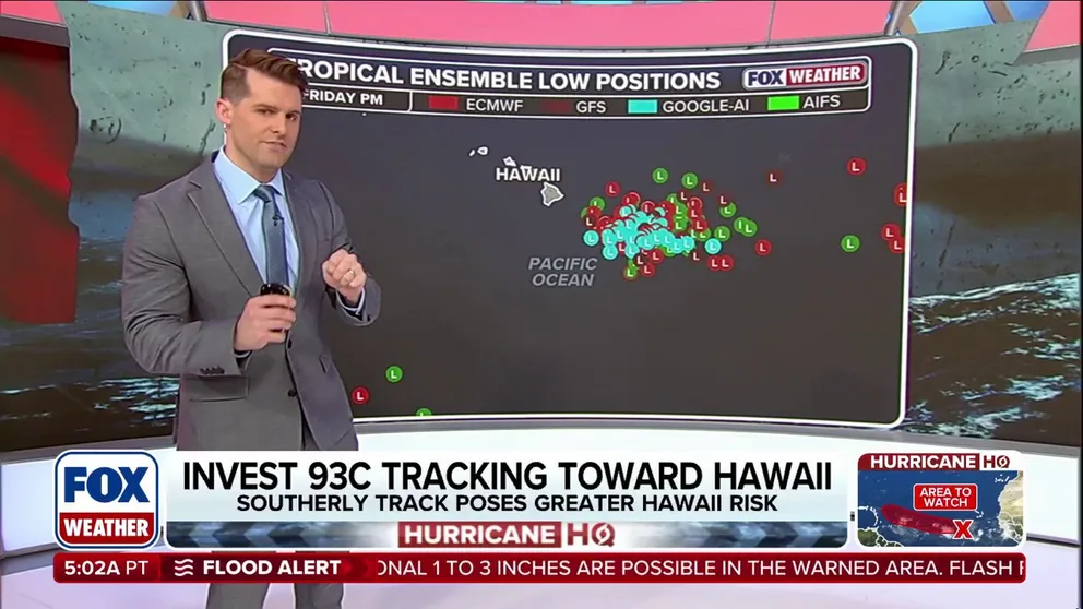
Tropical system expected to form southeast of Hawaii, threating late-week impacts
A tropical depression or tropical storm is expected to form hundreds of miles east-southeast of Hawaii over the next couple of days, according to the National Hurricane Center. Why the islands could be facing their first threat since 2024:
A tropical depression or tropical storm is expected to form hundreds of miles east-southeast of Hawaii over the next couple of days, according to the National Hurricane Center (NHC).
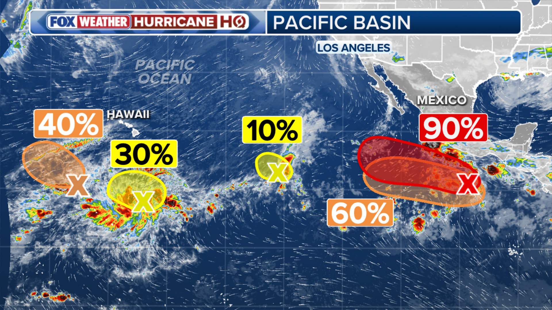
The NHC is monitoring an area of disorganized thunderstorms that has been designated as Invest 93C, which is expected to move in the general direction of Hawaii as it develops.
HAWAII COULD BE IN PATH OF TROPICAL THREAT AS EL NIÑO BOOSTS EASTERN PACIFIC ACTIVITY
(FOX Weather)
The term "invest" is a naming convention used by the NHC to identify areas it is investigating for potential tropical development. Since 93C was designated in the Central Pacific, it would become Tropical Depression Lala if it forms.
The list of Central Pacific storm names does not reset every year as it does in the Eastern Pacific or Atlantic because fewer tropical systems form in the basin and unused names roll over from year to year.
According to the NHC, 93C is currently nearly stationary, but conditions are expected to be conducive for further tropical development.

(FOX Weather)
It's being given medium odds of forming over the next two days and a high chance of development within the next week.
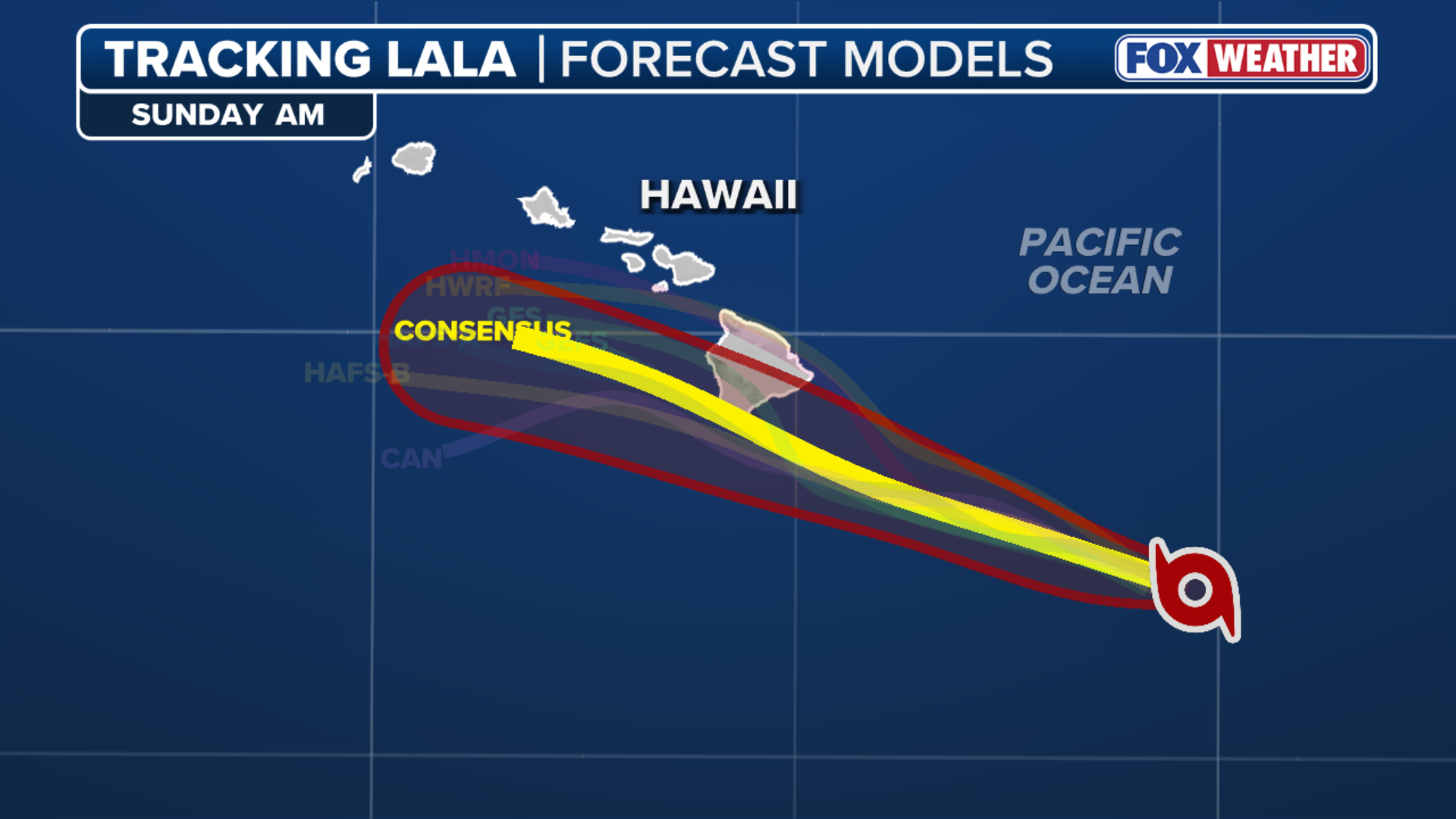
The FOX Forecast Center said 93C is in the process of consolidating and exactly where a center of circulation form will help determine where 93C tracks.
"If the center stays on the eastern side of thunderstorm activity, this would eventually allow the storm to track closer to the Hawaiian Islands, perhaps even a near landfall, the FOX Forecast Center said.
(FOX Weather)
If the center stays toward the western side of storm activity, a landfall would be unlikely, but Hawaii could still see impacts from the storm.
Unlike Fausto, which passed well to the north of the state as a tropical storm last month, 93C could remain over warm waters for much longer — sustaining more tropical development.
LATEST FROM FOX WEATHER HURRICANE SPECIALIST BRYAN NORCROSS
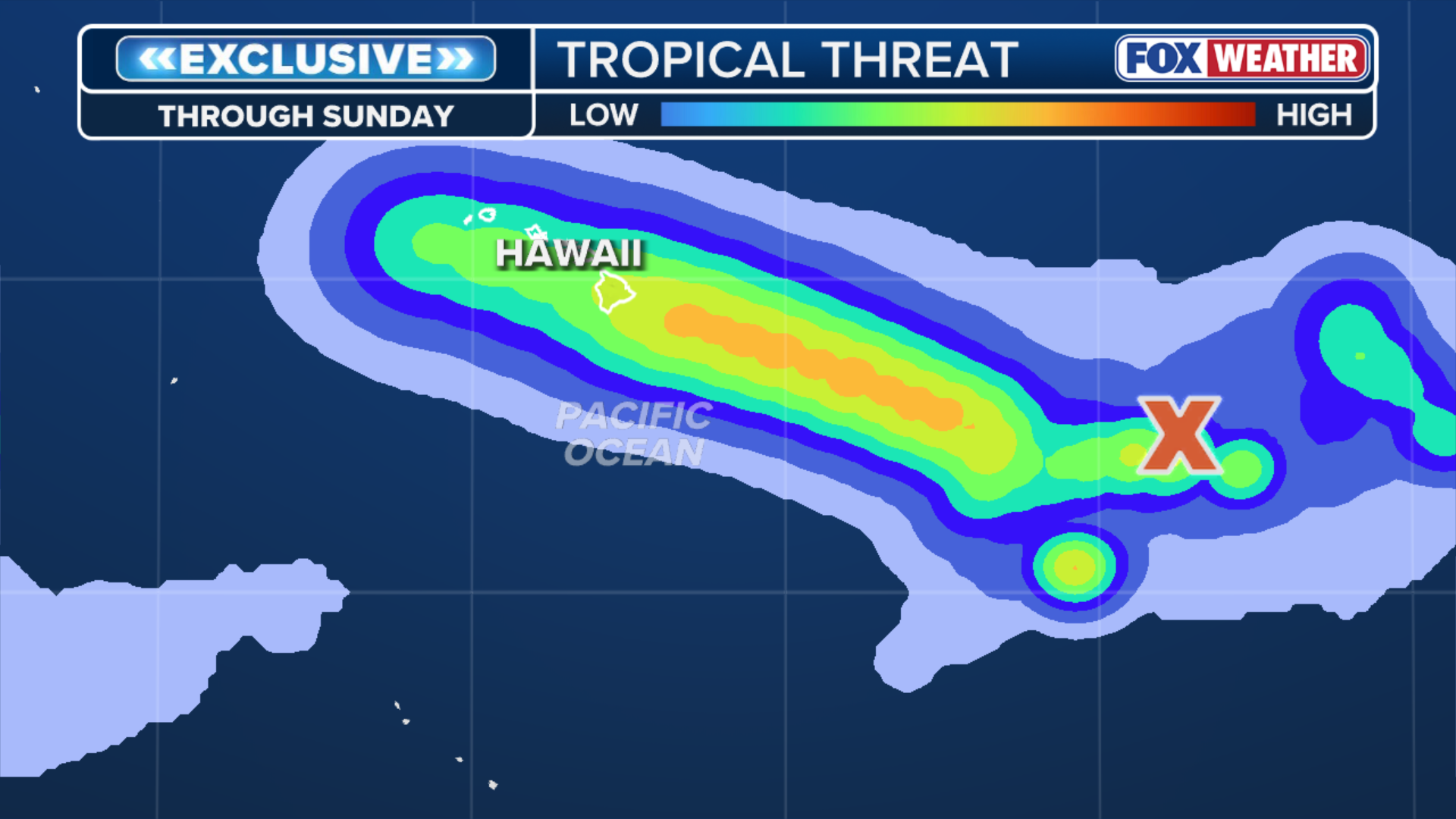
Since a center has not formed yet, there are a wide range of outcomes for future-Lala.
Regardless of direct impacts to Hawaii, monster waves of 16 to 20 feet could batter the islands later this week as the system approaches.
(FOX Weather)
Additionally, the FOX Forecast Center notes that Hawaii is facing a legitimate tropical threat for the first time since Hurricane Hone in 2024, which brushed just south of the islands as a hurricane.
Meanwhile, in the western Eastern Pacific, the NHC is giving an area to watch medium odds of tropical development over the next two days. According to the FOX Forecast Center, this disturbance is not a threat to land at this time.
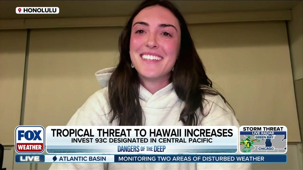
Monster surf eyes Hawaii as Invest 93C brews in the Pacific
The potential for monster surf is likely headed for Hawaii later this week as Invest 93C looms in the Pacific. Surfer and content creator Katlin Kerby joins FOX Weather to break down the deep-water dangers, surf safety, and how to assess storm threats.
So far this season, the strengthening El Niño has helped keep the basin active, producing seven named storms, including Hurricane Genevieve, which reached Category 5 intensity.
Stay ahead of the storm with FOX Weather for continuous hurricane season updates.