Hurricane Hunters’ winter storm reconnaissance well underway off West Coast
Atmospheric river events can produce more water than the Mississippi River holds and can be thousands of miles long over the Pacific Ocean.
Hurricane Hunters help improve atmospheric river forecasts
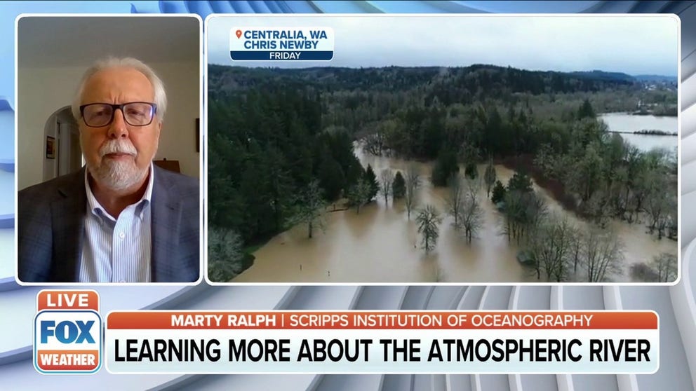
FOX Weather talks to Marty Ralph, Director of the Center for Western Weather and Water Extremes about aircraft reconnaissance missions into atmospheric rivers to improve forecasts.
An active jet stream impacting the West Coast is keeping Hurricane Hunter aircraft busy during what historically is a quiet time for the flying laboratories.
A program observing atmospheric rivers kicked off in 2016, and in subsequent years more resources have been devoted to the efforts, including two WC-130J Super Hercules aircraft for the 2022-23 winter season.
These aircraft are widely known to fly through hurricanes but when the U.S. is out of the heart of the tropical cyclones season, the planes are playing an increasingly vital role to keep forecasters abreast of subtle changes in the atmosphere over the eastern Pacific.
The University of California’s Scripps Institution of Oceanography said aircraft started surveying systems in November and crews will likely continue through March 2023.
"Climatologically, November and December can bring some of the worst floods for that part of the world," Marty Ralph, a research meteorologist at Scripps Institution of Oceanography, said in a statement.
‘WE GOT ROCKED:’ HURRICANE HUNTER DESCRIBES IAN AS ROUGHEST FLIGHT OF HIS CAREER
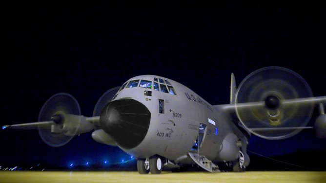
Airmen prepare a WC-130J Hercules for a mission to collect data, on St. Croix, Virgin Islands. Known as the 'Hurricane Hunters,' the 53rd Weather Reconnaissance Squadron mission is to provide surveillance of tropical storms and hurricanes in the Atlantic Ocean, the Caribbean Sea, the Gulf of Mexico and the central Pacific Ocean for the National Hurricane Center in Miami.
(HUM Images/Universal Images Group via Getty Images / Getty Images)
During a reconnaissance mission, a crew deploys dropsondes to measure conditions such as temperature, pressure, water vapor and winds at varying altitudes. This data is fed into high-tech systems that ultimately produce weather forecasts and predict who will see precipitation from the atmospheric river.
Researchers said these giant streams of water vapor can be hundreds of miles wide and carry 25 times the water equivalent to the Mississippi River.
Forecast models can determine where heavy rain, snow and flooding occur but are deemed to have higher accuracy when real-time data in ingested into the computer.
"Results over a 5-year period of evaluation from 2016 to 2022 demonstrated significant improvement in precipitation forecasts over regions impacted by Atmospheric Rivers when the aircraft reconnaissance data is assimilated in real-time into the Global Forecast System," stated Vijay Tallapragada, a scientist at NOAA’s Environmental Modeling Center.
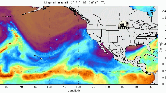
Atmospheric river event from 2017.
(NOAA)
WHAT IS AN ATMOSPHERIC RIVER? THE PLANET’S LARGEST FRESHWATER RIVERS ARE IN THE SKY
Only a handful of atmospheric river events occur each year, but their moisture is considered critical to water supplies in the West.
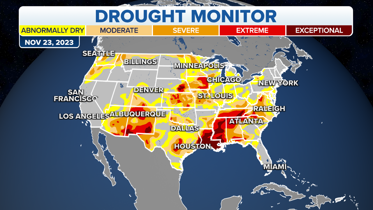
As of early December, more than 92 percent of the western U.S. was experiencing either abnormally dry or drought conditions, and future precipitation forecasts are considered critical for water suppliers and other stakeholders.
"The wets are getting wetter, and the dries are getting drier. And the atmospheric rivers are the key player in both," Ralph said.
Researchers believe additional resources devoted to atmospheric river research could further improve forecasts.
NOAA's multiyear strategy highlighted the need for additional mission support, but the agency did not state when resources would be operational.