Front to produce snow squalls, enhance lake effect snow in the Northeast
Areas along the lakes could pick on the heaviest snow through Monday
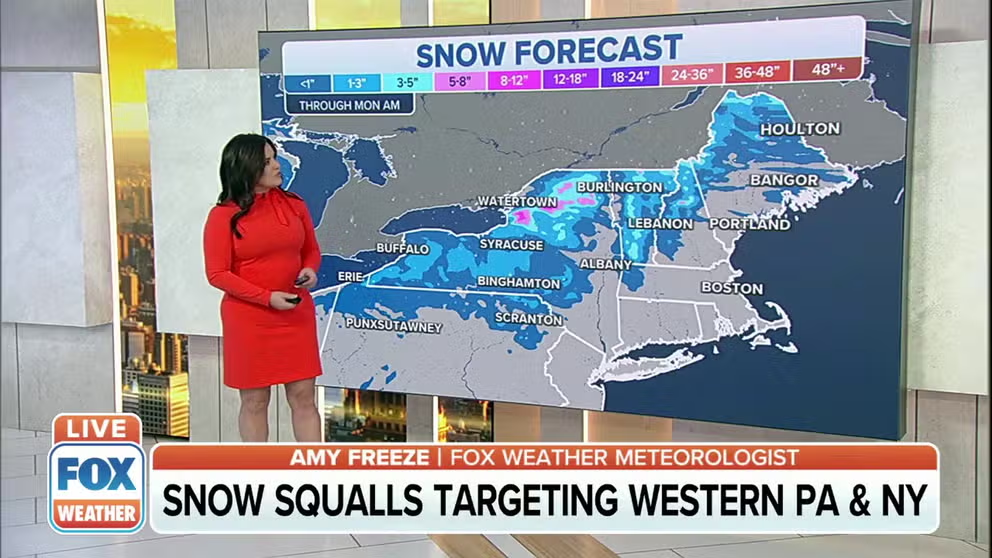
Snow squalls, lake-effect snow target the Northeast
A front will produce snow squalls and lake0effect snow in the Northeast through Monday.
An arctic front will reinforce cold air in the Northeast and produce snow squalls for interior parts of the region through Monday.
Most expected snowfall accumulations will be light, but localized heavy amounts will be possible where lake effect snow forms and mixes with snow squalls.
Areas around Syracuse, New York; Watertown, New York; and Burlington, Vermont could wind up seeing the most snow, and few isolated locations could see around of foot of new powder.
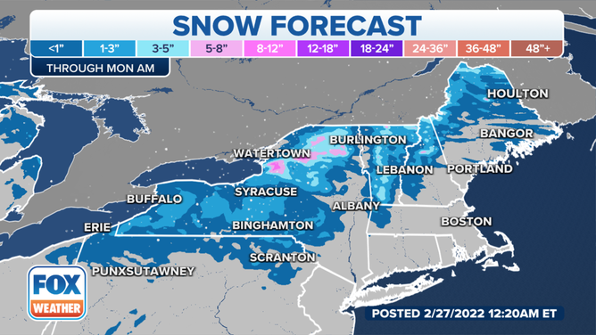
The heaviest snowfall is expected around the Great Lakes through Monday.
(FOX Weather)
The snow squalls will also be accompanied by gusty winds, which meteorologists warn could temporarily reduce visibilities to less than a few hundred feet.
7 THINGS YOU NEED TO KNOW ABOUT WINTER DRIVING
Once the front moves through the region on Sunday, a northwesterly flow will usher in arctic air for the start of the workweek. Temperatures on Monday morning are forecast to be in the single digits for areas around the U.S.-Canadian border and southward into interior regions of the Northeast.
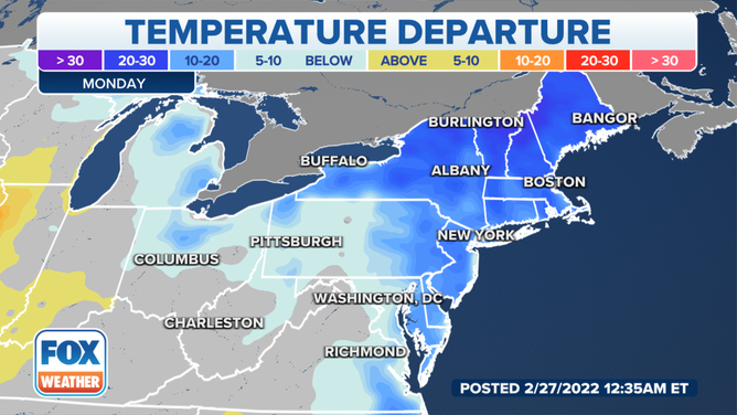
Monday is expected to be the coldest day courtesy of a front that will pass through the Northeast.
(FOX Weather)
Temperatures are expected to moderate slightly ahead of the next storm system.
A weak, quick-moving system is expected to transverse across the region on Tuesday, providing another chance of snow showers.