

Relentless flood threat expected to extend into weekend for millions across Midwest, Ohio Valley
The September scorcher across the South is fueling what's shaping up to be a September soaker for parts of the Plains, Midwest and Great Lakes.
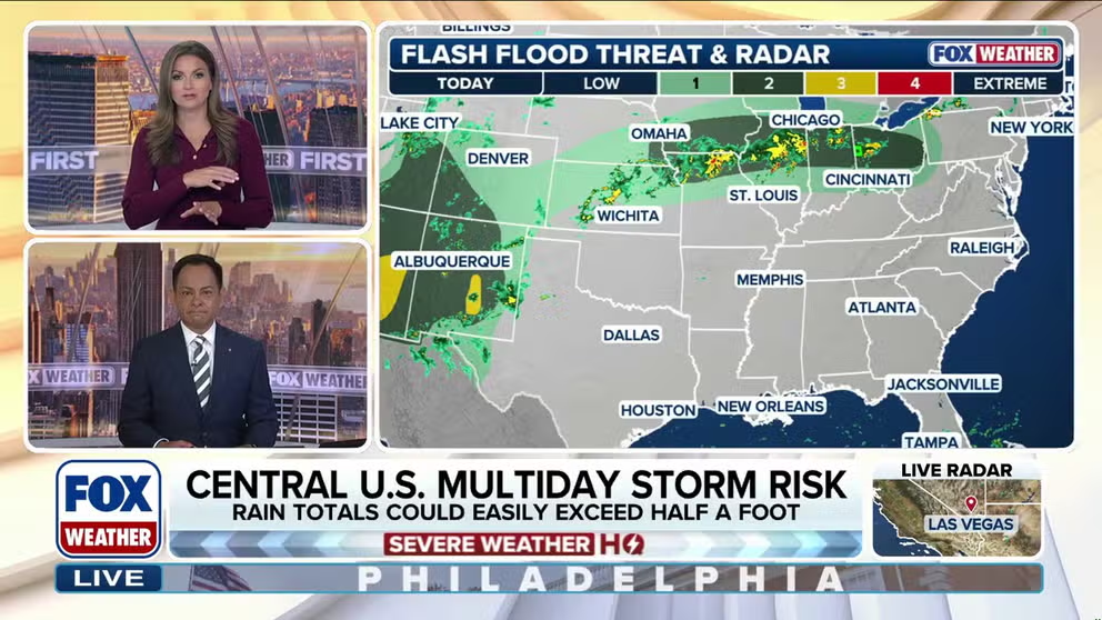
Midwest, Ohio Valley under relentless multiday flash flood threat
A multiday flash flood threat covering millions of people across the Midwest and Central Plains has been extended through Sunday as a stalled weather pattern is expected to bring relentless rounds of thunderstorms over the region.
THE TAKEAWAY
- A persistent pattern is set to bring heavy rain, flooding and severe storms to parts of the Plains, the Midwest, and the Great Lakes through Sunday.
- The area from Northern Illinois to the Indiana-Ohio border is in the bull's-eye of Wednesday's flash flood threat.
- Storms will target the Interstate 80 corridor from Iowa into northern Illinois Wednesday night into Thursday morning.
A multiday flash flood threat covering millions of people across the Midwest and Central Plains has been extended through Sunday as a stalled weather pattern is expected to bring relentless rounds of thunderstorms over the region.
NOAA's Weather Prediction Center (WPC) has issued a Level 2 out of 4 flash flood threat for parts of the Midwest every day through Saturday, where a widespread 5-8 inches of rain is expected all told.
KNOW YOUR FLOOD TERMINOLOGY: WHAT FLOOD WATCHES, WARNINGS AND EMERGENCIES REALLY MEAN

Watch: Rounds of rain turn parts of Western Iowa into a swamp
Rounds of rain triggered flash flooding on Tuesday afternoon, Sep. 16, 2026, in Atlantic, Iowa.
The initial rounds of storms on Monday and Tuesday brought flooding to parts of Western Iowa. The heavy rain sent rivers and creeks out of their banks in Cass County Tuesday.
A September scorcher across the South is fueling what's shaping up to be a September soaker for parts of the Plains, Midwest and Great Lakes.
An intense heat dome has reformed over the Southeast, with many states experiencing their hottest start to September on record. Rounds of storms filled with deep tropical moisture are moving from the Southwest and the Gulf around the western flank of the heat dome, creating the weeklong rainy pattern, with storms capable of producing intense rain rates.
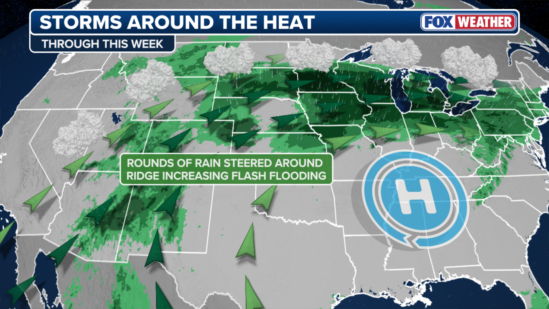
(FOX Weather)
On Wednesday, the heaviest rain is expected to pick up through morning and afternoon across parts of the Ohio Valley.
According to the WPC, the area from Northern Illinois to the Indiana-Ohio border is in the bull's-eye of Wednesday's flash flood threat, with storms also expected to concentrate over Northern Ohio into the evening.
Parts of Central and Southern Iowa and Northern Missouri are also included in Wednesday's Level 2 flood risk.
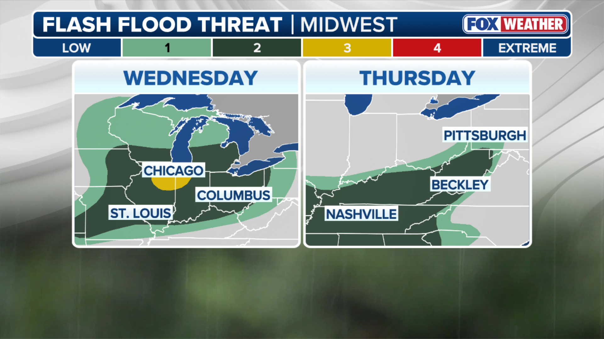
(FOX Weather)
Another round of thunderstorms capable of heavy downpours will fire Wednesday night into Thursday morning across the Interstate 80 corridor from Iowa into northern Illinois, with rain reaching Chicagoland.
The WPC warned that the Quad Cities and southeastern Iowa, which were hit hard by flooding earlier in the week, could see more flooding due to these storms.
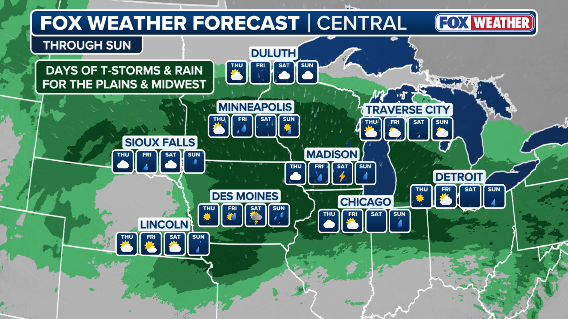
(FOX Weather)
According to the FOX Forecast Center, severe storms could ignite over Nebraska, Kansas and Iowa again on Friday.
The core of flood threat is expected to begin to shift eastward into the Great Lakes by Saturday.