Bundle up. Big chill about to sag over Midwest
It’s time to bundle up as a persistent dip in the jet stream across the eastern half of the country will result in many below-average temperatures
Temperatures drop over Midwest
There’s a chilly change in the Plains and upper Midwest. Get ready for the coldest temperatures of the season.
KANSAS CITY, Mo. -- We've got some big changes coming to the Midwest as far as temperatures are concerned.
It’s time to bundle up as a persistent dip in the jet stream across the eastern half of the country will result in many below-average temperatures. After such a mild start to fall, these below-average lows will be enough to give multiple locations their first freeze and others their coldest temperatures since spring.
(FOX Weather)
There are freeze warnings in place Saturday morning for portions of Kansas, especially across the northeast and northwestern corner of Missouri. Temperatures as of 6:30 a.m. Central were about 32 degrees in these areas. Frost advisories are still in place all the way down through Oklahoma, as the cold air continues to move through.
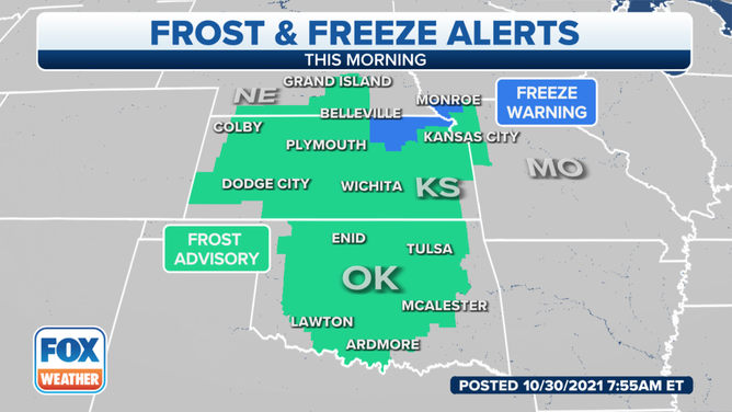
(FOX Weather)
As the cold air continues to move through, it's slow-moving and will sag down to the south. As we go through Monday morning, daytime temperatures will be 10 to 20 degrees below average. Highs will dip into the 30s in the far north to 40s and low 50s farther south. Low temperatures will drop into the 20s and 30s.
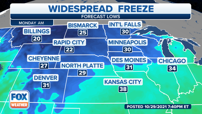
(FOX Weather)
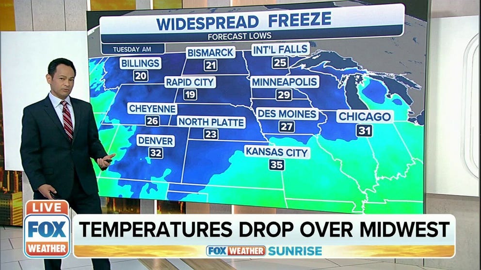
The big chill happens Tuesday when the cold front pulls down into Kansas City and extends over portions of the Great Lakes area.
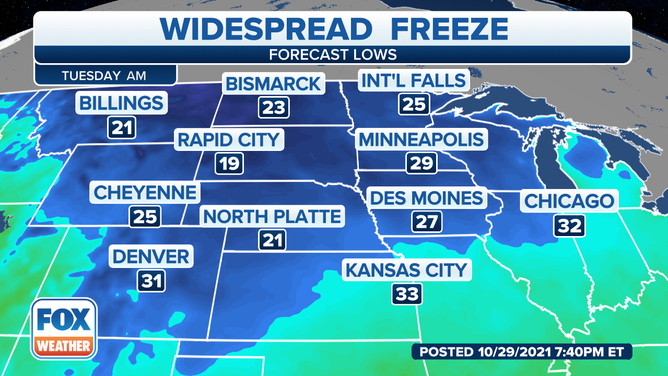
(FOX Weather)
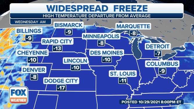
You need to keep bundling up on Wednesday as temperatures will start off in the 20s and 30s as far as overnight lows.
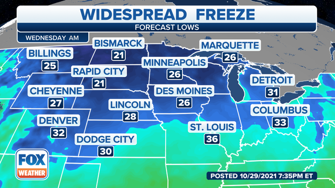
(FOX Weather)
No low-temperature records are predicted.