Historic snowfall in Buffalo area causes flooding threat as eastern US sees major thaw
The FOX Forecast Center said model estimates have put the rate of snow melt around half an inch per hour.
Flash flooding threat from melting snow
FOX Weather's Robert Ray is in Buffalo where some creeks and streams are near flood status due to rapidly melting ice and snow.
BUFFALO, N.Y. – A stunning flip in the weather pattern from record cold to record warmth in less than a week means areas that saw their share of snow could experience flooding concerns as the frozen precipitation melts and finds its way into lakes and streams.
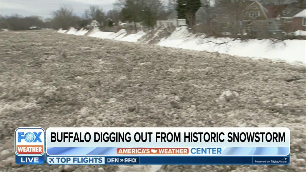
Some communities saw over 4 feet of snow which paralyzed parts of western New York and is blamed for the deaths of more than three dozen residents.
Front loaders and other trucks continue to remove the snow to dump spots, but Mother Nature is adding insult to injury by causing streams and creeks to rise due to runoff that is usually experienced during the spring.
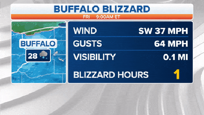
Buffalo Blizzard Stats
(FOX Weather)
Temperatures in the 40s and 50s, as well as rounds of sunshine, are leading to melting rates that the FOX Forecast Center estimates could be around half an inch per hour.
Due to the threat of ice jams and water level rises, the National Weather Service has issued a Flood Watch from Niagara Falls through Buffalo and warned that piles of snow could be blocking vital drainage structures.
SCHOOL’ VANDAL’ PRAISED AS HERO FOR SAVING SEVERAL FROM FREEZING IN BUFFALO BLIZZARD
"There are tree branches, full trees and just the mess of ice and snow here from this historic Christmas weekend with those hurricane-wind conditions and over 4 feet of snow," said FOX Weather's Robert Ray while reporting from Buffalo. "It’s going to be a rough weekend leading into the new year as high temperatures and rain are on the way, and as we’ve been saying, our potential for flash flooding."
River gauges could reach moderate to occasional major flood status off and on through the new year around the Buffalo metro.

Western New York is not the only area of the country seeing snow coverage evaporate before their eyes. Snow is now a distant memory for the Ohio and Tennessee valleys, who were snow-covered just a week ago.
The NWS’ National Operational Hydrologic Remote Sensing Center tracks snow coverage across the country and reports 55.4% of the U.S. was covered with new powder on Christmas Eve in large part due to a historic bomb cyclone that led to arctic air reaching the Gulf Coast.
Fast-forward a week later, and snow coverage had dropped to only around 34% of the lower 48, a figure similar to late November.
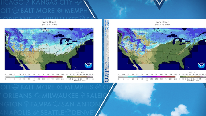
U.S. snow coverage has melted drastically in a week's time.
WATCH: AERIAL VIDEO SHOWS ICY EFFECTS OF SEICHE FROM BUFFALO BLIZZARD
The extended warm streak could last through much of the first few weeks of the new year.
Forecast models show no significant winter storms or arctic blasts in the short-term outlook for New York or many areas east of the Mississippi River.
Temperature outlooks released by National Oceanic and Atmospheric Administration’s Climate Prediction Center show probabilities that warm weather could hang on through most of the first month of 2023.
![Temperature Outlook]() Image 1 of 3
Image 1 of 3NOAA's temperature outlook for early January. ( )
![Temperature Outlook]() Image 2 of 3
Image 2 of 3NOAA's temperature outlook for mid-January. ( )
![Temperature Outlook]() Image 3 of 3
Image 3 of 3NOAA's temperature outlook for late January. ( )


