

Bryan Norcross: Watching the Atlantic but odds of development of the disturbance (#96L) are trending lower
There's no sign that a significant storm will impact the Caribbean islands, though, as always, we'll watch it to be sure.
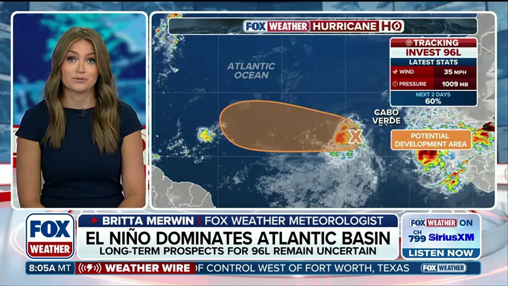
Invest 96L development odds drop amid strengthening El Niño
The Atlantic Basin has been dominated by a strengthening El Niño, suppressing tropical activity across the basin this season. However, Invest 96L is attempting to develop, with odds now dropping to a medium chance. FOX Weather Meteorologist Britta Merwin has the latest on tropical activity across the basin:
Updated at 9:05 a.m. on Wednesday, Aug. 26, 2026.
The tropical disturbance that came off Africa on Monday is still trying to get organized over the tropical Atlantic. The National Hurricane Center officially tagged it Invest #96L, which triggered various internal systems and specialty models to run. The runway ahead looks sufficiently conducive to development that we could briefly get a tropical depression or maybe Tropical Storm Dolly, but the road is going to get very bumpy by Friday.
The NHC's odds of development into at least a depression are now in the medium range as it heads in the general direction of the northeast Caribbean.
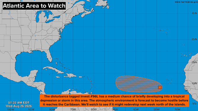
Tropical Overview of the Atlantic.
(Bryan Norcross / FOX Weather)
The Saharan dust and dry air just to the north will try to gum up the works, but the disturbance is carrying a decent moisture envelope, so at least a depression will develop. By Friday, however, the consensus of the computer forecast models is that the dry air will win out and whatever develops will weaken. In addition, as the system nears the Caribbean, the upper-level winds are forecast to become extremely hostile.
There's no sign that a significant storm will impact the Caribbean islands, though, as always, we'll watch it to be sure.
Over the weekend, the system or whatever's left of it could end up well north of Puerto Rico and the nearby islands. Then what happens after that?
WHAT’S THE DIFFERENCE BETWEEN A TROPICAL DEPRESSION, TROPICAL STORM AND HURRICANE?
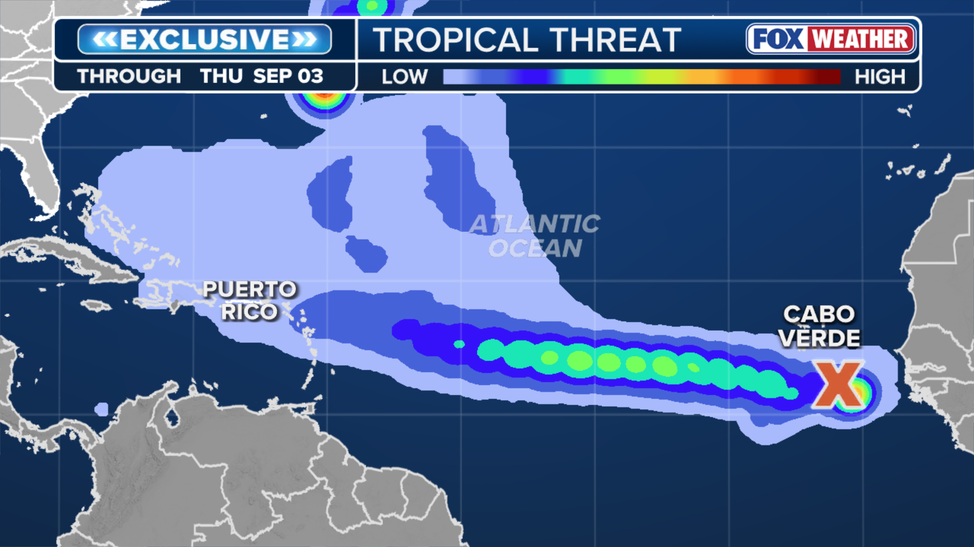
(FOX Weather)
The message from the computer forecasts is that there's a small but non-zero chance that the surviving disturbance could resurrect itself over the Atlantic waters north of the islands where the atmospheric environment is forecast to be conducive to development.
The odds of this scenario have been decreasing every day. So for now, let's play the odds and assume the disturbance is going to succumb to the hostility ahead. But we'll watch the trends in the long-range computer forecasts for later next week.
Elsewhere in the Atlantic
The disturbance north of Bermuda that was tagged Invest 95L has run out of time to develop. It's being absorbed in a North Atlantic weather system.
Disturbances will continue to move into the Atlantic from Africa, but there's no sign in the computer forecasts that any of them will develop anytime soon.
In the Pacific
The flurry of activity continues. But there's no sign that any of the systems will threaten land in the foreseeable future.
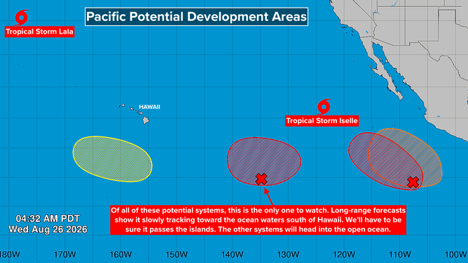
Tropical overview of the Eastern Pacific
(Bryan Norcross / FOX Weather)
The developing disturbance well southeast of Puerto Rico is the only one we might need to eventually keep an eye on. The early forecasts show it eventually tracking in the direction of the waters south of Hawaii.