It's the peak of hurricane season, and the Atlantic is mostly quiet
Even though it's the peak, today is not the "middle" of the hurricane season, however. On average more tropical storms are named before September 10, but more hurricanes are named after. In an average year, about 57% of the hurricanes come later in September, October and sometimes in November.
The podcast Tracking the Tropics with Bryan Norcross is now available to stream.
(FOX Weather)
Updated 9:15 a.m. EDT
On average, September 10 is the date that we are most likely to have a named storm in the Atlantic Ocean, the Caribbean Sea, or the Gulf of Mexico. This year is no exception, although the only named storm, Earl, will probably transition to a non-tropical system later today. Overall, the Atlantic has moved into a phase where tropical development is less likely.
Even though it's the peak, today is not the "middle" of the hurricane season, however. On average more tropical storms are named before September 10, but more hurricanes are named after. In an average year, about 57% of the hurricanes come later in September, October, and sometimes in November.
HOW TO WATCH FOX WEATHER ON TV
For now, the Atlantic is remarkably quiet for reasons that are not obvious. The air over the Atlantic has been uncommonly dry this year. Some of the dry air, but by no means all, was related to dust blown off the Sahara Desert. But there's more to it. The factors involved will take research to sort out.
Of course, what's happened so far doesn't say anything about the coming six weeks, which still qualify for the heart of hurricane season.
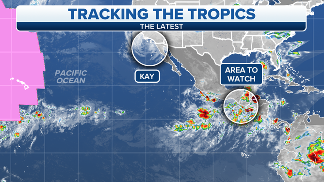
In the Pacific off the coast of northern Mexico, Kay is now just a remnant low-pressure system. There are no longer thunderstorms related to the center of the large swirl of clouds. Kay's moisture is still covering Southern California, however. The winds are still a bit gusty, especially over the islands offshore, but they are nothing like the hurricane-force gusts that tore through the mountains of San Diego County yesterday.
(FOX Weather)
Several inches of rain have fallen in the range of mountains nearest the coast known as the Peninsula Range. Flooding continues to be a threat in and near those mountains.
As the remnants of Kay drift away from the coast, conditions will improve. By later today and especially tomorrow, only a few showers will be in the forecast. A bonus from Kay is that the heatwave that has plagued the Southland of California is over.
HOW TO DOWNLOAD THE FOX WEATHER APP
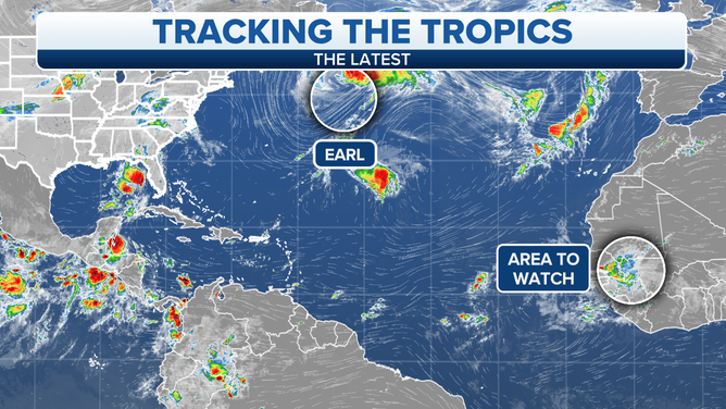
In the North Atlantic, Hurricane Earl is in the process of evolving into a non-tropical system. It is merging with another northern-type low-pressure system. The combo storm will be very large and powerful and will lash the Canadian province of Newfoundland for a couple of days.
(FOX Weather)
Former Earl will also create strong swells and dangerous surf conditions along the U.S. East Coast.
A Tropical Disturbance will move off Africa into the Atlantic late tomorrow or early Monday. The National Hurricane Center is giving it a slight chance of developing in the eastern Atlantic over the next 5 days as it plows west into dry air and a somewhat hostile environment.
Otherwise, nothing threatening appears to be in the offing through midweek at least.
FOX Weather Hurricane Specialist Bryan Norcross has a podcast, Tracking the Tropics with Bryan Norcross, available now on FOX News Audio. You can get it on your device by clicking here.