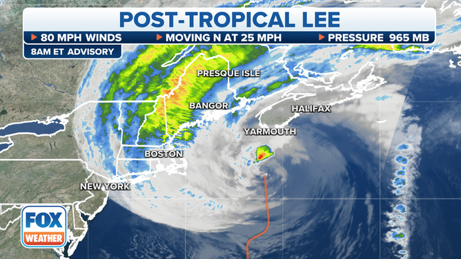
Bryan Norcross: Lee speeding past New England, will move over Nova Scotia, Canada today
The meteorological structure is a combo between a tropical system and a nor’easter. When a system becomes integrally tied to a front, it is designated “Post Tropical."

FOX Weather is your Hurricane HQ, streaming free 24/7.
(FOX Weather)
Updated 8:30 a.m. ET Saturday
Lee is still producing hurricane-force winds over the ocean, but because a cold front wrapped around it, it’s technically not a tropical system anymore. The meteorological structure is a combo between a tropical system and a nor’easter. When a system becomes integrally tied to a front, it is designated "Post Tropical."
Post-Tropical Cyclone Lee is an unfortunate name because it sounds like Lee has weakened or died out. But the top winds are still the same. The distinction is only technical.
Winds at Provincetown at the tip of Cape Cod have gusted over 40 mph – tropical-storm strength. Otherwise, somewhat gusty winds cover most of coastal New England, but nothing damaging is expected beyond isolated power outages.
A water rise of 1 to 2 feet caused some local coastal effects, but no significant problems were likely.
Lee is still producing hurricane-force winds over the ocean, but because a cold front wrapped around it, it’s technically not a tropical system anymore.
(FOX Weather)
New England is behind the front, so temperatures are cool and the air is dry. That means that the moisture-rich tropical air is not reaching the coast, and what rain is falling is light to occasionally moderate. The dry air absorbs much of the moisture before it reaches the ground.
Lee will bring strong onshore winds to Nova Scotia when the center makes landfall around midday. This will likely be the highest wind experienced on land.
Conditions over southeastern Massachusetts will dramatically improve by afternoon, with the clearing moving north during the day as Lee accelerates out of the region.
Well out in the Atlantic, Tropical Storm Margot is fading out without affecting land.
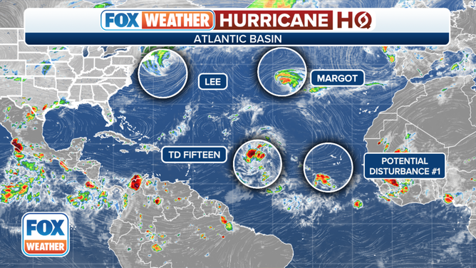
Here's a look at the current storms in the Atlantic basin.
(FOX Weather)
Tropical Depression Fifteen is a large system, but does not yet have organized thunderstorms rotating around the center. It is forecast to become Tropical Storm Nigel in the next day or so. Its track will be into the Western Atlantic. Right now, it does not appear to be a threat to land, although Bermuda will have to watch to be sure it turns north.
Another system will move off Africa about midweek. It has a chance of developing as it moves west in the tropical Atlantic. It will be something to watch.