Bryan Norcross: Disturbance to drench Florida, then watching for development in the Gulf
FOX Weather Hurricane Specialist Bryan Norcross said this type of weather scenario often produces flash flooding and everyone should plan to stay aware.
Tropical trouble monitored in Gulf as new system to drench Southeast US
FOX Weather Hurricane Specialist Bryan Norcross discusses what is being monitored in the Gulf, as a new system could brew tropical trouble later this week.
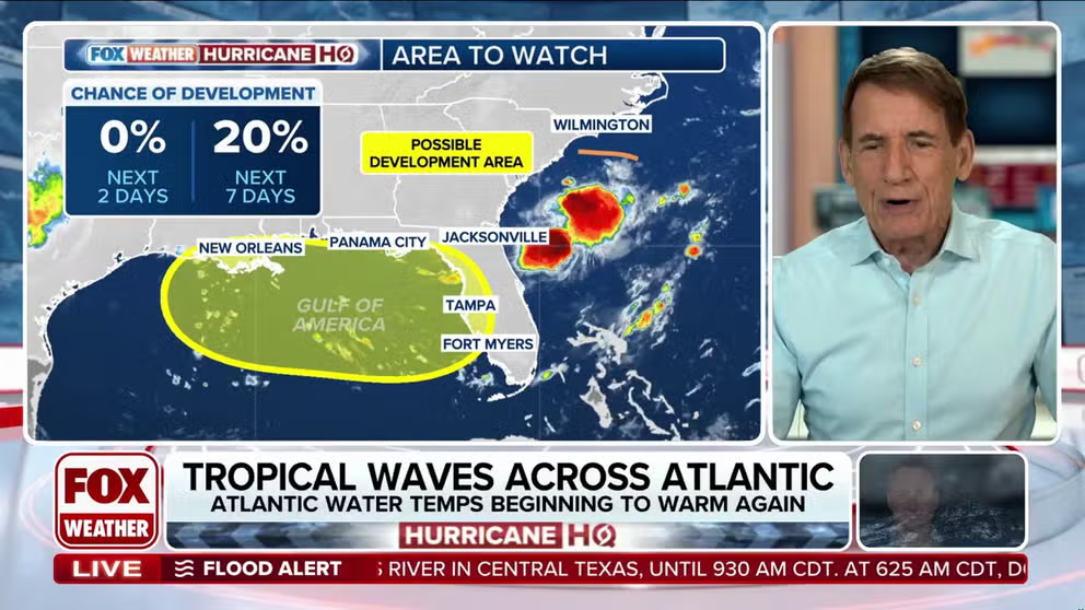
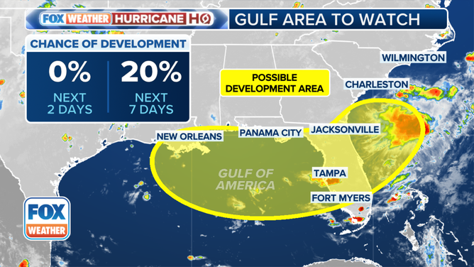
An area of disturbed weather offshore of the Southeast coast is going to turn into a problem for the Florida Peninsula this week. It's going to take an unusual path from east to west, slowly looping toward the Gulf. It will bring a tremendous amount of tropical moisture to Florida and produce slow-moving downpours.
This type of weather scenario often produces flash flooding. So plan to stay aware.
After the system moves into the Gulf mid-week, the National Hurricane Center is giving it a slight chance of developing into at least a tropical depression. The strong consensus of the various computer forecasts is that the system will stay weak and disorganized, but it's important to remember that forecasts for systems that haven't even begun to develop are always subject to change.
(FOX Weather)
The current consensus is that the disturbance with its expansive tropical moisture will track toward the northern Gulf coast and spread heavy rain along the coast and well inland. The system might stall late in the week over or near the northern Gulf. If that happens, extremely wet weather will affect coastal areas next weekend. Plan to stay informed.
The disturbance developed from the tail end of a cold front that moved offshore of the U.S. East Coast. The main storm system and front are pushing away into the Atlantic, but the disturbance was left behind over the warm Gulf Stream waters offshore of Georgia and South Carolina.
The system is best organized in the middle levels of the atmosphere. When a disturbance develops from a non-tropical system, like a front, it often takes a number of days to gain much organization. That's why the National Hurricane Center has the Area to Watch in the Gulf. It will take until about Wednesday before the disorganized, but very wet system gets there.
Rain looks likely to increase across the Florida Peninsula tomorrow and continue into Wednesday. Then our attention will focus on the Gulf and the northern Gulf coast.
The atmosphere is extremely moist over Florida, and that moisture level is forecast to increase. So heavy rain looks very likely over a good part of the Florida Peninsula. It appears that the thunderstorms will be slow moving, increasing the threat of local flooding.
Otherwise, the tropics remain calm. Hostile upper winds and dry air are holding development at bay.