Bryan Norcross: New disturbance faces a slow, tough road ahead in the tropical Atlantic
As always, long-range forecasts are subject to significant changes when the system in question hasn't even begun to develop. So it makes sense for residents on the northeast Caribbean islands to keep an eye on the system next week.
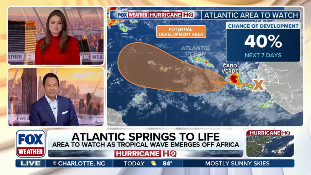
National Hurricane Center monitoring area to watch for tropical development off Africa
The National Hurricane Center is monitoring a tropical wave that's about to move off the coast of Africa that's producing a broad area of showers and thunderstorms. The NHC gives this system a medium chance of developing into a Tropical Depression by the middle of next week.
Updated: 10:30 a.m. ET, Sept. 12, 2025.
The disturbance just moving off Africa is accompanied by a cluster of moderate thunderstorms. Sometimes systems this robust relatively quickly turn into tropical depressions or tropical storms in the Atlantic. That’s unlikely to be the case this time, however.
Dry and dusty air covers a good part of the eastern Atlantic, so the disturbance will have to fight to develop. The National Hurricane Center shows a large orange potential development area, indicating that the system has a medium chance of developing, but notice that it will take some time before the disturbance makes it into the development zone.
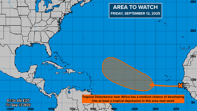
The outlook for an are of interest in the Atlantic as of Sept. 12, 2025.
(FOX Weather)
The consensus of the computer forecast models is that the system has a decent chance of eventually developing, just not quickly. If it does approach the islands, on the current schedule, the system will be in the general vicinity about next weekend. Some computer forecasts turn it north before it gets anywhere near the Caribbean, while others bring it closer. As of now, the odds of a direct impact are very low.
As always, long-range forecasts are subject to significant changes when the system in question hasn't even begun to develop. So it makes sense for residents on the northeast Caribbean islands to keep an eye on the system next week.
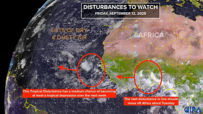
An overview of tropical waves being monitored as of Sept. 12, 2025.
(FOX Weather)
Another disturbance is forecast by the computer models to be in the eastern Atlantic around next Tuesday. The early predictions are that it will track a little farther to the south. But it's too early to know anything more.
For now, there are no threats. Recall that last year, a switch got flipped and suddenly storms started forming. We're not seeing that in the long-range forecast at this point, so… so far so good.