

Bryan Norcross: Peak of hurricane season arrives with a whimper while Pacific tropical explosion continues
The unusually warm water associated with El Niño causes the air to rise over the Eastern and Central Pacific, which gives tropical systems a head start.
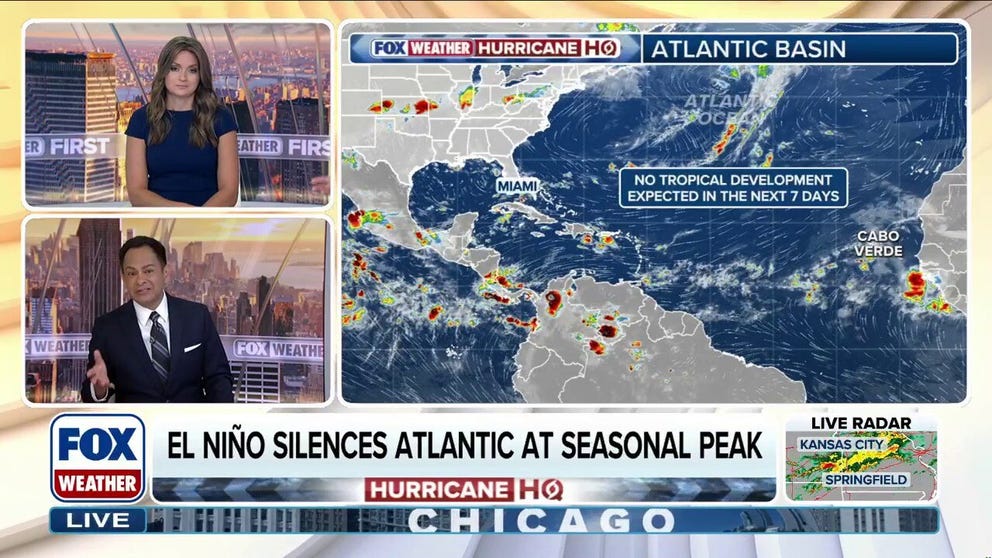
El Niño silences Atlantic as climatological peak of hurricane season arrives
The climatological peak of Atlantic hurricane season arrives today, September 10, yet the basin remains eerily quiet, largely due to El Niño’s influence. Wind shear remains high across the entire Main Development Region (MDR), while Saharan dust and low instability are severely limiting the numerous tropical waves moving off the coast of Africa.
Updated 9:22 A.M. on Thursday, September 10, 2026
On average, September 10 is the date when there is most likely to be a named storm in the Atlantic, the Caribbean, or the Gulf. In fact, it's rare that there is not a named storm somewhere in the Atlantic basin on this date. But here we are.
In the interests of precision, the National Hurricane Center’s graph is based on 77 years of storm data from 1944 to 2020. A few weak storms could have been missed in the pre-satellite years between 1944 and 1965, but aircraft reconnaissance had begun, so the record is believed to be reasonably accurate.
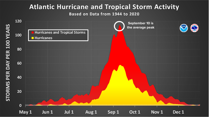
Atlantic hurricane and tropical storm activity.
(National Hurricane Center/ NOAA)
In the 1970s and 1980s, however, tropical activity was limited by air pollution from Europe, so the numbers were artificially skewed. In addition, modern high-resolution technology has caused an extra storm or two to be named over the past 25 years.
The point is that the graph is representative of reality, but it could be off a few days due to a number of variables.
Now in 2026, even with our modern technology, not only is the Atlantic quiet today, there's no sign of any development until past the middle of the month, at least.
This is obviously extremely unusual. But the El Niño going on in the Pacific is extreme and unusual. The El Niño creates hostile upper-level winds and sinking air over the Caribbean and the tropical Atlantic, and this El Niño strengthened extra early. The timing coincided with the part of an average season where most of the tropical development comes from disturbances rolling off Africa. The early, strong El Niño quashed development of African systems.
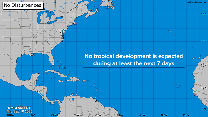
Atlantic Basin on Sept. 10, 2026.
(Bryan Norcross)
The complete name of the El Niño is El Niño de Navidad – Spanish for the Christ child. Peruvian fishermen named it in the 1600s because it normally peaks in December, and it has a detrimental effect on fishing off the Pacific coast. This El Niño is coming on so strong, however, that it's having dramatic effects on the atmospheric environment early, which has created the tropical-system drought over the Atlantic.
Since El Niño is forecast to continue to strengthen, there's a reasonable chance that the Atlantic will remain shut down. That means we'll wait for late September and October, when tropical systems are more likely to develop in the Gulf or east of Florida, where the El Niño has less impact.
Remember, broadly speaking, the Atlantic hurricane season has three phases: the Gulf and close to Florida phase, the Atlantic/African systems phase, and the western Caribbean/Gulf/east of Florida phase.
Phase 1 produced five tropical storms. Phase 2 has been and might stay a zero. We'll see about Phase 3 when it kicks in in a few weeks.
So for now we rest.
In the Pacific
Tropical Storm Norbert has formed in the Eastern Pacific. The system has a healthy circulation and is forecast to become the next hurricane. The system is heading in the general direction of Hawaii, but it's a long way away – about 2,400 miles.
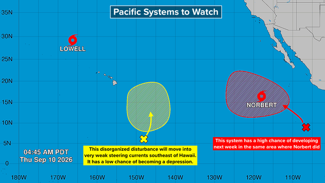
Pacific Basin on Sept. 10, 2026.
(Bryan Norcross)
According to the long-range computer forecast models, it will take more than a week to get to the general vicinity of the islands. Obviously, a lot can happen in that amount of time. It will be something to check on next week.
The National Hurricane Center has identified a system southeast of Hawaii that they have given a low chance of developing as it tracks slowly to the north. There's no indication at this point that it would affect the islands.
And the third system has a high chance of developing over the next several days in the same patch of ocean that spawned Norbert. It's too early to know if it might affect land.
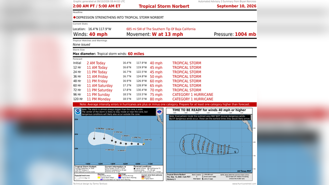
Hurricane Norbert summary.
(Bryan Norcross)
And the long, long-range computer models forecast another system after that in the same part of the ocean.
The unusually warm water associated with El Niño causes the air to rise over the Eastern and Central Pacific, which gives tropical systems a head start. In addition, there is a marine heat wave from Hawaii to California to the equator which is providing extra energy.
Unfortunately, this hyper-tropical production looks likely to continue.