Bryan Norcross: Atlantic disturbance showing signs of slow development
Some computer forecasts show the system eventually developing into a hurricane, but the consensus is that it will not become terribly strong before it reaches the vicinity of the northeast Caribbean islands on Thursday or Friday.

FOX Weather is your Hurricane HQ.
(FOX Weather)
Updated at 9 a.m. on Monday, Oct. 6, 2025.
A broad circulation is developing in the large disturbance tracking across the tropical Atlantic. The thunderstorms are still disorganized, however, so it has a ways to go before it gets designated a tropical depression or tropical storm. The National Hurricane Center has odds in the high range that the system will organize.
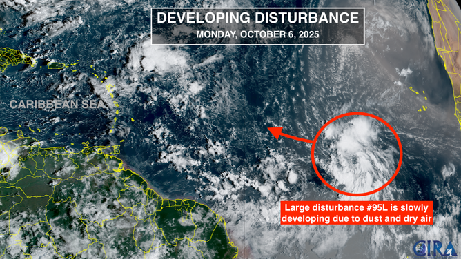
This satellite image shows Invest 95L in the Atlantic on Oct. 6, 2025.
(FOX Weather)
Dust and dry air cover much of the tropical Atlantic, which appears to be the limiting factor. And even if the system becomes a depression or Tropical Storm Jerry, the dry air looks likely to tamp its ability to strengthen quickly.
Some computer forecasts show the system eventually developing into a hurricane, but the consensus is that it will not become terribly strong before it reaches the vicinity of the northeast Caribbean islands on Thursday or Friday.
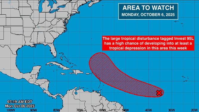
This graphic shows the tropical Atlantic Basin on Oct. 6, 2025.
(FOX Weather)
There is a strong consensus among the computer forecasts that the disturbance, or whatever it turns into, will track over or near the islands east of Puerto Rico. Everybody there should stay well-informed over the next few days and be ready for at least a gusty moisture surge.
A sharp and strong dip in the jet stream is forecast to once again develop over the eastern part of the U.S. That should deflect any system that tracks near the islands into the central Atlantic.
East Coast Storm Possible
Nothing else is in the offing in the tropics, but long-range computer forecasts indicate that the sharp jet stream dip will generate a powerful nor'easter along or just offshore of the East Coast late in the week and through the weekend.
If it develops, it won't be a tropical system, but it could produce disruptive and potentially dangerous weather from North Florida to New England. If the system develops like many of the computer forecasts indicate, the combination of the storm and the astronomical high tides could cause significant coastal flooding.
If a nor’easter does develop as forecast, it could push a significant cold front south across Florida, although it’s not clear that South Florida will share in the seasonal change.