

Bryan Norcross: Developing low pressure in the Atlantic still has a chance to be named Kyle
Potential-Kyle will have to fight off strong upper-level winds and dry air, but the system still has a chance to land in the 2026 record book.
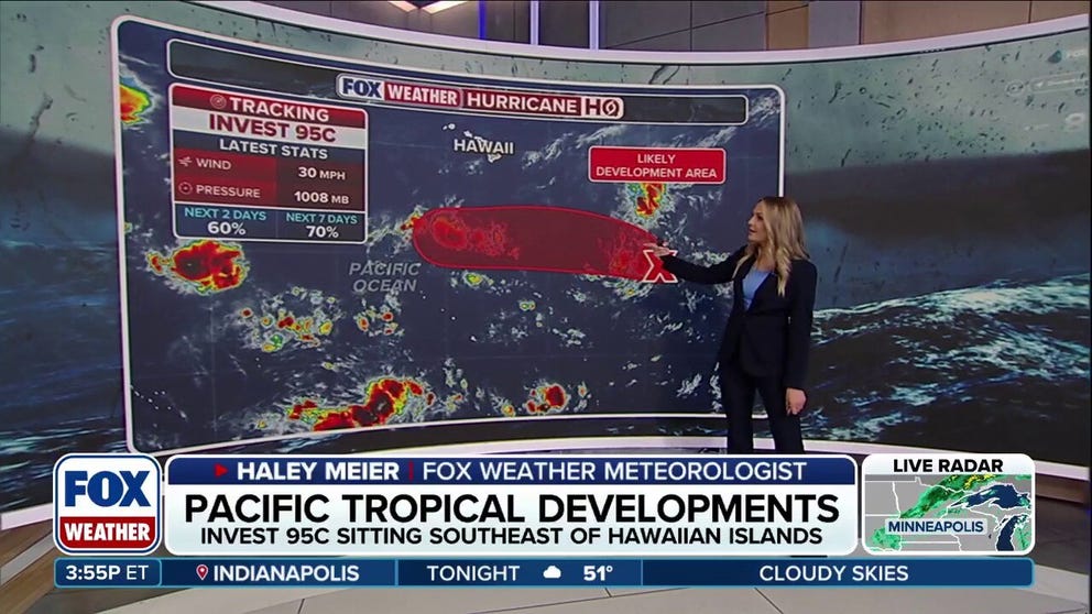
Tropical disturbances emerge in Pacific and Atlantic basins
Two tropical disturbances are being monitored in the Pacific, with one forming southeast of Hawaii and another developing closer to Mexico. Invest 95C and Invest 95E are both being watched for potential tropical development over the coming days. Meanwhile, the National Hurricane Center is monitoring an area of disturbed weather along a stalled frontal boundary a few hundred miles south of Bermuda.
Last updated at 9:30 a.m. on Nov. 5, 2026
A non-tropical low-pressure system is strengthening south of Bermuda. The system developed from an old front and an upper-air disturbance embedded in the El Niño-driven jet stream – the same disturbance that enhanced the latest round of flooding rains in Florida.
LATEST FROM FOX WEATHER HURRICANE SPECIALIST BRYAN NORCROSS
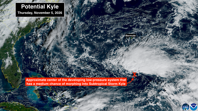
Satellite imagery of Atlantic Basin on Nov. 5, 2026.
(CIRA / FOX Weather)
Upper-level winds are currently super hostile to tropical development, but a small window of marginally conducive atmosphere could open over the next few days.
Winds on the north side of the developing low are already above 40 mph. The air is being squeezed between high pressure offshore of the Mid-Atlantic coast and the low pressure of the system. As a result, if the atmospheric environment allows thunderstorms to organize around the center, the system will skip the depression stage and go directly to being a named storm.
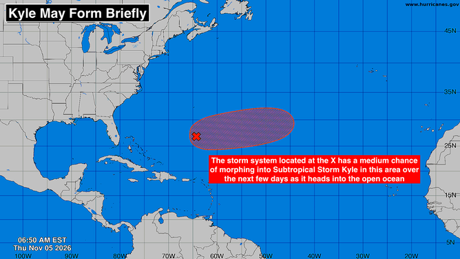
Atlantic Basin on Nov. 5, 2026.
(Bryan Norcross / FOX Weather)
The National Hurricane Center is giving the disturbance a medium chance of meeting the criteria to be named Subtropical Storm Kyle. The window of opportunity is pretty short. By early next week, the possibility is likely to end. In the meantime, potential-Kyle will have to fight off strong upper-level winds and dry air, but the system still has a chance to land in the 2026 record book.
The good news is that the latest disturbance impacting Florida has moved on and relatively dry air will cover the state through the weekend. The El Niño-powered jet stream will continue across the southern U.S., however. So more rounds of stormy weather will be likely across the southern tier from coast to coast.