

Bryan Norcross: A chance the coastal storm briefly becomes tropical enough to be named Kyle this weekend
At this point, just be aware of the possibility of a strong coastal storm from the Carolinas to Cape Cod, and we'll see how and where the low-pressure center develops.
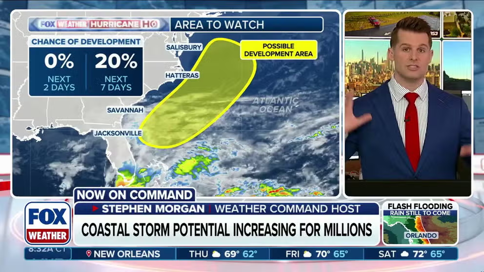
National Hurricane Center monitoring brewing Southeast coastal storm for tropical development
The same system responsible for bringing a weeklong flash flood threat to Florida could develop into a coastal storm by the weekend and threaten early Thanksgiving travel plans for millions of people as the National Hurricane Center (NHC) designated the area off the Southeast coast as an area to watch for tropical development.
Last updated at 10 a.m. on Wednesday, Nov. 18, 2026.
A complex combination of a front across South Florida, a sharp upper-air disturbance moving across the Gulf, an unusually moist atmosphere for November, and the El Niño-powered jet stream is producing bands of torrential rain across the southern part of the Florida peninsula and the Florida Keys.
LATEST FROM FOX WEATHER HURRICANE SPECIALIST BRYAN NORCROSS
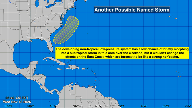
Atlantic Basin on Nov. 18, 2026.
(Bryan Norcross / FOX Weather)
The consensus of the various computer forecast models is that the current broad area of disturbed weather will consolidate into a low-pressure system near or offshore of the east coast of Florida on Friday. That low could strengthen into a significant coastal storm (nor'easter) if it develops far enough offshore. In any case, it will track north along or near the U.S. East Coast into early next week.
If the system develops far enough east of Florida and avoids the Carolinas offshore, it could be over extra-warm ocean water long enough to shed the original fronts and consolidate into an independent storm. The National Hurricane Center is putting the odds in the low category that that will happen. If it did, the system would be named Subtropical Storm Kyle.
No consolidated system has even begun to develop, so the range of threats is wide if and when a low-pressure center develops from the current broad South Florida disturbance. If the system forms as some computer forecasts indicate, it could be a significant coastal storm from the Southeast to New England, but it's too early to be certain about the strength or impacts.
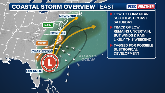
Potential coastal storm overview
(FOX Weather / FOX Weather)
Whether the low-pressure system morphs into Subtropical Storm Kyle over the weekend or it moves north as a non-tropical coastal storm is irrelevant to the impacts on the coast.
At this point, just be aware of the possibility of a strong coastal storm from the Carolinas to Cape Cod, and we'll see how and where the low-pressure center develops.
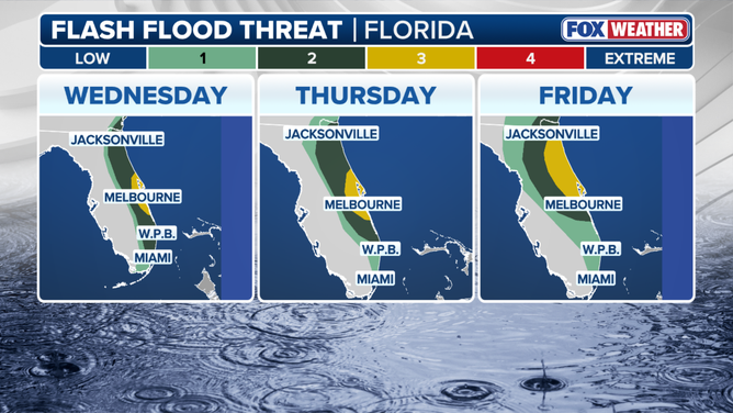
Multiday flash flood threat
(FOX Weather / FOX Weather)
Along the east coast of the Florida peninsula and across the southern part of the state, the broad and complex disturbance will continue to produce heavy rain with flooding likely in some areas. Stay aware of the local threats. Pay attention to flood alerts from the National Weather Service.
If the system develops as some computer forecasts indicate, alerts will spread up the coast over the next few days. Stay informed.
As long as the ocean is warm, and it is significantly warmer than normal east of Florida this year, there is the possibility of these hybrid systems that start non-tropical and, at least briefly, take on some tropical characteristics – like Josephine did last month. They add to the tropical record book, but behave much more like typical wintertime coastal storms/nor'easters.