Bryan Norcross: The Gulf disturbance's last chance and first live hurricane Q&A of the season
The National Hurricane Center is still drawing a slight-chance lemon where it could develop, but the odds are in the ultra-low category. Even if that very unlikely event happened, and it developed an organized circulation, the main effect would be spotty, heavy tropical downpours along the coast.

FOX Weather is your Hurricane HQ.
(FOX Weather)
Updated at 9 a.m. ET Friday, July 25, 2025
The broad disturbance that we've been following across the northern Gulf will move into Texas later today. The National Hurricane Center is still drawing a slight-chance lemon where it could develop, but the odds are in the ultra-low category. Even if that very unlikely event happened, and it developed an organized circulation, the main effect would be spotty, heavy tropical downpours along the coast.
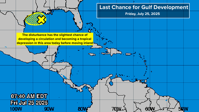
The broad disturbance that we've been following across the northern Gulf will move into Texas later today.
(NOAA)
Even after the system moves inland, it will continue to pull tropical moisture into the coastal sections, so the rain won't immediately turn off. The National Weather Service map shows the areas where they are forecasting the heaviest rain to fall, but don't look at the details. The blue shading tells you where the tropical moisture is forecast to linger over the next few days, and tropical downpours from the system are still possible.
Rain chances will decrease by the end of the weekend, and unfortunately, extreme heat will return to the Gulf Coast. Feels-like temperatures will be up in the 110°F range once again.
In the Atlantic
There is some consensus among both the traditional and AI long-range forecasts that a robust disturbance will move off the coast of Africa about Monday. If these projections are right, it will have the best chance to organize of any system we've seen in the tropical Atlantic this season.
The projections seem to indicate that the system will find a gap in the dry air and Saharan dust. We'll see about that.
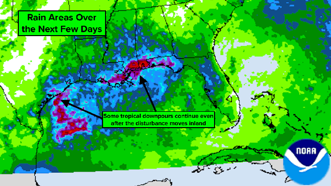
Even after the system moves inland, it will continue to pull tropical moisture into the coastal sections, so the rain won't immediately turn off.
(NOAA)
Remember the fundamental rule: forecasts for just-developing or disorganized systems are subject to larger errors and will probably change. This system hasn't even started to think about developing, so it's more interesting because the models have some measure of consensus than anything else.
On average, Saharan dust season continues into August, although coverage is often fading a bit by this time.
Q&A at midday Friday
Today at 12 p.m. ET, we are doing our first Hurricane Q&A of the season. We tested the new system earlier this week on Facebook, and it works great. Today, we'll be live on Facebook and YouTube, and the system is in place for you to send in comments and questions.

Today at 12 p.m. ET, Bryan Norcross is doing FOX Weather's first Hurricane Q&A of the season.
(FOX Weather)
Before the hurricane season gets going, we wanted to fully test out the system that we plan to use during a storm threat.
If you'd like to participate, ask a question, or just help us test out the system, tune in to the FOX Weather YouTube channel, the FOX Weather Facebook page, or my Facebook page to participate.
See you then!