Bryan Norcross: Long range forecasts suddenly show the Atlantic coming alive
Suddenly, there is broad consensus among the various computer forecast models—both the traditional ones and the new AI models—that a new system coming off Africa will eventually develop into a tropical storm or hurricane.

New tropical area to watch tagged off the coast of the Carolinas
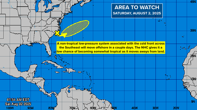
And just like that, the Atlantic springs to life. The National Hurricane Center has tagged a new area to watch with low odds for development right off the coast of North and South Carolina. The system is anticipated to move east further off the coast.
Updated Saturday 10 a.m. ET
Before I discuss the changes in the long-range computer forecasts, there's a new area to monitor off the Southeast coast. The National Hurricane Center is drawing a squished lemon—or more like a summer squash, actually—offshore of North Carolina. This non-tropical low-pressure system is related to a front sagging toward the coast. It's forecast to move offshore and could take on some tropical characteristics as it moves away from land.
There is no expectation that this system will pose a threat, but it could add to the seasonal storm list if it develops winds of at least 40 mph.
NOAA Tropics Map
(NOAA)
The bigger threat on land is the quasi-permanent front that's going to settle across North Florida and southeastern Georgia. Periods of heavy rain are likely over the next few days, and some flooding is possible. Stay in touch with local National Weather Service alerts.
Long-Range Computer Forecasts
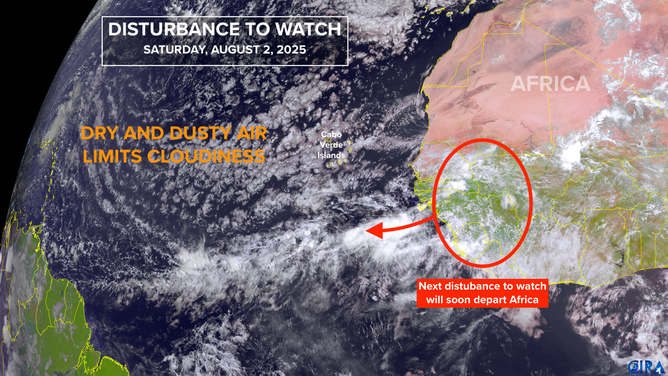
A disturbance is forecast to move off Africa tomorrow and head in the general direction of the Caribbean. Suddenly, there is broad consensus among the various computer forecast models—both the traditional ones and the new AI models—that this system will eventually develop into a tropical storm or hurricane.
The possible future tracks range from the Gulf to offshore of the East Coast, so there's certainly no definitive threat at this time. In addition, the long-range predictions show this happening well into next week, beyond the period that we have much confidence in the forecasts.
Tropics Satellite Map
(NOAA)
The takeaway at this point is that the consensus of the various computer forecasts suggests that the atmosphere over the Atlantic, Caribbean, and Gulf looks to become conducive to tropical development in 10 to 15 days.
Looking at the calendar, if this happens, it would be right on schedule. Obviously, we're moving toward the traditionally busier part of the hurricane season.
For now, we wait, and make sure our hurricane plans are in place.
In the Pacific
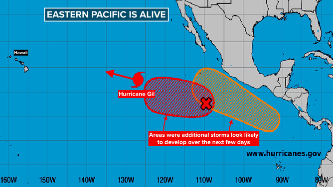
Hurricane Gil is heading in the general direction of Hawaii, but will move over cool water and slowly die out before it reaches the islands. Otherwise, the parade of storms looks to continue offshore of the Mexican coast.
NOAA Tropics Map
(NOAA)
This eastward progression of general atmospheric conditions conducive to storm development might lend some credence to the idea that the Atlantic will come alive in another week or two. We'll see.