

Bryan Norcross: Tropical Storm Lala is moving away from Hawaii while the Atlantic stays asleep
We were concerned about Hawaii this hurricane season because of the super strong El Niño plus the widespread marine heat wave from the Hawaiian Islands to Mexico and south to the equator.
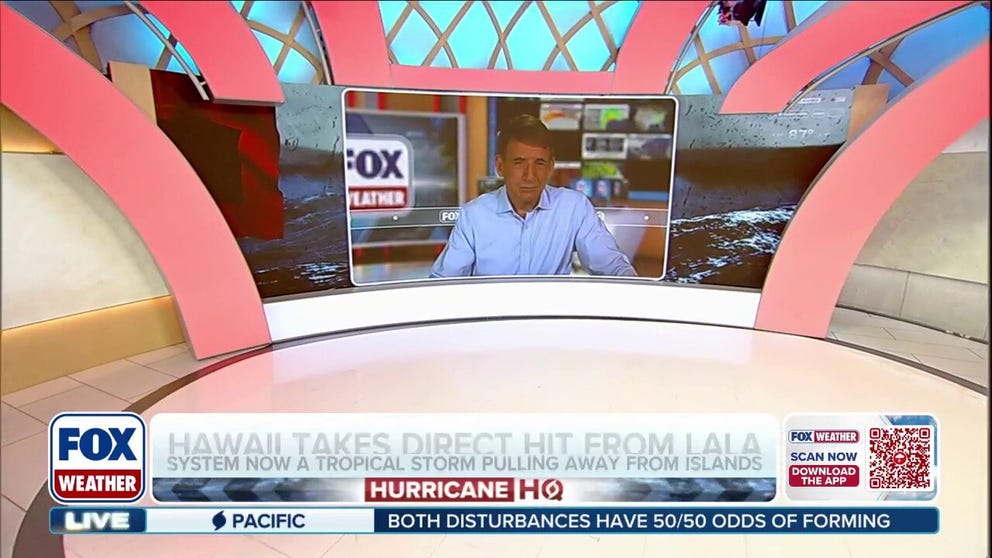
Exclusive Analysis: Lala dumps over 3 feet of rain on Hawaii; new disturbances lurk in Pacific
🌀EXCLUSIVE ANALYSIS: FOX Weather Hurricane Specialist Bryan Norcross discusses Lala's unique track and devastating impacts on Hawaii's Big Island. Plus, a new system in the Eastern Pacific that could bring significant moisture to the Southwest U.S. See the exclusive analysis:
Last updated at 9:30 a.m. on Aug. 17, 2026
Lala is heading into the open Pacific where it's forecast to strengthen back into a hurricane but not impact land. But the damage is done. The most severe impacts were on the Big Island of Hawaii where roads and bridges were washed out, and some parts of the island were devastated.
LATEST FROM FOX WEATHER HURRICANE SPECIALIST BRYAN NORCROSS
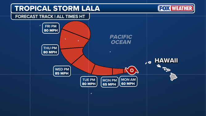
Lala forecast track
(FOX Weather / FOX Weather)
There were significant impacts across all of the Hawaiian Islands, especially on the east or windward sides, where the mountains enhanced the rain and funneled the wind, making it stronger and more destructive.
We were concerned about Hawaii this hurricane season because of the super strong El Niño plus the widespread marine heat wave from the Hawaiian Islands to Mexico and south to the equator. There is more energy than normal in the ocean to power storms that might track toward the state.
Elsewhere in the Pacific
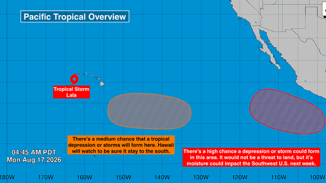
The National Hurricane Center is watching two other areas in the Pacific. The orange one represents a medium chance that a tropical depression or tropical storm could form over the next week. The long-range computer forecasts generally show this system staying south of Hawaii, but it will bear watching next weekend just to be sure.
Pacific Basin
(Bryan Norcross / FOX Weather)
There's a high chance of a tropical depression or tropical storm developing in the red area off Mexico. This system looks to stay offshore and have no direct impact on land. But long-range computer forecasts show the moisture being ripped out of it and spread over the Southwest U.S. That moisture-rich stream of air could have significant impacts. We'll watch the forecasts next week.
In the Atlantic
Saharan dust and hostile upper-level winds dominate the tropical zone. A robust disturbance is forecast to move off Africa this week, but there are no signs that it will develop in the broadly unsupportive atmospheric environment.
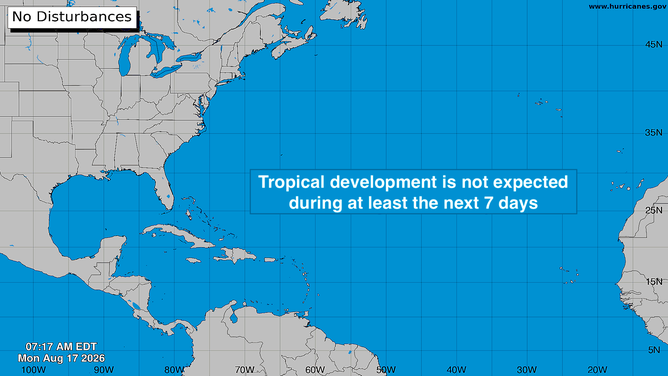
Atlantic Basin
(Bryan Norcross)
Long-range computer forecasts show an even stronger disturbance moving into the tropical Atlantic next week, but it's nothing to think about at this point.