

Bryan Norcross: Dolly's remnants to bring rain and wind to the northeastern Caribbean islands starting today
There continues to be a slight chance that the leftover disturbance from Dolly will regenerate later this week as it heads in the general direction of Florida.
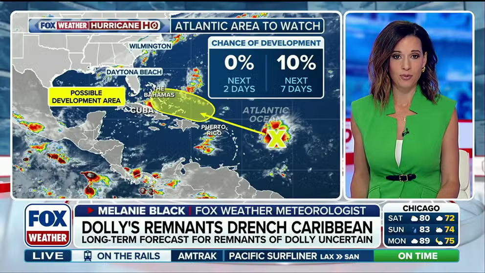
Remnants of Dolly hit Caribbean islands as new Area To Watch emerges in the Gulf
Dolly may have been downgraded, but its remnants are still slamming islands in the Caribbean. The National Hurricane Center has issued the remnants a 10% chance of development over the next 7 days. This comes as a new Area To Watch emerges in the Gulf.
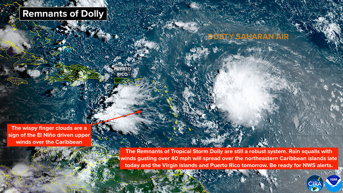
Dolly is no longer a tropical storm, but the remnant disturbance still carries very gusty winds and pockets of heavy rain. The squally moisture surge will move over Antigua and the surrounding northeastern Caribbean islands today and Puerto Rico and the nearby islands beginning tomorrow. Dolly's moisture will linger until at least Tuesday.
On the mountainous islands, heavy rain is possible, which could cause local flooding. Winds could gust to 40 mph or higher in squalls. Stay aware of any alerts issued by the National Weather Service in San Juan.
Remnants of Dolly in Atlantic basin
(Bryan Norcross)
Last updated at 9:00 a.m. on Saturday, Aug. 29, 2026.
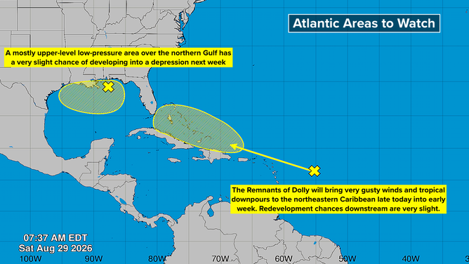
There continues to be a slight chance that the leftover disturbance from Dolly will regenerate later this week as it heads in the general direction of Florida. There's no clear signal in the models about where that might happen. There's a high probability that Dolly's remnants will die out over the tall mountains of Puerto Rico and the Dominican Republic, and that will be that.
Just in case, the National Hurricane Center is drawing a very low odds potential development area north of the Caribbean islands.
We'll see what state the remnant disturbance is in about Tuesday, but nothing significant is likely to happen.
Atlantic basin
(Bryan Norcross)
WHAT’S THE DIFFERENCE BETWEEN A TROPICAL DEPRESSION, TROPICAL STORM AND HURRICANE?
Also, the NHC is drawing a second very low odds area in the northern Gulf. A disturbance related to a weak dip in the jet stream is kicking off some disturbed weather. There's a very slight chance that it could develop into a tropical depression if it hangs around over the warm Gulf water for several days. It's forecast to drift to the west.
Otherwise, nothing of note is showing up in the long-range computer forecasts, even as we head toward the peak of the hurricane season when the historical odds of having a named storm in the Atlantic are highest.
In the Pacific
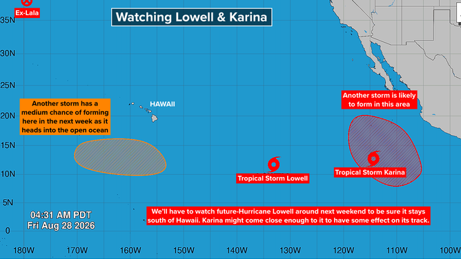
There are no immediate threats, but some long-range computer forecast models continue to show Tropical Storm and eventual Hurricane Lowell coming uncomfortably close to the Hawaiian Islands. Lowell is going to track south of the islands. The question is when it is going to turn north.
Pacific basin
(Bryan Norcross)
In addition, Tropical Storm Karina far to the east is forecast to reach hurricane strength in the next few days. It will then move over colder water and weaken. Its long-range track could also be in the general direction of Hawaii.
A wrinkle in the forecasts for these storms is that Karina and Lowell might come close enough to divert each other slightly when they are in the general vicinity of Hawaii. If that happens, the good thing is that they would tend to push each other away from the islands. But that's way down the road. Both systems are still organizing.
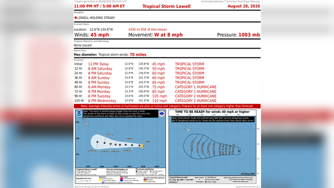
Tropical Storm Lowell stats
(Bryan Norcross)
LATEST FROM FOX WEATHER HURRICANE SPECIALIST BRYAN NORCROSS
For now, everybody in Hawaii should plan to stay informed toward the end of the week. On the current schedule, the potential threats, if they happen, wouldn't develop until next weekend at the earliest.