Bryan Norcross: Dust controls the tropics as Don meanders and Hawaiians watch Calvin
In the Pacific, Hurricane Calvin is past its peak and now losing strength. The long-range computer forecasts have consistently shown a weakened version of Calvin impacting the Hawaiian Islands late Tuesday through Wednesday, and the National Hurricane Center agrees with that prediction.

Generic Hurricane HQ
(FOX Weather)
Subtropical Storm Don is trapped in an area of light steering currents on the northern edge of marginally warm-enough water for the system to maintain some tropical characteristics. It’s forecast to loop back south. If Don survives its brush with cold water, it could lose its hybrid subtropical status and become a more typical tropical storm.
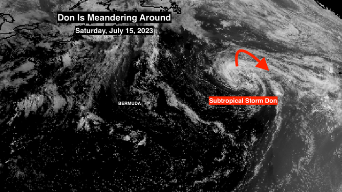
Don location as of Saturday, July 15, 2023.
(NOAA / NOAA)
This is all meteorological nuance, however. The storm may be around for the next few days, but it’s no threat to land.
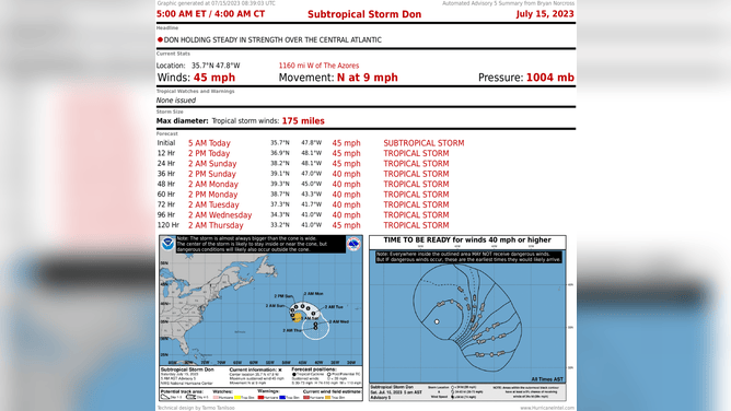
Status of Don.
(NOAA / NOAA)
In the Pacific, Hurricane Calvin is past its peak and now losing strength. The long-range computer forecasts have consistently shown a weakened version of Calvin impacting the Hawaiian Islands late Tuesday through Wednesday, and the National Hurricane Center agrees with that prediction.
The best estimate is that the sustained winds over the ocean will be at or below minimal tropical-storm strength when what’s left of Calvin reaches the islands. But very gusty winds and heavy rain are still possible, enhanced by the mountainous terrain. Unusually high surf is a certainty, of course.

Status of Calvin.
(NOAA / NOAA)
A slight track deviation will make a lot of difference in which towns and neighborhoods have the most impact. Everybody in Hawaii, and especially on the Big Island, should stay up to date on the forecasts.
The tropical Atlantic and the Caribbean continue to be covered in Saharan Dust and hostile upper winds. So no tropical development is expected for the next week, at least.