Cindy could regenerate in the North Atlantic, but the tropics are calm
If the new system has a robust circulation with thunderstorms wrapping around the center, it will once again get a name. Whether that name will be Cindy or Don depends on whether the National Hurricane Center thinks that the new system is substantially a rebirth of the system that was Cindy, or whether other factors or disturbances might have merged to make the new storm.

Generic Hurricane HQ
(FOX Weather)
Updated Monday 10 a.m. EDT
Hostile atmospheric conditions more typical for June have returned to the tropical Atlantic. Upper-level winds are forecast to be strong, and a robust plume of Saharan dust has finally made an appearance.
As a result, no development in that part of the ocean is expected this week.
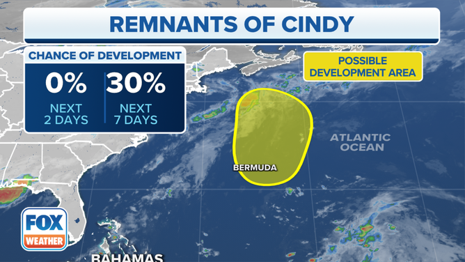
Tropical Storm Cindy has dissipated over the tropical Atlantic Ocean, but the National Hurricane Center (NHC) is watching its remnants for possible redevelopment later this week.
(FOX Weather)
Northeast of Puerto Rico, however, the swirl that was the core of Tropical Storm Cindy before it was ripped apart by strong upper winds yesterday is tracking north in the general direction of Bermuda.
In a few days, when the system is in the vicinity of Bermuda, it might reorganize. Some computer models develop it near the island, others well north. And if it waits until it’s in the North Atlantic, it might end up being one of those hybrid, subtropical systems.
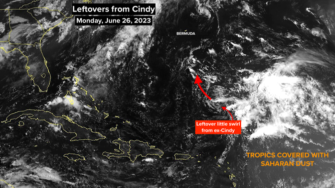
The tropics are covered with Saharan dust as what's left of what was once Tropical Storm Cindy spins above the Atlantic Ocean.
(FOX Weather)
In any case, it does not appear to be a significant threat to Bermuda. Atlantic Canada will have to keep an eye on it to see how it comes back together, if it does.
If the new system has a robust circulation with thunderstorms wrapping around the center, it will once again get a name. Whether that name will be Cindy or Don depends on whether the National Hurricane Center thinks that the new system is substantially a rebirth of the system that was Cindy, or whether other factors or disturbances might have merged to make the new storm. It’s too soon to know for sure.
So for now, enjoy the break. The tropics are back to behaving like normal for June.