Bryan Norcross: Atlantic disturbance Invest 96L running out of time to develop
Computer forecasts no longer show the system developing, and the National Hurricane Center only gives it a slight chance. It will likely run out of time tomorrow.

FOX Weather is your Hurricane HQ, streaming free 24/7.
(FOX Weather / FOX Weather)
UPDATED Wednesday at 8:40 a.m. ET
Hostile upper-level winds continue to make life difficult for the Tropical Disturbance in the middle of the Atlantic. The system is officially known as Invest 96L, which means the National Hurricane Center has designated it for investigation.
The system has a healthy circulation and a robust cluster of thunderstorms, but they aren’t aligned. The thunderstorms need to wrap around the center for the system to be upgraded to a depression or named storm. The upper winds and dry air appear to be keeping that from happening.
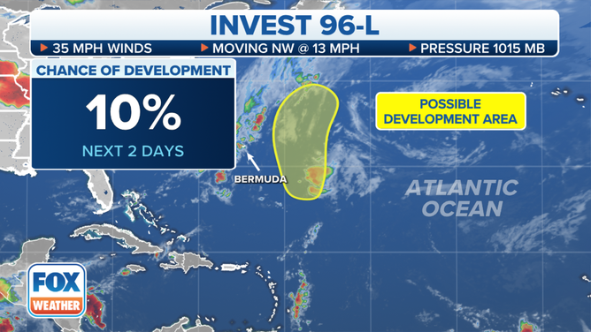
The latest information for Invest 96L in the Atlantic Ocean.
(FOX Weather)
A strong frontal system is bearing down, and cooler waters are ahead as the disturbance tracks to the north. Computer forecasts no longer show the system developing, and the National Hurricane Center only gives it a slight chance. It will likely run out of time tomorrow.
The tropical Atlantic continues to be dominated by dry air and Saharan dust, and upper-level winds over much of the Caribbean continue to be hostile to tropical development.
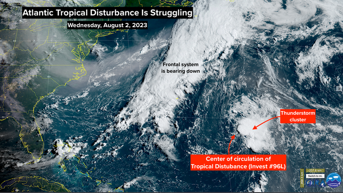
NOAA Satellite image of Invest 96L.
(FOX Weather)
Recall that last year, nothing was developing until suddenly it was. We’ll stand by for signs the pattern might change, but there’s no indication of any significant development for the next week, at least.