Clipper brings blizzard conditions to upper Midwest
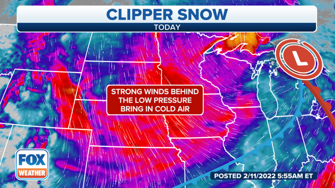
Blizzard conditions were prevalent in parts of the upper Midwest Friday as a clipper system brought snow, rain and gusty winds from the Dakotas to the Great Lakes through Friday night.
Blizzard Warnings issued as clipper brings snow, gusty winds to upper Midwest
Blizzard Warnings have been issued as an Alberta clipper brings snow and gusty winds to the upper Midwest.
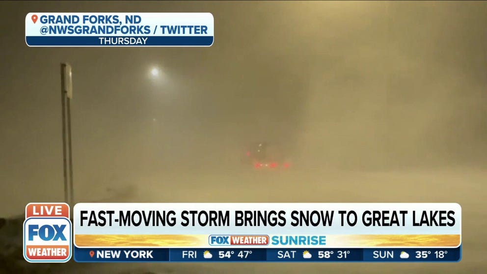
GRAND FORKS, N.D. – Blizzard conditions were prevalent in parts of the upper Midwest Friday as a clipper system brought snow, rain and gusty winds from the Dakotas to the Great Lakes through Friday night.
(FOX Weather)
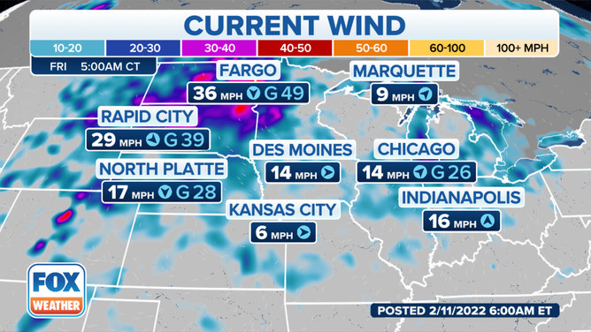
The National Weather Service issued Blizzard Warnings until noon Central Friday for northeastern North Dakota and northwestern Minnesota as winds gusted as high as 50-55 mph, causing whiteout conditions, especially in open country.
The NWS in Grand Forks, North Dakota, said travel was not advised Friday morning within the majority of the Red River Valley into the lakes country of west-central Minnesota, with some road closures reported in eastern North Dakota and western Minnesota, including I-94 and Highway 210.
Minnesota State Police troopers posted photos on social media of several crashes on the slick roads including a number of semi-trucks.
In addition, dangerously cold wind chills as low as 40 degrees below zero could cause frostbite on exposed skin in as little as 10 minutes. A Wind Chill Advisory was in effect through Saturday morning across much of eastern Dakotas and much of Minnesota.
(FOX Weather)
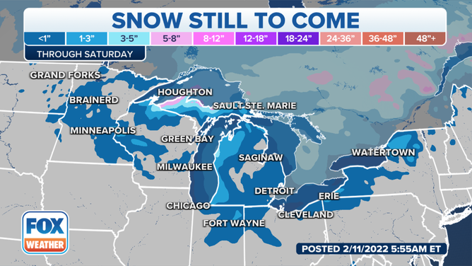
Between 1 and 5 inches of snow could accumulate across the region, with higher totals expected in the Upper Peninsula of Michigan, where lake-effect enhancement will pile up the snow to the tune of a foot or more.
(FOX Weather)
Colder air returns behind the system, with highs dropping into the teens and lows below zero by Saturday. Light to moderate lake-effect snow could fall across portions of Michigan and upstate New York in the wake of this clipper system.
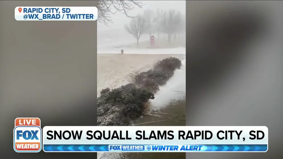
Watch: Snow squall seen slamming Rapid City, South Dakota
Video captures howling wind, blowing snow in Rapid City, South Dakota Friday.