Big November chill continues across much of eastern US until weekend
Freeze Warnings were in effect for more than 32 million people early Thursday
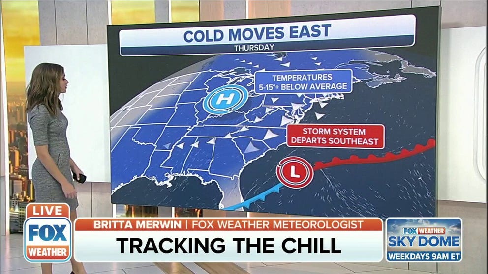
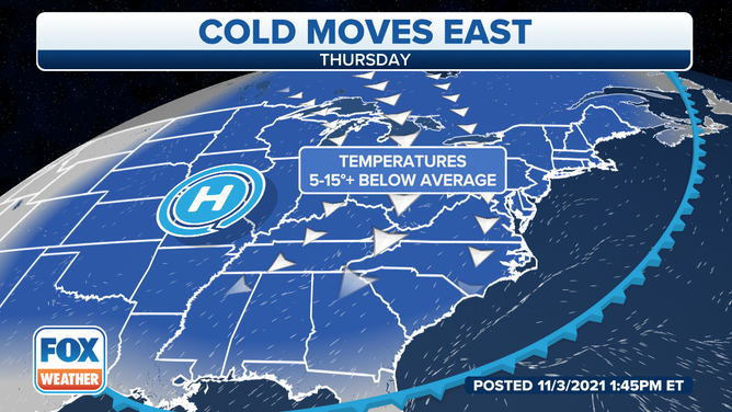
Cold temperatures target the eastern half of the U.S.
Cold temperatures continue to target the eastern half of the U.S.
The calendar says fall, but is winter already here to stay? You’ll want to grab the jackets, hats and gloves because it's getting cold across the central and eastern United States through the weekend.
A large ridge of high pressure is pulling in Canadian air that’s plummeting temperatures easily 10 to 15 degrees below average for this time of year all the way down to the South.
(FOX Weather)
As low temperatures dipped into the 20s and 30s Thursday morning, Freeze Warnings were in effect for more than 32 million people early Thursday. Additionally, Frost Advisories were up for more than 30 million.
The National Weather Service issued those alerts from the Texas and Oklahoma panhandles and southern Kansas into parts of the mid-Mississippi Valley, mid-South, and lower Ohio Valley.
Parts of the Northeast – including areas from northeastern New Jersey into the lower Hudson Valley, southern Connecticut and central and eastern Long Island – were also under frost and freeze alerts early Thursday.
(FOX Weather)
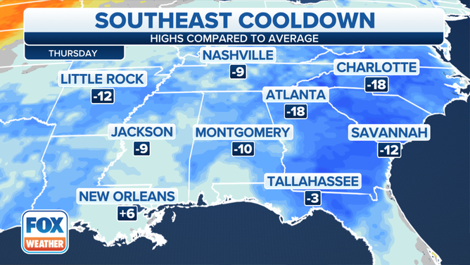
On Thursday, the core of the colder-than-average temperatures will settle across the nation's southern tier.
Highs will be 10 to 20 degrees below average from the Southern Plains to the Southeast, translating to temperatures mainly in the 50s, with any 60-plus-degree highs confined to areas along the Gulf Coast.
(FOX Weather)
In the Midwest and Northeast, highs will mainly be in the 40s on Thursday, though a few spots along the coast or farther south into the mid-Atlantic may reach the lower 50s.
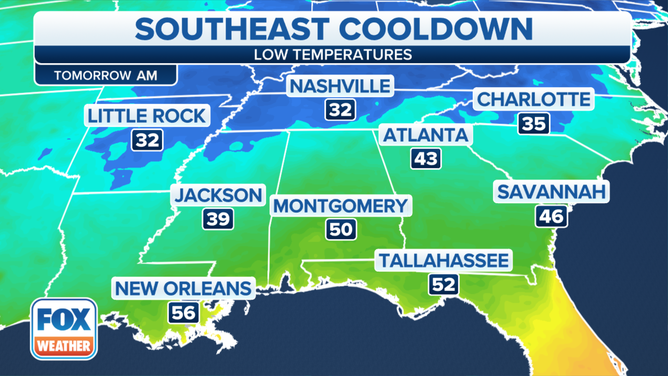
Additional frosts and freezes are likely Thursday night into Friday morning as far south as the mid-South. Lows near 32 degrees are forecast in Nashville, Tennessee, and Little Rock, Arkansas.
(FOX Weather)
Most places will start to warm up this weekend. By Sunday, many locations will see high temperatures 5 to 15 degrees above average for early November.