Atlantic tropical disturbance is showing some signs of development
This current break in the high, plus another big dip in the jet stream moving off the East Coast of the U.S. in a few days, should ensure that the system – whether it develops or not – turns to the north into the open ocean.

FOX Weather is your Hurricane HQ, streaming free 24/7.
(FOX Weather)
Tropical Disturbance #1 is the system we have been watching trek across the dusty tropical Atlantic. It has now accumulated enough moisture that thunderstorms have been able to develop, although no organization is evident yet. The atmosphere in every direction is filled with Saharan dust, which should limit or slow its ability to come together, but reaching tropical depression status is a pretty low bar.
The National Hurricane Center is giving the system a good chance of developing into at least a tropical depression in a few days, once it clears the dusty plume of air it's embedded in.
The system is still being driven toward the west by blocking high pressure to the north - the so-called Bermuda High that usually sprawls across the ocean during the summer. At the moment, however, there's a low-pressure gap in the middle of the Atlantic that will pull the disturbance to the north. That's why you see the northward arc of the NHC potential development area.
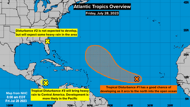
Current tropical areas to watch map, created by NHC on July 28, 2023.
(NOAA)
Updated Friday 9:25 a.m ET
This current break in the high, plus another big dip in the jet stream moving off the East Coast of the U.S. in a few days, should ensure that the system – whether it develops or not – turns to the north into the open ocean.
Forecasts for undeveloped systems are notoriously poor, however. So residents of the northeastern Caribbean islands should keep an eye on it to be sure it follows the consensus of the computer forecasts and the National Hurricane Center's thinking.
After it turns north, the atmospheric pattern would seem to favor some strengthening. If the NHC analysis is that the top winds in the circulation are at least 40 mph, it will get the name Emily.
Saharan Dust and dry air are forecast to dominate the tropics for the next week, so no threats are evident for now.
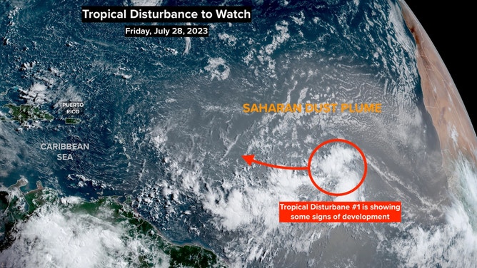
Satellite image on July 28, 2023.
(NOAA)
The National Hurricane Center is noting two other areas on the map, primarily because of their heavy rain potential. Tropical Development is not expected with either of these systems before they move inland.
Tropical Disturbance #2 has a decent chance of developing into a tropical depression or tropical storm once it crosses Central America and reaches the Pacific.
Disturbance #3 is a low-pressure area off the north Florida and Georgia coasts. This is the same system that drenched parts of South Florida yesterday. Some heavy rain is possible along the Southeast coast as it moves to the north.