Aquatic 'drones' to go where no sailor dares tread: Into the heart of a hurricane
A first-of-its-kind mission has a team of scientists and engineers sending aquatic drones into the heart of hurricanes feeding real-time data from the fiercest parts of the storm.
Aquatic 'drones' will help feed back real-time data from inside the heart of a hurricane
Aquatic ‘drones’ to go where no sailor dares tread: Into the heart of a hurricane.
MIAMI -- A first-of-its-kind mission has a team of scientists and engineers sending aquatic drones into the heart of hurricanes feeding real-time data from the fiercest parts of the storm.
"It's never been attempted in a hurricane, like this," says NOAA oceanographer Greg Foltz.
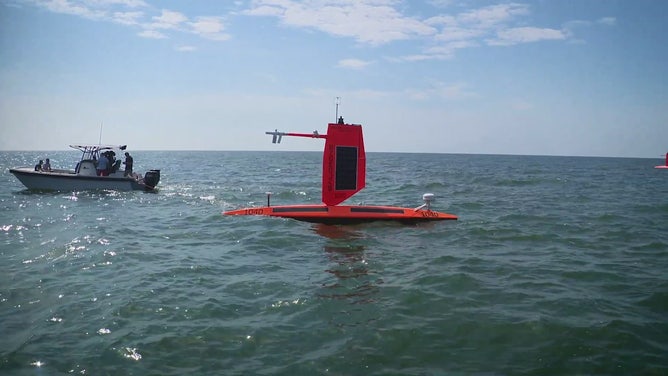
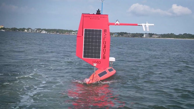
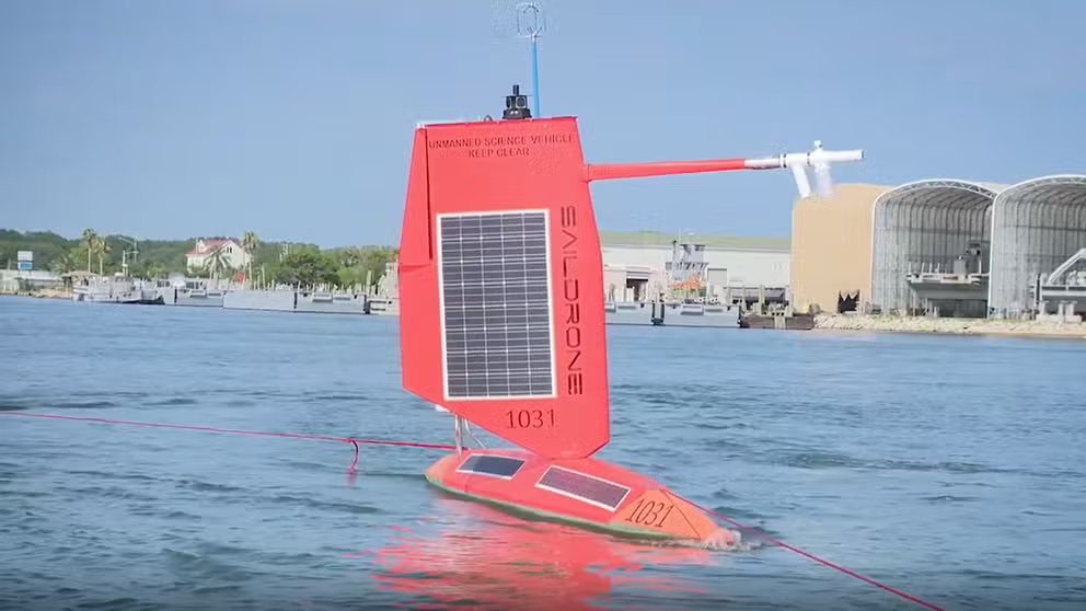
The bright orange surfboards with wings are fully autonomous and are powered by wind and solar energy. They're controlled remotely via satellites at home base and travel at roughly 3.5 miles per hour.
"We can steer these vehicles into the path of the storm," says Saildrones CEO Richard Jenkins. "They can stay out there for up to a year, and we’ll maneuver them as long as the storms keep coming."
They may look undersized, but they are prepared to brave the largest storms.

A Saildrone sits in Florida waters, ready to head out to sea in search of a hurricane.
(FOX Weather)
"These drones have a very small wing designed for hurricane strength -- over 100-knot winds -- to survive getting into the eye of a hurricane," Jenkins said.
The drones are equipped with cameras and continuously look around, giving full-motion video from inside a hurricane.
"It'll really opens the door for getting a lot of very valuable measurements, especially in the hurricane environment because it's never been done," Foltz said.
The drones allow for long-range missions in the harshest ocean environments.
"Really, the wave conditions are the unknown," Jenkins said. " 'How big are the waves? Are they breaking? What are the impact forces? Can the wing survive the waves?' is the question for me."
These drones will feedback real-time data like wind speed, humidity, water temperature, barometric pressure, water currents and other vital signs at the surface.
"Putting the data into NOAA's forecast models will help better predict intensity (of hurricanes)," Foltz said. "And that, of course, leads to better lead times for things like warnings for storm surge and high winds."

A Saildrone sits in Florida waters, ready to head out to sea in search of a hurricane.
(FOX Weather)
Typically, forecasters measure wind and pressure with planes and dropsondes. Still, to truly understand how much heat is coming from the ocean, we need to collect data above and below the ocean's surface.
"The main goal is to get this data to help improve understanding of how the energy exchanges from the ocean to the atmosphere," Foltz said. "That is what fuels hurricanes. It’s that warm ocean, giving energy to the hurricane."
For the past few decades, forecasting the hurricane's track has improved, but predicting the strength of these significant storms has lagged. These Saildrones will hopefully be the tool to fill in that gap.
Not just for sailing into hurricanes
Saildrones are also being sent around the globe for other weather research. A year-long project will send Saildrones into the North American Current to study how the currents affect weather in Europe and provide additional data for forecast models.
And a new version of a drone will have ocean surveyor equipment to allow oceanographers to map the bottom of the ocean cheaper and more nimble than larger surveyor ships.
