Storms bring threat of tornadoes, damaging wind, heavy rain to the South and Southeast
Severe thunderstorms are possible during the afternoon and into Monday night from southeastern New Mexico to West Texas and the Texas Hill Country. Large hail, damaging wind gusts and a tornado or two are all possible with this round of storms.
Coverage for this event has ended.
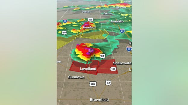
Radar indicated a tornado four miles northeast of Levelland, Texas moving east at 15 mph. The NWS issued a Tornado Warning for Hockley County until 10 p.m. for the storm capable of producing golf ball-size hail.
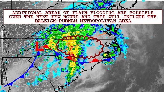
Additional flash flooding, especially around the Raleigh-Durham metropolitan area, will be present over the next few hours as new rounds of heavy showers and thunderstorms arrive.
Intense thunderstorms in Denham Springs formed an impressive shelf cloud.
The Spartanburg County Emergency Management office posted pictures of damage by a possible tornado in Chesnee.
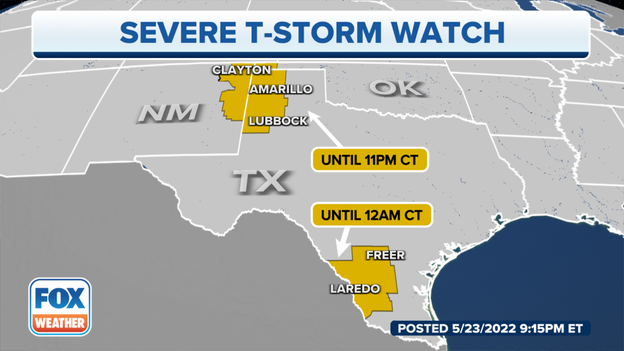
The National Weather Service issued Severe Thunderstorm Warnings for two areas of Texas. The watch that expires at midnight includes Laredo and Freer. Amarillo, Lubbock and parts of New Mexico and Oklahoma are at risk of severe thunderstorms until 11 p.m.
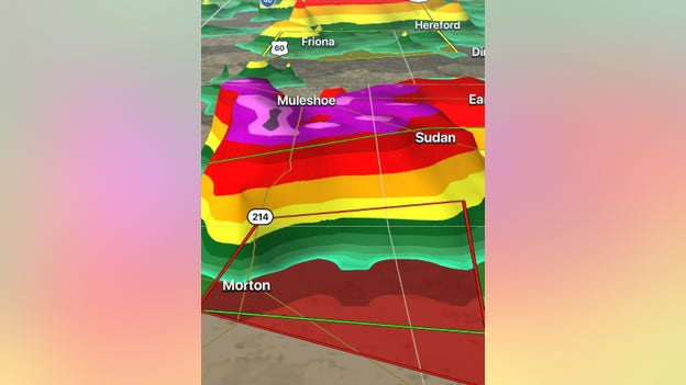
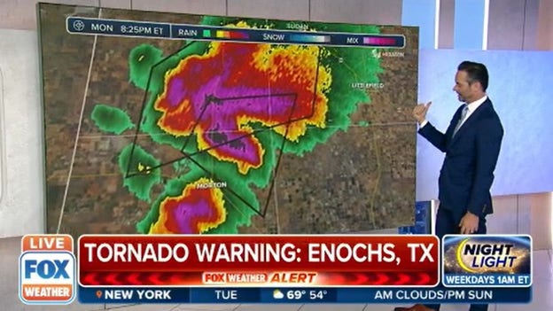
A confirmed tornado northeast of Morton, Texas is moving east. Bailey, Cochran, Hockley and Lamb Counties remain in a Tornado Warning until 8:45 p.m. CDT.
Nick Kosir tracks the tornado that forced storm chaser Nick Busby to relocate from Morton to Levelland, Texas.
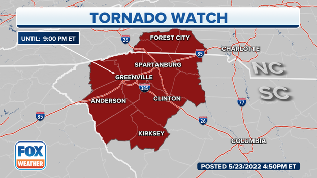
Several counties across North and South Carolina remain under threat of tornadoes. The NWS issued a Tornado Watch until 9 p.m.
The NWS issued a Tornado Warning for Bailey, Cochran and Hockley Counties in Texas until 7:45 p,m. They termed this a Particularly Dangerous Situation.
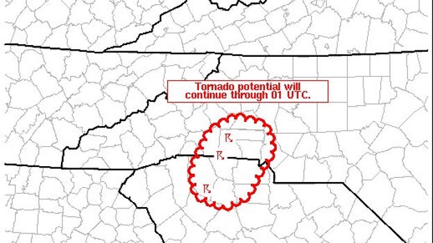
The tornado potential will likely persist through 9 p.m. ET along the northern North Carolina/South Carolina border, the Storm Prediction Center says.
Live Coverage begins here
