NWS aims to cut down on confusion over cold weather alerts as country sees first signs of winter
Signs of winter are on the horizon with snow being seen in Montana and Wyoming.
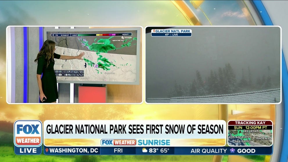
Glacier National Park sees first snow of the season
Glacier National Park in Montana is seeing its first snow of the season.
Some parts of the country are already seeing the first signs of winter, with snow falling in mountain passes of Wyoming and Montana, but for residents in the Northeast, the upcoming season will mean some changes for alerts issued by the National Weather Service.
NWS offices in New England and New York are participating in an experimental program that they hope will simplify when cold weather alerts are issued and when they are stopped for the season.
A Freeze Warning is typically issued when the temperature is expected to drop below 32, and a Frost Advisory is usually hoisted when temperatures drop into the mid to lower 30s, and a thin layer of ice is expected to form.

Freeze warnings and frost advisories in high elevations in the Rockies.
(FOX Weather)
Parts of the lower 48 have already seen these alerts issued, such as in Montana and Wyoming, where temperatures are expected to drop near or below the freezing mark.
The cold air has even caused some snow to fall in mountain passes above 9,000 feet.
"It’s not unheard of to get snow this time of year. It may be a little earlier than normal, but we are expecting a warmup next week, and the snow will melt," an NWS meteorologist in Wyoming said.
![Wyoming snowfall]() Image 1 of 2
Image 1 of 2Mountain passes in Wyoming and Montana saw snow on Friday. (State of Wyoming)
![Wyoming snowfall]() Image 2 of 2
Image 2 of 2Mountain passes in Wyoming and Montana saw snow on Friday. (State of Wyoming)


Multiple rounds of cold weather not only signify the changing of the season, but the intrusions also mark the end of the growing season.
Agriculture experts say when the air is cold enough, cells inside a plant can freeze and form ice crystals. The crystals then rupture through cell walls and damage the plant.
The cooldown happens every year, so NWS offices issue alerts such as the Freeze Watch, Freeze Warning and Frost Advisory designed for the agricultural industry and people with backyard vegetation.
Every office has its own approach regarding when to end the advisories for the growing season, and the weather agency admits the lack of uniformity is confusing.
"Collectively, all the offices in New York and New England have come together and said it makes a lot more sense to just go until a date when climatologically nothing has been growing anymore," said Mike Fries, NWS warning coordination meteorologist in the Buffalo, New York.
WHEN CAN YOU EXPECT THE FIRST SNOW OF THE SEASON?
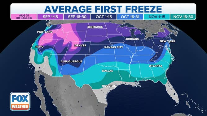
First Freeze Date
(FOX Weather)
Under the experiential program, alerts will stopped being issued approximately 10 days beyond the area’s typical freeze date.
"Our goal is to streamline the frost/freeze process by using defined closing dates, which make it easier and aid in planning decisions for our users," Fries said.
The average first significant cold snap of the season is only a few weeks away for places in the Northeast.
Many communities report seeing their first freeze in late September and early October, which will serve as a reminder that the end of the growing season is not too far behind.