Seen from space: Intense Tropical Cyclone Freddy sets sights on eastern Africa
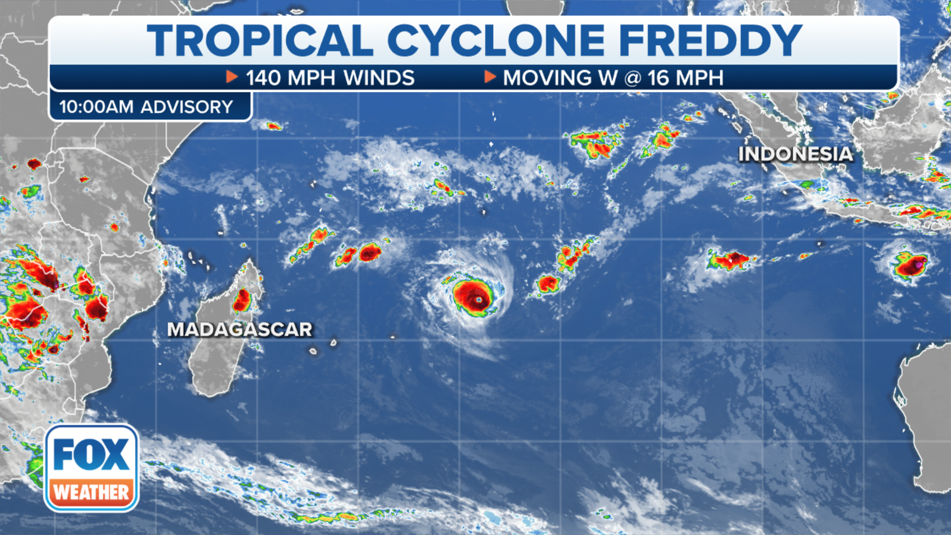
Freddy peaked in intensity on February 16 with winds of 165 mph, and the cyclone is expected to remain strong through its duration across the Indian Ocean.
Tracking Tropical Cyclone Freddy
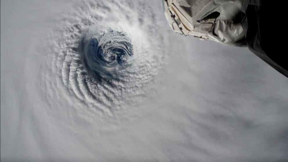
Meteorologists are tracking one of the strongest cyclones of the year in the Indian Ocean. The cyclone was visible from International Space Station.
ANTANANARIVO, Madagascar – A cyclone that has traveled more than 2,500 miles over vast open regions of the Indian Ocean could one day threaten eastern Africa as a powerful cyclone as the area continues to clean up from what has already been a busy tropical season.
Tropical Cyclone Freddy formed off the southern coast of Indonesia in early February and strengthened into a significant storm with maximum sustained winds at 165 mph. If ranked on the Saffir–Simpson Hurricane Wind Scale, the cyclone would have been labeled as a Category 5, capable of catastrophic damage.
The United Nations said two million people are bracing for what could be the strongest cyclone in more than a decade.
DOZENS FEARED MISSING, DEAD AFTER SLOW-MOVING TROPICAL CYCLONE IMPACTS MADAGASCAR
"The risk for dangerous storm surge, flooding and strong and damaging wind is increasing by the minute, and we’re terribly worried for families and children living on the storm path. We know more than two million people, including one million children, are facing increased danger as the storm gathers speed," Tatiana Dasy, director of Save the Children’s Programme in Madagascar, said in a statement.
The tropical cyclone was even visible from space as the International Space Station orbited Earth on Friday.
As Freddy approaches Madagascar, the FOX Forecast Center expects the cyclone to significantly weaken from its current state.
Several other African nations along the coast from Tanzania to South Africa are monitoring the storm's progress for potential impacts from flooding.