Tornadoes possible in America's heartland
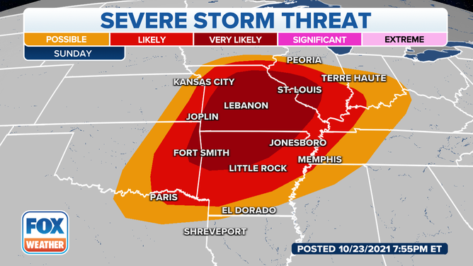
More than 11 million people are under the gun for severe weather on Sunday,
Places from eastern Oklahoma to Illinois could see severe weather on Sunday.
(FOX Weather)
ST. LOUIS, Mo. – More than 11 million people are under the threat for severe weather Sunday, as a storm system makes its way through America's heartland.
The threat of damaging storms stretches from northern Texas to as far east as Indiana, with places from northern Arkansas to western Illinois seeing the brunt of the system.
The tornado threat could be significant from Arkansas through Missouri.
(FOX Weather)
Meteorologists say rich, Gulf moisture will drive dewpoints into the 60s, as far north as Missouri and Illinois. The combination of the available moisture and the instability will lead to numerous storms, capable of producing large hail, damaging winds and tornadoes.
The strongest storms are expected to form during the late afternoon and last well into the overnight hours.
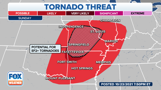
Within the severe weather zone, the area with the greatest likelihood to see tornadoes stretches from Fayetville, AR to St. Louis, MO. The Storm Predication Center believes the potential exists for even a few violent, long track tornadoes.
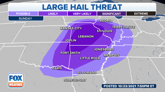
In addition to tornadoes, large hail is also a possibility.
As the storm system works eastward, so will the chance for severe storms and heavy rains. Isolated severe storms are expected Monday in the Tennessee and Ohio valleys, before the storm system targets the Northeast.
The rain is expected to arrive in the Northeast on Tuesday, and it could be heavy. Forecast models already show parts the region receiving 3-5 inches of rain by midweek.
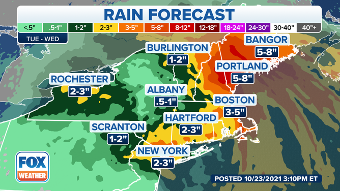
Heavy rain are expected on Tuesday for areas in the Northeast.
(FOX Weather)
Track the severe storms around the clock on the FOX Weather 3D Radar.