Major river flooding unleashed as powerful atmospheric river slams Pacific Northwest
Drone video captures flooded town as Washington state waterfall reaches highest flow rate in 10 years, fueled by powerful atmospheric river.
Powerful atmospheric river slams Pacific Northwest, triggers major river flooding
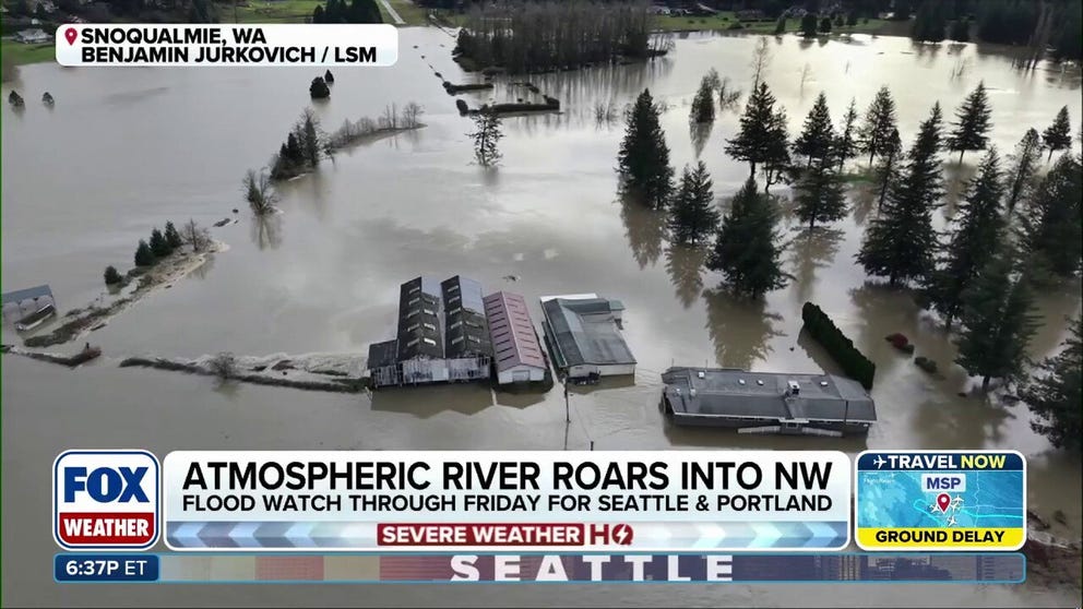
A powerful atmospheric river is roaring in the Pacific Northwest and is continuing to slam the region. Major flooding from the Snoqualmie River inundated several areas adjacent to the river in Fall City, as the powerful atmospheric river is expected to continue to soak the region.
FALL CITY, Wash. – A powerful atmospheric river has delivered bouts of serious rain, soaking the Pacific Northwest, triggering major river flooding.
Drone footage captured major river flooding near Fall City, Washington stemming from the Snoqualmie River, located just east of Seattle, showcasing residences and farms inundated by major river flooding.
Fueled by the atmospheric river, the Snoqualmie River crested the highest it's been at Snoqualmie Falls in 10 years, with a flow rate of 45,000 cubic feet per second, at 17.8 feet.
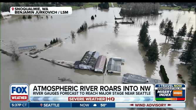
Drone footage captured major river flooding near Fall City, Washington stemming from the Snoqualmie River, located just east of Seattle, showcasing residences and farms inundated by major river flooding.
(FOX Weather)
The powerful atmospheric river will continue to slam the region through the middle of the week, as rounds of Pacific moisture will continue to soak the region, resulting in an elevated risk of flooding.
Through Thursday, localized amounts of 3-5 inches are possible as downpours continue to soak the region. Continuous heavy rain has already led to a sharp rise in water levels, with several rivers, including the Cowlitz River near Randle, Washington, and the aforementioned Snoqualmie River at Carnation, Washington, at major flood stage as of late Tuesday.
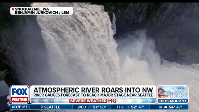
Fueled by the atmospheric river, the Snoqualmie River crested the highest it's been at Snoqualmie Falls in 10 years, with a flow rate of 45,000 cubic feet per second, at 17.8 feet.
(FOX Weather)
According to the FOX Forecast Center, other surrounding streams and rivers are in minor to moderate flood stage, as over a dozen rivers are forecast to reach major flood stage in the coming days.
"When you get this much water and rain, it overflows, and you get a chaotic scenario," FOX Weather Meteorologist Steve Bender said.

(FOX Weather)
Due to very saturated ground and ongoing rainfall into Wednesday, the risk of flash flooding remains at a level 2/4 through Thursday morning for cities such as Seattle, Portland, and Eugene, Oregon.
FLOOD WATCH, WARNING AND EMERGENCY: HERE ARE THE DIFFERENCES THAT COULD SAVE YOUR LIFE
Flood watches also continue across northwest Washington, including Seattle, as a widespread 2–3 inches of additional rain is still likely for coastal Washington and Oregon through Friday.

(FOX Weather)
"This atmospheric river literally looks like a fire hose when you look at it on the radar, or any type of satellite image, because there's just this moisture that funnels in time in and time out over the same areas (that are) really not seeing a break," FOX Weather Meteorologist Kiyana Lewis said.
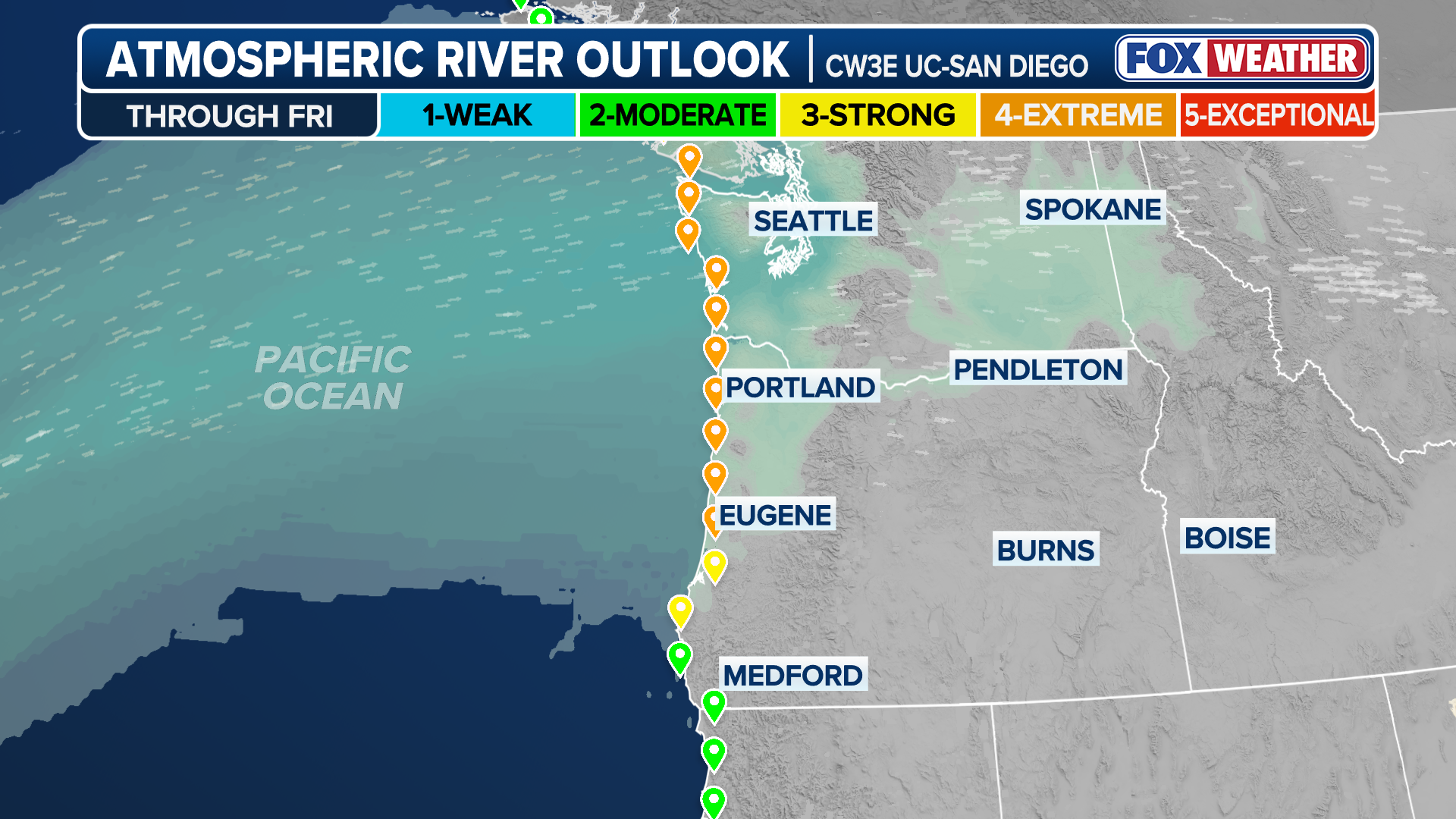
ATMOSPHERIC RIVER OUTLOOK
Since arriving on Monday, the atmospheric river has soaked the region with heavy rain, bringing river flooding, high winds and snow to the higher elevations.
(FOX Weather)
Over 3 to 4 inches of rain has already been reported across portions of Oregon and Washington since Monday, with Portland measuring over 2.5 inches and Seattle approaching one inch of rain, according to the FOX Forecast Center.
On top of snow and rain, gusty wind will accompany the active pattern, as Wind Alerts have been issued for most of coastal Washington and Oregon through Wednesday, with gusts potentially exceeding 65 mph.
(FOX Weather)
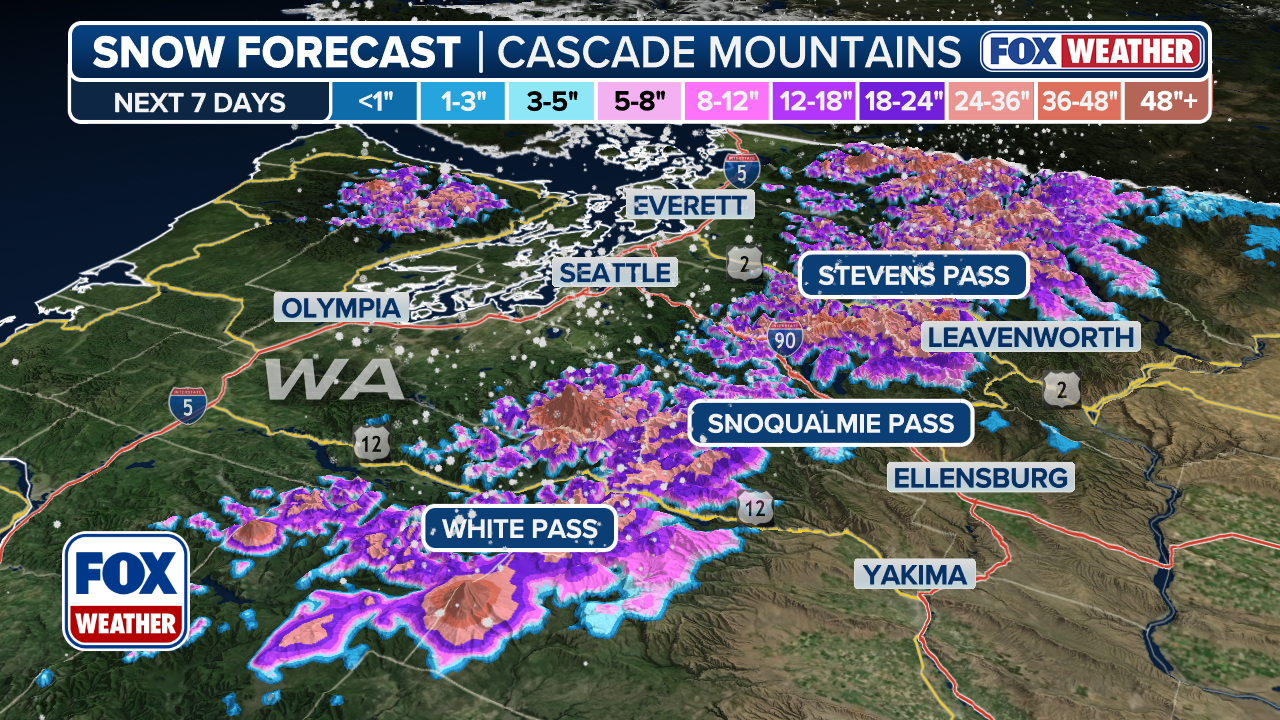
Mountain snow in the region's higher elevations in the Cascade Mountains, with over one foot of snow possible, according to the FOX Forecast Center.
Snow levels will continue to rise as the atmospheric river shifts north through Wednesday, likely making travel difficult and dangerous through the passes across northern Washington.