RocketLab launches NOAA payload to continue global wildlife, climate-tracking mission
Rocket Lab Electron rocket lifts off from New Zealand, carrying the ARGOS-4 payload. AGROS-4 joins the fleet of NOAA satellites gathering global data to provide a full picture of Earth's weather and changing climate, but the Argos system might be most known for its wildlife tracking.
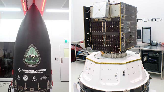
The Rocket Lab Electron rocket fairing on the left with the "Its Argos Up From Here" mission patch and the GAzelle Satellite with ARGOS-4 on the right. Both not to scale. (Image credit: Rocket Lab)
A new satellite launched from New Zealand on Friday continues the work of an international program co-founded by NOAA known for tracking wildlife movements and climate.
In 1978, NOAA and the French Space Agency, Centre National d’Etudes Spatiales or CNES founded the international Argos System to track wildlife, weather, maritime, weather and climate data. In 1986, CNES founded the Collecte Localisation Satellite (CLS) to manage and distribute Argos data.
ARGOS-4 is the newest instrument that will collect data from thousands of transmitters around the globe, from wildlife trackers to volcanoes, from buoys to ships.
The ARGOS-4 payload was carried to space on the GAzelle satellite built by General Atomics. Rocket Lab launched the satellite on Friday from the Mahia Peninsula in New Zealand at 6:09 a.m. New Zealand time (1:09 p.m. EDT) from Launch Complex 1.
The launch happened just before sunrise in New Zealand. A pastel-colored sky offered the perfect backdrop for the Electron rocket launch. Brady Dyer in Lower Hutt, which is about six hours south of Mahia, captured the beautiful rocket trail image below.
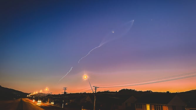
A Rocket Lab Electron rocket streaks across the New Zealand sky before sunrise carrying the GAzelle Satellite to orbit with the ARGOS-4 payload. (Image credit: Brady Dyer)
Rocket Lab dubbed the mission "It Argos Up From Here."
The launch marks Rocket Lab's eighth overall this year, a new record for the company founded in 2006 by CEO and New Zealander Peter Beck. Rocket Lab's headquarters is in California, and the company has another soon-to-be operational launch site at NASA's facility on Wallops Island, Virginia.
AGROS-4 joins the fleet of NOAA satellites gathering global data to provide a complete picture of Earth's weather and changing climate, but the Argos system might be most known for its wildlife tracking.
Argos monitors about 22,000 transmitters worldwide, including nearly 7,800 from wildlife. The satellite zooms from North to South across Earth's poles at 17,000 mph collecting data from all the transmitters, helping to track bird migration patterns or following the 1,000-mile journey of an Arctic fox, for example.
According to NOAA, Argos-4 receives signals from the small ground transmitters on wildlife or remote stations, and then the Argos relays those signals to the ground station and the data back to scientists.
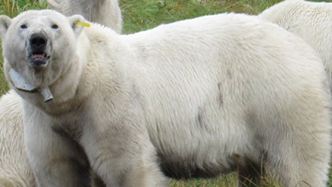
A polar bear wearing an Argos tracking collar. (Image credit: CLS; A. N. Severtsov Institute of Ecology and Evolution of the Russian Academy of Sciences)
Using tracking collars, Argos data has helped show the impact of dramatic sea ice loss on polar bears' seasonal behavior.
Since the 1980s, Argos began tracking marine mammals and sea turtles.
Recently, researchers developed a new Argos tag to follow the long-range travel of large whale species.
According to CLS, creating a whale tag is difficult because whales submerge for long periods, and the tags need to send quick signals when they surface.
The data is sent to NOAA and CNES and used for various applications to help understand Earth's physical and biological environment. More than 100 agencies, organizations and research institutions worldwide use Argos data.
Another Argos instrument is scheduled to launch on the Indian Space Research Organization’s Oceansat-3 satellite in a few weeks. With these two launches, the Argos constellation will grow to eight polar-orbiting satellites, according to NOAA.