Severe storms threaten the Upper Midwest
Severe thunderstorms will sweep across the Upper Midwest through Monday evening. Large to very large hail, damaging gusts, and a few tornadoes are all possible.
Coverage for this event has ended.
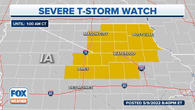
The NWS allowed the Tornado Watch across Minnesota and Wisconsin to expire. The Severe Thunderstorm Watch remains in effect until 1 a.m. for six Wisconsin counties and 22 Iowa counties.
Primary threats include hail up to two inches in diameter and wind gusts up to 70 mph warns the NWS.
Quarter-sized hail hammered down on Canby, Minnesota this morning during a thunderstorm. Watch how fast the hail accumulates.
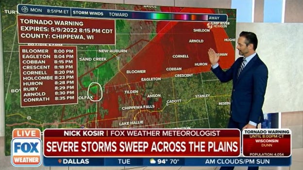
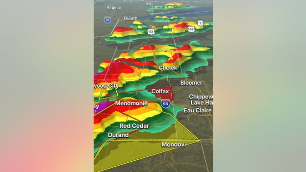
A spotter confirmed a tornado near Colfax, Wisconsin moving northeast at 55 mph. Dunn, and Chippewa remain in a Tornado Warning until 8:15.
Several counties in Iowa are now under a Severe Thunderstorm Watch until 1 a.m.
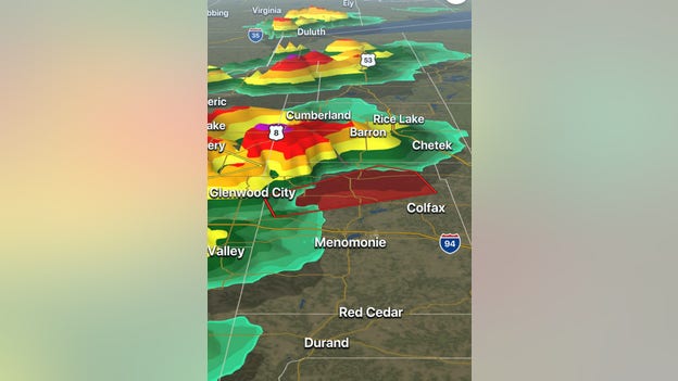
Central Dunn County, Wisconsin is under a Tornado Warning until 8 p.m. Radar indicated rotation in a storm near Knapp moving east at 45 mph.
The NWS issued a Tornado warning for Dunn County, Minnesota until 7:15 p.m. The radar indicated storm was over Boyceville and moving northeast at 45 mph.
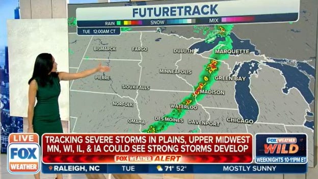
FOX Weather's Future Track shows the strong line of storms well past Minneapolis by midnight. Madison and Green Bay, Wisconsin as well as Des Moines will get the heavy rain and strong winds in the early hours of Tuesday morning.
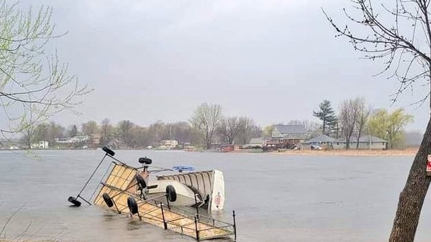
The Chisango County Sheriff in Minnesota found a boat and dock flipped by straight-line winds on South Center Lake.
The threat for severe thunderstorms and tornadoes continues into the evening for parts of Minnesota and Wisconsin. More storms and possible tornadoes threaten Wisconsin Tuesday and a new storm threatens the Southern Plains. FOX Weather has the forecast.
Here is another view of the funnel cloud in Benton County, Minnesota.
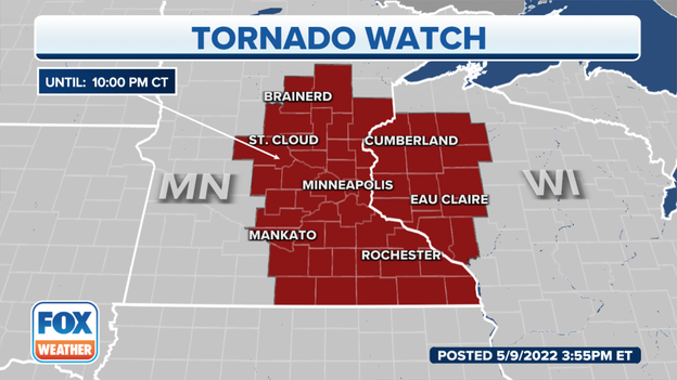
A Tornado Watch for parts of Minnesota and Wisconsin is in effect until 10 p.m. CT.
Live Coverage begins here

