Recap: Tropical Storm Warnings issued as first storm of season threatens millions
Recap: Tropical Storm Warnings issued as first storm of season threatens millions
Download the App⏩ Live coverage from FOX Weather continues
View postCoverage for this event has ended.
Our live coverage of Potential Tropical Cyclone One and the impending development of Tropical Storm Arthur has moved to a new page for Wednesday, June 17.
Click here to follow Wednesday's live updates, tracking maps, and flood alerts from FOX Weather.

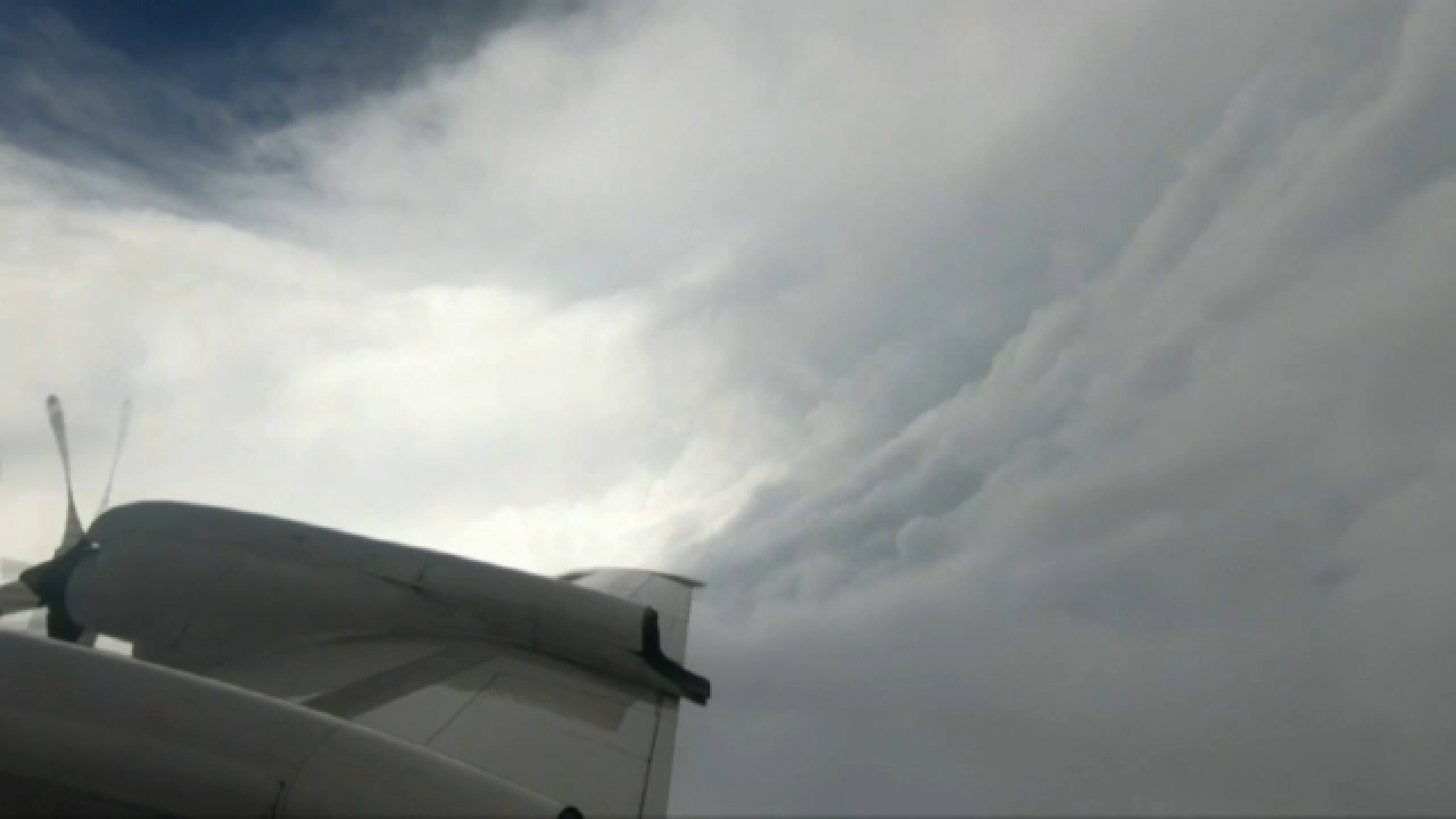
As Potential Tropical Storm One churns over the warm waters of the Gulf, a specialized team of meteorologists and aircrews known as the Hurricane Hunters has been tasked with flying directly into the system to gather critical data that satellites alone can't provide.
While flying into a developing tropical system may seem dangerous to most travelers, Hurricane Hunters routinely penetrate some of the most powerful storms on Earth, collecting critical data from deep within their cores.

Hurricane Hunters Tracking PTC One
The National Hurricane Center has tasked both NOAA and Air Force Reserve Hurricane Hunter aircraft to investigate Potential Tropical Cyclone One on Wednesday, with crews expected to sample the storm throughout the afternoon and overnight hours.
Hurricane Hunters are scheduled to investigate Potential Tropical Cyclone One twice on Wednesday, with NOAA's P-3 aircraft expected to enter the system around 2 p.m. EDT (1800 UTC) and an Air Force Reserve Hurricane Hunter mission slated to begin around 7:30 p.m. EDT (2330 UTC), continuing overnight into early Thursday.
The data collected will help forecasters determine whether the system has strengthened into a tropical storm and refine forecasts for impacts along the Texas and Louisiana Gulf Coast.
Stick with FOX Weather throughout hurricane season as we track everything from juvenile tropical disturbances to the season's next major storm, delivering the information you need, when you need it most.

Forecast track for Potential Tropical Cyclone One in the Gulf.
In their latest advisory, the National Hurricane Center said Potential Tropical Cyclone One could become Tropical Storm Arthur in the overnight hours.
The disturbance will move offshore the Texas coast in a few hours, move roughly parallel to the upper Texas coast tomorrow and move back inland in extreme eastern Texas and southwestern Louisiana late Wednesday or early Thursday, the NHC said.
Sustained winds are at 30 mph, with higher gusts expected.
"The disturbance is forecast to gradually strengthen and could become a tropical storm early on Wednesday," the advisory said.
The storm is expected to weaken on Thursday after it moves back over land.
The National Hurricane Center made no significant changes in its latest advisory on Potential Tropical Cyclone One, which continues to track along the Gulf Coast and is expected to bring a growing threat of flooding rainfall to parts of Texas and Louisiana.
Dangerous, life-threatening flooding is likely over portions of Texas and Louisiana as the system moves northeast at 6 mph.

PTC One 8 PM
The storm is currently 15 miles south southeast of Corpus Christi, Texas, and about 300 miles southwest of Lake Charles, Louisiana.
The system currently has maximum sustained winds of 30 mph, with higher gusts. Forecasters expect gradual strengthening as the disturbance moves over the Gulf, and it could become a tropical storm as early as Wednesday. Any intensification is expected to be limited, however, and the system should begin to weaken on Thursday after moving back inland along the Texas-Louisiana border region.
The disturbance is expected to move offshore of the Texas coast later today before tracking northeast just off the upper Texas coastline on Wednesday. Forecasters expect the system to remain near the coast as it moves across the northwestern Gulf, then make landfall again in far eastern Texas or southwestern Louisiana late Wednesday into early Thursday.
A tropical storm warning is in effect from Sabine Pass, Texas, to Morgan City, Louisiana. A tropical storm watch is in effect from Sargent, Texas, to Sabine Pass, Texas.

A tropical storm warning means that tropical storm conditions are expected within the warning area, in this case within 24 hours. A tropical storm watch means that tropical storm conditions are possible within the watch area, in this case within 12 to 24 hours.
Much of coastal Texas will see major impacts from a tropical disturbance tomorrow, but one major city will be spared.
Houston, Texas, falls just outside the bull's eye of the system, as Potential Tropical Cyclone One barrels toward Louisiana.

Rain still to come through Friday in the South.

Scattered showers to fall Wednesday morning.

Here's why Houston will miss out.
The city is directly in the storm's path, but is only forecast to see up to 1 inch of rain, according to the FOX Forecast Center.
The city got some rain today, and any precipitation that does fall tomorrow will happen in the morning.
The tropical disturbance that looms in the Gulf is essentially lopsided, and Houston is situated right in the middle.
The FOX Forecast Center said dry air pulled south behind the storms will impact Houston, preventing heavy rain focused on the east side of the storm.

Potential Tropical Cyclone One storm path.
The first warnings have been issued for the Louisiana coast as future Tropical Storm Arthur looms.
The disturbance is currently Potential Tropical Cyclone One. A PTC is designated when a storm hasn't yet formed, yet there is the expectation that it will and produce at least tropical storm conditions within 72 hours.
Currently spinning south of Corpus Christi, the system is forecast to move back offshore into the exceptionally warm waters of the northwestern Gulf tonight.

Potential Tropical Cyclone One Tropical Alerts
In the newest update on Potential Tropical Cyclone One, the first Tropical Storm Warnings of Hurricane Season have been issued for the coast of Louisiana from Sabine Pass to Morgan City.
The National Hurricane Center has officially issued its 5 p.m. advisory on Potential Tropical Cyclone One as the disorganized system spins over Southern Texas.
The FOX Forecast Center is actively analyzing the newly released tracking maps, intensity projections and atmospheric data, and our team will be providing real-time forecast updates and live radar tracking right here throughout the day.

Flash flooding possible in Louisiana through Tuesday evening.
The FOX Forecast Center is monitoring flash flooding that could become significant in parts of Louisiana through the evening.
Baton Rouge is one of the cities that fall in the bull's eye of severe storms over the next three hours.
Opelousas, Lafayette and Hammond are also in the threat zone, with over 700,000 people at risk of seeing significant flooding.
The U.S. Coast Guard said they are tracking and preparing to respond to Invest-90L, which is expected to bring heavy rain and strong winds to parts of Texas and Louisiana tomorrow.
U.S. Coast Guard Heartland said they prepare year-round to respond to big weather events such as this, to ensure they're ready for whatever hurricane season may bring.
They suggest boaters secure their vessels to ensure boats remaining in the water are secured with extra mooring lines.
Boaters should also secure loose gear by tying down items, including kayaks, paddleboards and lifejackets to prevent them from washing away and triggering false distress searches.
"Even during a tropical disturbance, conditions on the water can deteriorate quickly and unpredictably. Please heed all local weather warnings and secure your gear early so you can ride out the weather safely," the Coast Guard said.

Rain still to come as tropical disturbance approaches the South.
A large portion of Louisiana, including the state's capital, Baton Rouge, is under Flash Flood Warnings as heavy rain slams the area, with even more on the way.
The National Weather Service issued warnings for over 700,000 people in Louisiana through 5:15 p.m. CDT.
People in the area should immediately move to higher ground and avoid walking or driving through floodwaters.
While the catastrophic flash flooding threat remains the primary concern with Potential Tropical Cyclone One, wind impacts are also ramping up.
According to the FOX Forecast Center, the strongest winds generated by this system are expected to target areas near and to the east of the Houston metro area.

Exclusive FOX Weather Model showing the highest wind gusts expected from Potential Tropical Cyclone One.
As the center of the storm tracks closer to the upper Texas coast, atmospheric tightening will cause winds to peak in intensity over the course of the day on Wednesday, stretching into Wednesday evening.
Communities inside this high-wind corridor need to prepare for powerful, tropical-storm-force wind gusts that could easily exceed 50 mph.
Because the ground is already heavily saturated from ongoing torrential downpours, these 50-plus mph gusts will pose an elevated risk for tree damage and widespread power outages across the region.
Local officials urge residents in the greater Houston area and neighboring southwestern Louisiana parishes to secure outdoor furniture, trash cans, and any loose property before the winds begin to intensify early Wednesday morning.

Radar and satellite showing Potential Tropical Cyclone One inundating the Deep South with heavy rain.
The National Hurricane Center has officially released its 2:00 p.m. ET (1:00 p.m. CT) intermediate public advisory on Potential Tropical Cyclone One.
The system remains a broad and disorganized disturbance, with its center currently located roughly 55 miles south-southwest of Corpus Christi, Texas.
It is maintaining a slow northeastward crawl at just 6 mph.
Because this is an intermediate update, the overall forecast track and intensity limits have not changed, and the previously issued Tropical Storm Watches remain in place from the upper Texas coast into southern Louisiana.
Forecasters continue to monitor satellite and coastal radar loops as the system edges toward the coastline, prepping to emerge over the warm waters of the open Gulf tonight where it still holds a 70% chance of developing into Tropical Storm Arthur.
The National Hurricane Center has officially increased the development odds for Potential Tropical Cyclone One to 70% over the next 48 hours.
This bump indicates growing confidence among forecasters that the system will successfully organize and transition into a named tropical storm—which would take the name Arthur—as it slides offshore into the warm waters of the northwestern Gulf of America.
Meteorologists and coastal residents are currently awaiting the National Hurricane Center's 2:00 p.m. ET (1:00 p.m. CT) intermediate public advisory on Potential Tropical Cyclone One.
While the comprehensive data packages—complete with fully updated tracking models and intensity guides—are released every six hours, these three-hour intermediate updates are crucial when active coastal watches are in place.

FIFA Fan Festival Houston/FOX26 Houston
The ongoing threat of severe weather from Potential Tropical Cyclone One has forced a major schedule shift for soccer fans in the Space City today.
The FIFA World Cup 2026 Houston Host Committee announced that the FIFA Fan Festival Houston has delayed its opening, shortening today's hours of operation to 6:30 p.m. to 10 p.m., instead of the originally planned 12:30 p.m. start time.
Officials emphasized that even these limited evening hours remain strictly subject to change if the environment continues to pose safety risks for attendees.
Public safety authorities are actively tracking the storm's progression, and fans are strongly encouraged to check the official @FWC26Houston social media accounts or visit www.fwc26houston.com throughout the afternoon for the absolute latest operational updates before heading out.

The National Weather Service has issued multiple Flash Flood Warnings stretching across Louisiana at this hour.
Tropical downpours are lashing Louisiana at this hour, prompting the National Weather Service to issue multiple Flash Flood Warnings across the state.
Massive amounts of water are easily overwhelming local drainage systems and causing rapid water rises in urban areas, low-lying streets, and underpasses.
In southeast Louisiana, intense training storms have triggered warnings for multiple parishes where rain is pooling faster than infrastructure can clear it.
The situation is rapidly deteriorating in the northern suburbs of Houston, Texas as staggering amounts of water fall on the area.
Recent radar estimates indicate that more than 5 inches of rain have fallen in just a three-hour window across parts of Montgomery and northern Harris counties, including The Woodlands.

Doppler radar estimates more than 5 inches of rain have fallen in and around The Woodlands in the past 3 hours.
This extreme rain rates have easily overwhelmed local drainage networks, turning neighborhood streets into rushing rivers and causing instantaneous urban flash flooding.
With tropical moisture continuing to feed directly into these stationary bands, rain rates could maintain an additional 3 to 4 inches per hour in the hardest-hit zones.
Emergency officials reiterate that driving in these conditions is incredibly dangerous, especially as high-water spots expand across major thoroughfares.
Dramatic video shared on X by user @tcgoldrush highlights the severe reality of today's torrential rain, showing horrible flash flooding unfolding across The Woodlands and broader Montgomery County in Texas.
The footage captures deeply inundated roadways and rapidly rising waters, underscoring the immediate danger facing the northern suburbs of Houston.
Dangerous flash flooding has prompted emergency officials in Picayune, Mississippi, to issue an urgent flooding notice as torrential tropical downpours leave numerous streets completely underwater across the city.
Local authorities warn that because conditions are deteriorating rapidly, crews cannot physically block off every flooded road, making driving extremely hazardous.
All residents are strongly urged to immediately stay off the roadways unless travel is absolutely necessary for a life-threatening emergency, and to shelter in place at home until conditions improve.

Doppler radar estimates more than 8 inches of rain has fallen around Picayune, Mississippi in the past 6 hours.
If rising waters threaten your home and you are unable to remain inside safely, an emergency evacuation shelter has officially been opened to provide immediate safety.
Residents in need of a safe place to go or seeking specific shelter location details should contact local emergency services immediately at 601-798-6513 for guidance and assistance.
As Potential Tropical Cyclone One churns closer to the coast, the National Hurricane Center is maintaining a strict schedule to keep the public informed.
Full, comprehensive advisory packages—which include updated cone graphics, intensity metrics, and computer model tracks—are released every six hours, with the next major update dropping at 5:00 p.m. ET (4:00 p.m. CT).
Because active coastal watches are in effect, forecasters will also release a streamlined, intermediate public advisory in between the major updates at 2:00 p.m. ET (1:00 p.m. CT) to provide immediate updates on any sudden changes in radar presentation or wind speed.
Tropical downpours from Potential Tropical Cyclone One are slamming the Greater Houston area today, prompting the National Weather Service to issue multiple Flash Flood Warnings for the heavily populated northern suburbs.

The National Weather Service has issued multiple Flash Flood Warnings north of Houston as heavy rain hammers the area.
Tropical thunderstorms are packing a punch, dropping massive amounts of water in incredibly short periods.
Radar estimates and automated rain gauges indicate that between 2 and 4 inches of rain have already fallen across parts of Harris and southwestern Montgomery counties.
Because these tropical downpours are "training"—repeatedly moving over the exact same communities—meteorologists warn that rain rates could reach an astonishing 3 to 5 inches per hour under the most intense cores.
An additional 2 to 4 inches of rain remains highly possible inside the warned areas, which will quickly overwhelm local drainage systems.
The FOX Forecast Center has highlighted a massive swath of the Gulf Coast in our exclusive FOX Weather Threat Zone graphic, mapping out the areas facing the most severe dangers from Potential Tropical Cyclone One through Friday.

Exclusive FOX Weather Threat Zone for Potential Tropical Cyclone One shows where life-threatening flooding is likely to occur this week.
The threat levels are broken down into distinct danger zones based on the latest forecast tracking data:
High Threat: A massive, continuous corridor stretches from the upper Texas coast near Corpus Christi and Houston, directly across southern Louisiana—including Lake Charles and New Orleans—and extends far eastward through Jackson, Mississippi, Mobile, Alabama, and into Montgomery. Communities inside this zone face the highest probability of torrential, multi-hour tropical downpours capable of overwhelming local drainage networks and causing life-threatening flooding.
Elevated Threat: An Elevated risk of impacts blankets the surrounding regions, stretching further inland to cover cities like Shreveport, Louisiana, as well as broader portions of eastern Texas, Mississippi, and Alabama. While the rain may not be as continuous in these areas, intense training tropical bands can still quickly trigger localized flash flooding.
While Potential Tropical Cyclone One is already packing 30 mph winds and could easily lash the immediate Gulf Coast with gusts over 40 mph on Wednesday, it doesn’t automatically get the name Arthur just by getting stronger.
The National Hurricane Center follows a strict set of meteorological rules before upgrading a disturbance into a named tropical storm.
To earn the name Arthur, it isn't just about wind speed—it's about structural organization.

Stages of tropical development
Right now, the system is a broad, elongated area of low pressure. For an official upgrade, Hurricane Hunter aircraft flying directly into the system early Wednesday must find a well-defined, closed center of circulation.
This means the winds must be spinning in a complete, uninterrupted counterclockwise circle around a definitive low-pressure core, with deep thunderstorms wrapped directly around that center.
If the reconnaissance flights find wind speeds matching the tropical storm threshold (40 mph or greater) but those winds are just blowing in a straight line or an open wave format without that closed loop, the NHC will keep it classified as a Potential Tropical Cyclone.
This serves as a vital reminder for coastal residents: a system doesn't need to be officially named "Arthur" to pose a severe hazard, as dangerous winds and catastrophic flooding will happen regardless of its structural title.
Now that the National Hurricane Center has officially designated the system as Potential Tropical Cyclone One, all eyes are on whether it can successfully organize into Tropical Storm Arthur before running out of time.
The broad area of low pressure is currently sitting inland over South Texas, but it is forecast to slide northeastward and emerge over the northwestern Gulf of America tonight.
Once it hits the water, a meteorological tug-of-war begins between atmospheric ingredients favoring and hindering its development.

FOX Weather exclusive tropical threat map showing where Potential Tropical Cyclone One is most likely to produce tropical storm conditions this week.
There are two major checkboxes working in the system's favor. First, sea-surface temperatures in the northwestern Gulf are sizzling in the mid-80s, providing plenty of raw thermal energy to fuel the storm.
Second, favorable large-scale lift aloft—provided by its close proximity to a sharp dip in the jet stream—is helping to exhaust air away from the center, encouraging thunderstorms to bloom.
However, the system faces two massive roadblocks.
It is running into moderate wind shear, which acts like an atmospheric blender, tearing at the storm's vertical structure and preventing it from stacking up efficiently.
Furthermore, its timeline is incredibly restricted. The system will only spend roughly 24 hours over the open ocean before steering currents drag it back inland over the upper Texas or southwestern Louisiana coast on Wednesday night.Because of these limiting factors, there is absolutely no indication that this system will become a hurricane.
Even in a worst-case scenario, we are looking at a mid-tier tropical storm.
Regardless of whether it officially earns the name Arthur, the main impacts remain unchanged: peak wind gusts over 40 mph will lash the immediate coast from Matagorda Bay to central Louisiana on Wednesday, alongside a life-threatening flash flooding disaster across the wider Gulf Coast.
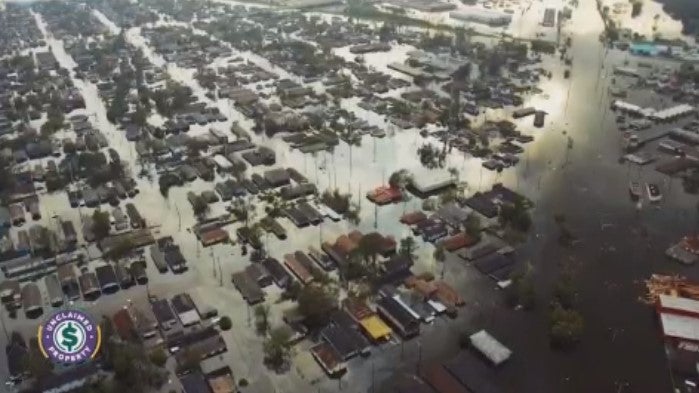
When we talk about tropical storms and hurricanes, wind speed usually gets the most attention, but it is actually water that poses the greatest threat to life and property.
Storm surge is the abnormal rise of water generated by a storm, over and above the predicted astronomical tides.

Storm surge is the abnormal rise of water generated by a storm, over and above the predicted astronomical tides.
This dangerous phenomenon occurs when the powerful, swirling winds of a tropical system literally scoop up the ocean water and push it ahead of the storm's path, forcing a massive wall of water onto the shore.
Storm surge is uniquely dangerous for three major reasons:
- Immense power: A single cubic yard of water weighs nearly 1,700 pounds. When that weight is moving inland at high speeds, it easily demolishes buildings, sweeps away vehicles, and destroys coastal infrastructure.
- Rapid rises: Surge isn't like a slow-moving tide; it can cause water levels to rise by several feet in just a matter of minutes, trapping residents who delayed their evacuations.
- Battering waves: The surge acts as a elevated platform for large, destructive waves. These waves ride on top of the higher water level, acting like a battering ram against structures that would normally be safely out of reach of the surf.
Because storm surge can sweep miles inland through bays, rivers, and coastal inlets, you should never underestimate a 2-to-4-foot forecast.
It takes less than two feet of rushing water to sweep away most vehicles, making it vital to heed local evacuation orders long before the water begins to rise.
Along with the threat of torrential rain, Potential Tropical Cyclone One is bringing a dangerous coastal flood and storm surge threat to a wide stretch of the northwestern Gulf Coast. The National Hurricane Center warns that the combination of a storm surge and the natural tidal cycle will drive rising waters into normally dry areas near the shoreline.

Official storm surge forecast from the National Hurricane Center for the Gulf Coast
Water could reach 2-4 feet above ground from Port Bolivar, Texas to Morgan City, Louisiana if the peak surge hits at the exact time of high tide.
The deepest, most dangerous inundation will occur along the immediate coastline near and directly to the east of where the storm makes landfall late Wednesday night.
In these zones, the rising surge will be accompanied by large, destructive waves capable of causing significant beach erosion and flooding low-lying coastal roads.
Because surge-related flooding depends heavily on local geography and the exact timing of the tidal cycle, water levels can vary drastically over short distances.
People living in vulnerable waterfront communities from eastern Texas through southern Louisiana should monitor local National Weather Service updates closely and prepare for sudden, rapidly rising coastal waters over the next 24 to 36 hours.

The National Hurricane Center has issued a Tropical Storm Watch for portions of the Gulf Coast.
Along with the initiation of advisories on Potential Tropical Cyclone One, the National Hurricane Center has officially issued a Tropical Storm Watch for a wide swath of the northwestern Gulf Coast, stretching from Sargent, Texas, eastward to Morgan City, Louisiana.
This watch means that tropical storm conditions—specifically sustained winds of 40 mph or greater and rough surf—are officially possible within the designated area over the next 24 to 36 hours as the system moves offshore tonight.
Local emergency management officials urge residents within the watch zone to finalize their storm preparations today and secure any loose outdoor items before gusty winds and heavy rain bands begin ramping up early Wednesday morning.
The clock is ticking on Potential Tropical Cyclone One as the National Hurricane Center projects it could intensify into Tropical Storm Arthur just hours before making landfall on Wednesday night.
Currently spinning south of Corpus Christi, the system is forecast to move back offshore into the exceptionally warm waters of the northwestern Gulf tonight.

Official forecast track of Potential Tropical Cyclone One from the National Hurricane Center
This brief window over open water will provide the atmospheric fuel needed to wrap its center together and boost sustained winds past the 40 mph threshold.
However, its time as a named storm will be short-lived. The storm's path curves right back inland late Wednesday night along the extreme upper Texas coast or southwestern Louisiana, cutting off its ocean energy source and initiating a quick weakening trend by Thursday morning.
The National Hurricane Center has officially initiated advisories on Potential Tropical Cyclone One, positioned just 65 miles southwest of Corpus Christi, Texas.
The system currently packs maximum sustained winds of 30 mph and is tracking toward the northeast at 6 mph.

Potential Tropical Cyclone One latest data from the National Hurricane Center
The National Hurricane Center has officially issued its first advisory on Potential Tropical Cyclone One as the disorganized system spins over Southern Texas.
This crucial designation allows meteorologists to drop initial Tropical Storm Watches and Warnings along parts of the Texas and Louisiana coastlines well before a defined storm center locks into place.
The FOX Forecast Center is actively analyzing the newly released tracking maps, intensity projections, and atmospheric data, and our team will be providing real-time forecast updates and live radar tracking right here throughout the day.
A "Potential Tropical Cyclone" (PTC) is a special designation used by the National Hurricane Center to issue life-saving watches and warnings before a tropical system has officially formed.
Historically, forecasters had to wait until a storm developed a closed center of circulation and achieved tropical depression status before they could issue formal alerts, often costing coastal communities valuable preparation time.

Potential Tropical Cyclone is a term used by the National Hurricane Center before tropical storms or hurricanes form.
Under the PTC protocol, if a disorganized area of low pressure is not yet a tropical depression but poses a direct threat of bringing tropical-storm-force winds to land within 48 hours, the NHC can initiate full advisory packages.
This allows local officials to trigger early tropical storm watches or warnings, ensuring residents can secure their property and prepare for incoming hazards well before the storm wraps itself together.
The National Hurricane Center has announced it will officially initiate advisories on Potential Tropical Cyclone One at 11:00 a.m. ET (10:00 a.m. CDT) today as the system triggers widespread flash flooding risks over southern Texas.
This crucial designation allows forecasters to issue official tropical storm watches and warnings for the Gulf Coast ahead of the system fully organizing into a named storm.

Doppler radar showing tropical downpours approaching the Houston metro area this morning.
Heavy tropical rain bands are tracking inland off the Gulf this morning, heading directly toward the Houston metropolitan area.
The FOX Forecast Center is monitoring a thick shield of tropical downpours that is already bringing heavy rain to coastal communities like Galveston and is now pushing steadily north into the heart of the city.
Because these individual storm cells are loaded with deep tropical moisture and are moving relatively slowly, they are capable of dropping 1 to 2 inches of water in a very short amount of time.
While the primary tropical flood threat remains focused well east of the area along the Gulf Coast, emergency management officials in the Texas Hill Country are using this period of quiet weather to finalize critical public safety upgrades.
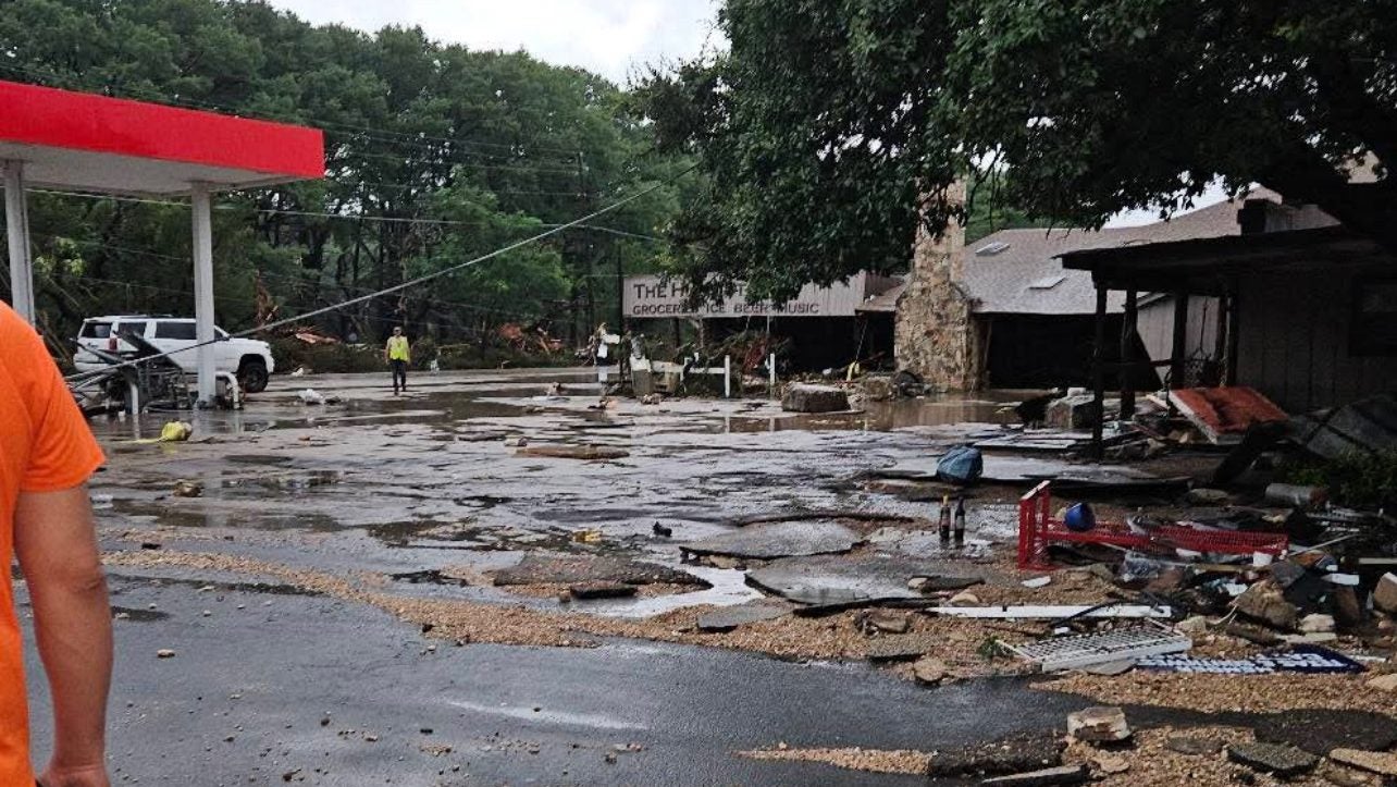
Following last year's devastating July 4th flash flooding along the Guadalupe River, Kerr County Emergency Management Coordinator Shorey Harmon announced that officials are actively establishing the strict Standard Operating Procedures (SOPs) that will govern the county's massive new outdoor siren network.
Built in partnership with the Upper Guadalupe River Authority (UGRA), the Guadalupe River Flood Warning System will feature high-powered, 50-foot siren poles capable of broadcasting both alerts and voice messages to vulnerable low-lying areas and youth camps.
To ensure there is no breakdown in communication during future severe weather events, the automated sirens will be linked directly to real-time river gauges and the UGRA’s "RiverHub" watershed dashboard, giving emergency managers immediate, data-backed authority to trigger the system the moment a National Weather Service Flash Flood Warning is declared.
While the primary threat from Invest 90L remains the relentless, multi-foot deluge of rain, residents across the Deep South need to keep an eye on the sky for a secondary hazard today: tornadoes.

The Storm Prediction Center has highlighted a zone from the Gulf Coast of Texas to Georgia for the threat of tornadoes today.
Tropical systems are notorious for creating highly sheared environments, meaning that wind speed and direction change rapidly with height in the atmosphere.
As the outer rainbands of Invest 90L rotate inland over parts of Texas and Louisiana and interact with a stalled front, localized wind shear can easily cause individual thunderstorms to spin, occasionally dropping brief, rain-wrapped tornadoes with very little warning.
Unlike the massive supercell tornadoes typical of the Plains in the spring, tropical tornadoes tend to form quickly and end fast, making it critical for residents under any severe weather watches today to have a reliable way to receive alerts even while focusing on the ongoing flood threat.
While the National Hurricane Center has raised development odds for Invest 90L to 60%, the clock is ticking loudly for this system to officially become Tropical Storm Arthur.
FOX Weather meteorologists emphasize that the disturbance has a very narrow geographical and temporal window to organize. Because the broad low-pressure center is currently hugging the Texas coastline, it needs to drift far enough offshore over the warm, 83°F waters of the open Gulf late Wednesday into Thursday to establish a tight, closed circulation.

Computer forecast models are in alignment over the future track of Invest 90L and its narrow window for tropical development over the Gulf of America this week.
However, atmospheric steering currents are expected to pull the system back inland over Louisiana relatively quickly.
This fast-moving trajectory back over land, combined with only marginally favorable upper-level winds, means Invest 90L only has about 24 to 36 hours to wrap itself together before it loses its warm ocean fuel source entirely.
While southeastern Texas bears the brunt of the initial tropical deluge today, the FOX Forecast Center warns that the core of the catastrophic flood threat will shift progressively eastward starting Wednesday.
As Invest 90L tracks along the upper Texas coast and pushes inland, the core of the steering currents will pull that massive, Pacific-fed moisture plume right along with it.

The Weather Prediction Center has highlighted where the threat of flash flooding will shift east over the next few days.
This environmental shift places Louisiana, Mississippi, and eventually coastal Alabama directly in the crosshairs for the latter half of the week.
Because atmospheric winds remain incredibly sluggish, these new areas face the exact same danger Texas is experiencing now: heavy tropical rain bands "training" over the same communities for hours on end.
Residents across the central Gulf Coast should prepare now for rapidly expanding Flood Watches, as several days of unrelenting downpours threaten to drop a widespread 5 to 10 inches of rain, triggering life-threatening flash and river flooding.

The Weather Prediction Center has highlighted multiple areas where the the threat for flash flooding is increasing this morning.
The FOX Forecast Center is working around the clock this morning, actively tracking multiple high-risk corridors along the Gulf Coast as an intense tropical deluge expands across state lines.
Our team of meteorologists is continuously monitoring real-time radar data, local gauge heights, and incoming National Weather Service alerts from eastern Texas, across southern Louisiana, and deep into coastal Mississippi.
Deep tropical moisture colliding with a stalled weather pattern means these dangerous, slow-moving downpours are hitting communities that are already dealing with completely saturated soils.
FOX Weather hurricane specialist Bryan Norcross joined Weather Command this morning to provide his expert analysis on Invest 90L as its development odds climbed to 60%.
When the Atlantic hurricane season kicks off in June, forecasters don’t typically look toward the coast of Africa where late-summer monsters are born. Instead, historical data from the National Hurricane Center shows that early-season development relies on warm waters closer to home.
Climatology maps highlight two primary hotspots for June tropical genesis: the Gulf of America and the western Caribbean Sea, with a secondary area extending just off the southeast coast of the United States into the warm Gulf Stream.

Historical maps show that most tropical storms form close to the U.S. and the Caribbean during the month of June.
Because the deep central Atlantic ocean takes much longer to heat up, early-season systems almost always spin up in these shallow, coastal basins where sea-surface temperatures can quickly reach the necessary 79°F threshold.
Because these storms form so close to land, they frequently bring a much shorter warning time for residents along the Gulf Coast and southeastern seaboard, often manifesting as slow-moving, heavy rainmakers exactly like the current system over the western Gulf.
The specialized crews of the Hurricane Hunters are prepping their aircraft today for their very first data-gathering mission of the Atlantic season into Invest 90L.

The National Hurricane Center has tasked the 53rd Weather Reconnaissance Squadron (Hurricane Hunters) with investigating Invest 90L in the Gulf of America early Wednesday morning.
The reconnaissance flight is scheduled to take off shortly before midnight ET tonight from Keesler Air Force Base in Biloxi, Mississippi, charting a course directly toward the western Gulf of America.
Crews expect to be inside the target area by 2:00 a.m. ET on Wednesday morning to investigate the broad area of low pressure.
By flying directly into the disturbance, the meteorological team will drop specialized sensors to measure exact wind speeds, central pressure, and search for a closed surface circulation.
The real-time data collected during this overnight flight will be fed directly into tropical computer models, giving forecasters critical insights into whether a defined tropical depression or Tropical Storm Arthur has officially formed.

The exclusive FOX Weather Threat Zone shows where life-threatening flash flooding is most likely through the workweek.
The FOX Forecast Center has highlighted a massive Threat Zone across the Deep South this week, mapping out exactly where the risk for life-threatening flash flooding is highest.
The high-risk corridor currently blankets a sweeping portion of the Gulf Coast—concentrated heavily along the Texas Gulf Coast through Louisiana—before stretching eastward across Mississippi and Alabama.
Because deep tropical moisture is slamming into a stalled front, thunderstorms are expected to repeatedly stall and dump immense amounts of water over these highlighted areas.
Residents inside this designated threat zone should expect rapid runoff, blinding downpours during their daily commutes, and a heightened risk for localized river flooding through the end of the week.
People are closely watching the northwestern Gulf to see if Invest 90L will officially organize into Tropical Storm Arthur, but the atmospheric reality on the ground is simple: the name ultimately does not matter.
While a tropical storm designation triggers headlines and flags wind thresholds, it is not a metric for rain potential.

The FOX Forecast Center says 5-8 inches of rain is expected across the South, with some places picking up more than 15 inches of rain this week.
The FOX Forecast Center warns that this system is drawing from a highly energized pool of deep tropical moisture—originating all the way from the Pacific—and it is tracking straight into a stalling weather pattern over the South.
Because the steering winds aloft are incredibly weak, these massive moisture bands are going to "train" or repeat over the same exact communities from Texas to Mississippi for days on end.

Whether the National Hurricane Center clocks a 40 mph sustained wind speed to name the storm or leaves it as a disorganized depression, the primary hazard of this event has always been, and remains, a life-threatening, multi-foot deluge capable of widespread flash and river flooding.
As Invest 90L inches closer to the coast, the National Hurricane Center (NHC) has noted that Tropical Storm Watches or Warnings could be required later today.
To stay ahead of the alerts, it helps to understand the NHC’s strict, clockwork schedule.
The agency releases its full, primary advisory packages every six hours at 5:00 a.m., 11:00 a.m., 5:00 p.m., and 11:00 p.m. CT.
However, the moment that official coastal watches or warnings are actively placed into effect, the NHC steps up their schedule, rolling out intermediate public updates every three hours to provide continuous tracking information.
Coastal residents from Texas to Mississippi should closely monitor the late-morning and late-afternoon advisory times today, as these windows are the most likely targets for forecasters to initiate a "Potential Tropical Cyclone" designation and drop initial coastal alerts.
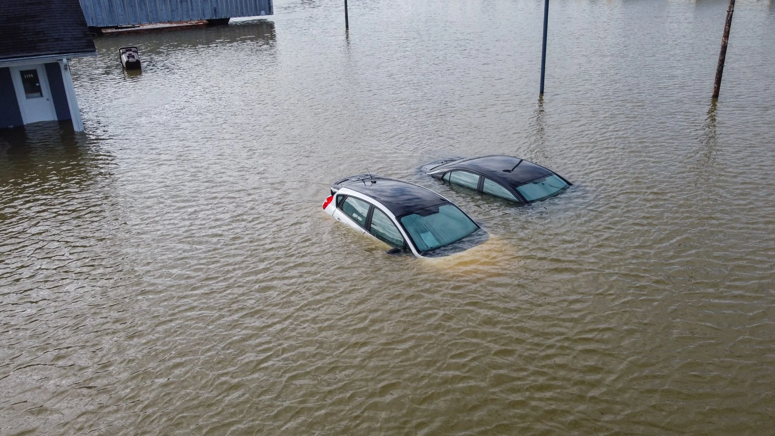
Texas Game Wardens and local first responders worked tirelessly from Sunday night into Monday morning, battling dangerous conditions to answer numerous swift-water and flooding rescue calls across multiple counties in central and east-central Texas.
During the chaotic night, game wardens successfully rescued five people whose vehicles had been swept entirely off the roadways by powerful currents.

Texas Game Wardens/Facebook
While emergency crews remain staged and ready to respond to ongoing calls for service, officials are issuing an urgent plea for the public to do their part to stay safe as the tropical deluge continues.
Drivers are reminded to monitor the forecast, obey all barricades, and never attempt to walk or drive through standing water, which can easily conceal washed-out roads and deadly debris.
If you encounter a flooded roadway, remember the life-saving rule: Turn around, don’t drown.
A soaking Tuesday morning is underway across the Deep South as a massive shield of tropical moisture unleashes heavy rain from eastern Texas all the way to Mississippi.

Doppler radar image showing where heavy rain is falling this morning from South Texas to Mississippi.
The National Weather Service has already issued a handful of Flash Flood Warnings for low-lying areas in Texas and Louisiana, where the initial rounds of rain are quickly pooling on saturated roads.
FOX Weather meteorologists warn that this is only the beginning; as daytime heating takes over and deep tropical downpours continue to regenerate over the same areas, the flash flood threat is expected to escalate rapidly through the afternoon, likely triggering widespread warnings across the entire coastal corridor.
The National Hurricane Center has officially bumped up development odds for Invest 90L, giving the system a 60% chance of forming into a tropical depression or tropical storm over the next few days.
Currently sitting near the Texas-Mexico border, the broad area of low pressure is forecast to drift back out over the open, warm waters of the northwestern Gulf of America today.
Once it re-emerges off the coast, environmental conditions are expected to be conducive enough to trigger some quick organization.
If wind speeds reach 40 mph, it will officially become Tropical Storm Arthur—the first named storm of the 2026 Atlantic hurricane season.

The National Hurricane Center says Invest 90L has a 60% chance of becoming a tropical depression or tropical storm in the Gulf of America this week.
Whether it earns a name or not, meteorologists emphasize that the impacts remain the exact same for residents in Texas and Louisiana.
The heavily moisture-loaded system is stalling, meaning days of relentless, heavy tropical downpours are ahead.
Tropical Storm Watches or Warnings could be issued by the NHC later today as the system inches closer to the coast.
A highly energized setup brought torrential downpours and early street flooding across parts of Southeast Texas on Monday as emergency officials finalized high-water rescue preparations.
For a complete look at how this dangerous system developed yesterday, check out our previous live blog coverage from Monday, June 15, which recaps the National Hurricane Center designating Invest 90L and the initial flash flooding reports.
You’ve reached the beginning of this live coverage.