Drone video shows 50-foot waves and destructive winds in the heart of Hurricane Fiona
Saildrone, in partnership with NOAA, has drones stationed in the Gulf of Mexico and the Atlantic Ocean to collect important data on tropical cyclones.
See inside Hurricane Fiona from a drone
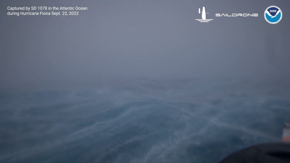
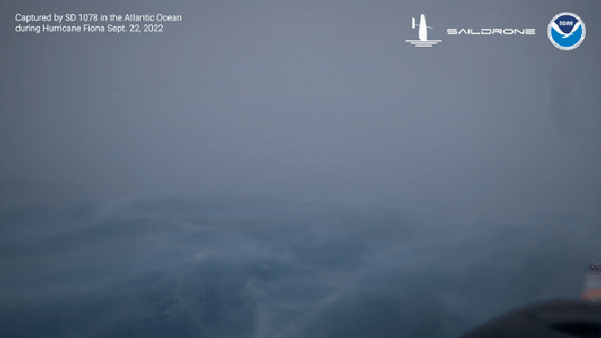
An ocean SailDrone captured 50-foot waves in the Atlantic Ocean from Hurricane Fiona
Hurricane Fiona is the strongest storm of the Atlantic basin season, and thanks to a Saildrone traveling through the heart of the cyclone, humans now have video evidence of what takes place inside one of Mother Nature’s most powerful forces.
On Thursday a Saildrone about 300 miles southwest of Bermuda took video of seas approaching 50 feet while winds gusted to around 100 mph.
The seas looked more like mountains as the Saildrone eerily climbed each wave and traveled down into a crevice before riding another.
Saildrone goes through Hurricane Fiona
The scenes are similar to those are only seen in movies, but with technology, humans can operate the device from thousands of miles away and still gather important data.
"Saildrone is once again demonstrating its ability to provide critical ocean data in the most extreme weather conditions. Hurricane Fiona intensified from a tropical storm to a Category 1 hurricane just before hitting Puerto Rico, causing significant damage and loss of life," Richard Jenkins, Saildrone founder and CEO said in a statement. "The data Saildrone vehicles are gathering will help the science community better understand rapid intensification, giving people living in our coastal communities more time to prepare."
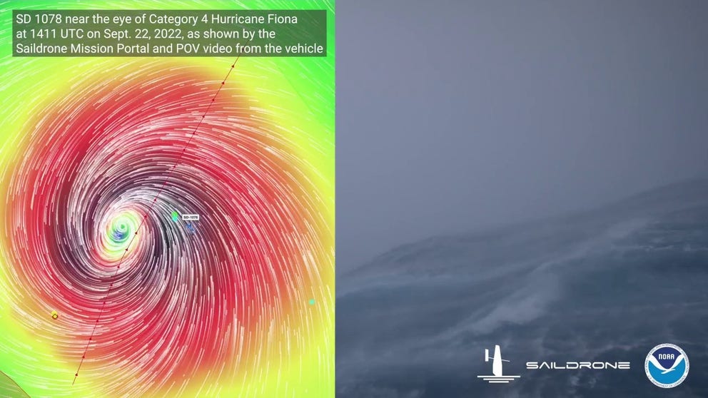
SAILDRONE’S JOURNEY INTO CATEGORY 4 HURRICANE UNCOVERS CLUE INTO RAPIDLY INTENSIFYING STORMS
See the waves inside a Category 4 hurricane
An ocean SailDrone captured 100 mph winds and waves of nearly 50 feet
The automated floating weather stations are remote-controlled and built to withstand the very worst impacts of Mother Nature.
The company said the drone in Fiona is traveling through the storm at about 9 mph, but when it reaches the top of a wave and surfs its way down, the drone’s forward speed can reach 40 mph.
Ocean drone captures wrath of Hurricane Fiona
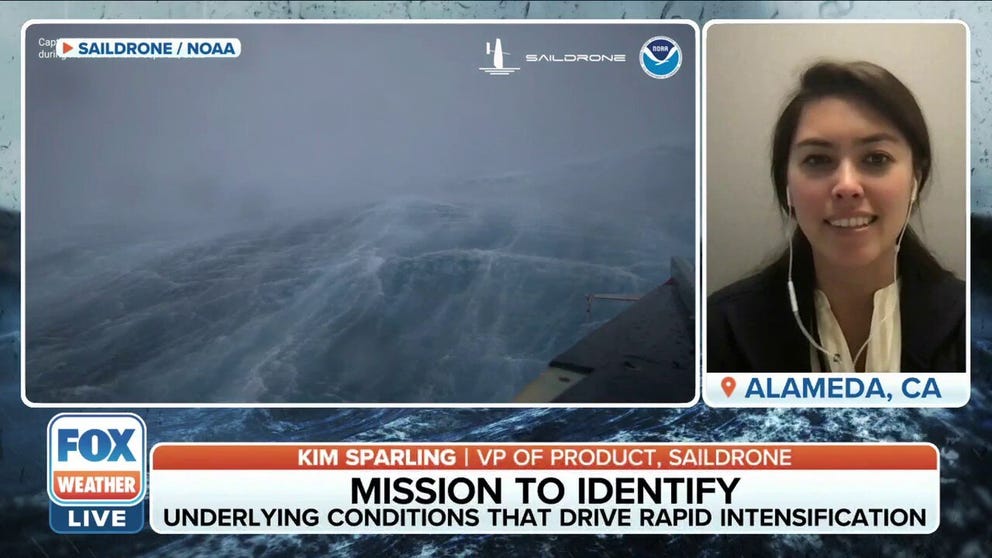
Vice President of Product at Saildrone Kim Sparling tells FOX Weather the mission is to sail robots on the surface of the ocean and collect data which is shared with partners such as the NOAA. A saildrone was able to capture 50 feet waves and 100 mph winds in the Atlantic Ocean on Thursday.
At least three other Saildrones have intercepted the storm as it made its way through the Caribbean and into the southwest Atlantic Ocean.
SAILING DRONES TO PINCH HIT FOR BUSTED BUOYS IN GULF OF MEXICO DURING PEAK HURRICANE SEASON
The powerful hurricane is not the first time a Saildrone has intercepted a Category 4 storm. In 2021, a vehicle was steered into the eyewall of Hurricane Sam.
The drone captured seas of 50 feet and winds estimated to be around 140 mph.
The goal of collecting data is to better understand storm intensity and ocean surges.
"Uncrewed systems in the air, on the ocean surface, and underwater have the potential to transform how NOAA meets its mission to better understand the environment," Capt. Philip Hall, director of NOAA’s Uncrewed Systems Operations Center said in a statement. "These exciting emerging technologies provide NOAA with another valuable tool that can collect data in places we can’t get to with other observing systems."
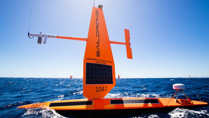
A Saildrone in the open ocean
(Saildrone)